Image Source: Tlinga
About Jampui Hills
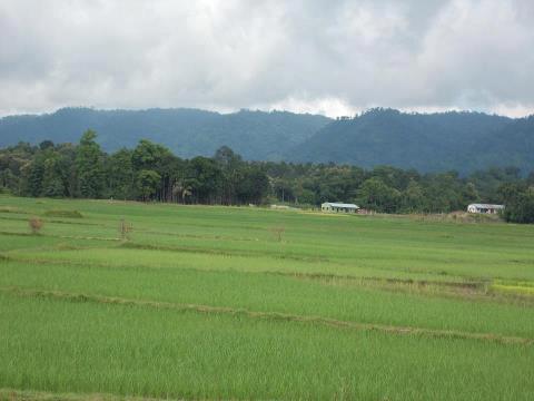
Perched in the North Tripura district, the Jampui Hills are one of the most scenic and serene hill stations in Northeast India. Rising to an altitude of about 1,000 meters above sea level, these hills form part of the Mizo Hills range and are blessed with lush greenery, panoramic views, and a cool climate that makes them a year-round retreat.
Famous as the “Orange Bowl of Tripura”, Jampui Hills are renowned for their sprawling orange orchards, cultural diversity, and breathtaking sunrises and sunsets.
Natural Beauty and Climate
The Jampui Hills are covered with verdant forests, tea gardens, and orange plantations, offering a refreshing break from the plains of Tripura. With a cool and pleasant climate throughout the year, the hills are dotted with scenic viewpoints that provide spectacular views of the Chittagong Hill Tracts of Bangladesh on one side and the valleys of Mizoram and Tripura on the other.
The fresh mountain air, misty mornings, and vibrant landscapes make Jampui Hills a popular destination for nature lovers and honeymooners.
The Famous Orange Orchards
Known as the orange capital of Tripura, Jampui Hills gained fame for its sweet and juicy oranges that were once exported across India and abroad. Although orange production has declined in recent years due to changing climatic conditions, the legacy continues to attract tourists.
The Orange & Tourism Festival, celebrated every November, is a major attraction, showcasing local produce, cultural programs, and traditional tribal dances. Visitors get a chance to walk through orange orchards, taste fresh fruits, and engage with local farmers.
Cultural Heritage of Jampui Hills
The Mizo community forms the majority of the population in Jampui Hills, giving the region a rich cultural and ethnic flavor.
The locals are warm and hospitable, and their traditional festivals, handicrafts, and cuisines add charm to the hill station. Bamboo and cane crafts, along with traditional weaving, reflect the artistry of the people. Visitors often get the chance to witness Mizo songs, dances, and cultural performances during festivals, adding to the vibrancy of the hills.
Activities and Attractions
Jampui Hills are a paradise for nature lovers, trekkers, and photographers. Popular activities include:
Trekking and hiking through the forested trails and hilltops.
Watching the sunrise at Betlingchhip (the highest peak in Tripura at 930 m).
Exploring local villages to experience traditional Mizo lifestyle.
Attending the Orange Festival for cultural immersion.
Birdwatching and photography amidst the forests and orchards.
The hills also offer panoramic views of nearby Chittagong Hill Tracts (Bangladesh), adding a cross-border scenic charm.
How to Reach Jampui Hills
By Air: The nearest airport is Maharaja Bir Bikram Airport (Agartala Airport), located about 200 km from Jampui Hills. Regular flights connect Agartala to Kolkata, Guwahati, and Delhi. From the airport, tourists can hire taxis or take buses to reach Jampui.
By Train: The nearest railway station is Dharmanagar Railway Station, about 70 km away. Dharmanagar is well connected with Agartala, Silchar, and Guwahati. From the station, taxis and jeeps are available to Jampui Hills.
By Road: Jampui Hills are accessible via well-connected roads from Agartala (200 km) and Dharmanagar (70 km). State transport buses, private cabs, and shared jeeps regularly ply the route. The drive itself is scenic, winding through valleys and hill slopes.
Local Transport: Within Jampui Hills, tourists usually depend on shared jeeps, private taxis, or local guides for sightseeing and visiting orchards and viewpoints.
Best Time to Visit
The best time to visit Jampui Hills is from October to March, when the weather is pleasant and the Orange Festival brings the hills to life with cultural activities. Winter offers clear skies and the best views of the valleys, while monsoon months (June to September) bring lush greenery but can make travel difficult.