Image Source: BVECJordan
Geographical Setting and the Barak–Surma Corridor
Karimganj is located in the western part of the Barak Valley, close to the border with present-day Bangladesh (Sylhet region). It lies along the Kushiara River, a distributary of the Barak that flows into the Surma–Meghna system. This hydrological alignment places Karimganj within a Bengal-oriented river network rather than the Brahmaputra system, shaping its economic and cultural history differently from most of Assam. Its geography made it a natural river port and border town, where agricultural hinterlands, wetlands, and cross-border routes converged. The surrounding floodplains supported rice cultivation and fishing, while river channels enabled trade and mobility, embedding Karimganj in a trans-regional river economy.
Ancient and Medieval Roots in Sylhet–Kachar Polities
Historically, Karimganj formed part of the wider Sylhet–Kachar cultural zone, rather than the Ahom heartland. It was influenced by the Kachari (Dimasa) kingdom and later by Bengali-speaking polities centered in Sylhet. This made the region a frontier between hill-based indigenous rule and lowland agrarian kingdoms. Its political identity evolved through shifting sovereignties, linking it alternately to Tripura, Kachar, and Bengal. Unlike Sivasagar or Jorhat, which grew around royal capitals, Karimganj grew as a corridor town, shaped by movement, trade, and cultural overlap.
Islamic Heritage and Sylheti Cultural Influence
Karimganj is especially significant for its deep connection with Islamic religious and cultural networks originating from Sylhet. The region absorbed influences from Sufi traditions, madrasas, and Bengali Islamic scholarship, making it a stronghold of Sylheti Muslim culture within Assam. Mosques, shrines, and religious institutions structured social life, while the Sylheti dialect became dominant in everyday communication. This gave Karimganj a distinct identity within Assam as a town shaped by Islamic heritage and Bengali linguistic traditions, rather than by Assamese Vaishnavite culture.
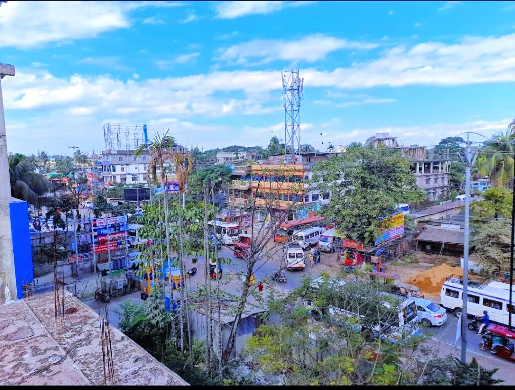
Colonial Period and River Port Economy
Under British rule, Karimganj developed into a river port and administrative subdivision, connecting Cachar district to Sylhet and Calcutta via steamer routes. It became a center for exporting rice, jute, and forest produce, and for importing manufactured goods. The British integrated it into the colonial revenue and transport system, reinforcing its outward orientation toward Bengal. The town’s urban growth followed the logic of ghats, warehouses, customs points, and bazaars, reflecting its role as a commercial hinge between Assam and Bengal.
Partition and Borderland Transformation
The Partition of 1947 dramatically altered Karimganj’s historical trajectory. Sylhet largely became part of East Pakistan (now Bangladesh), while Karimganj remained within India and Assam. This turned it into a border district, transforming a once-internal cultural corridor into a geopolitical edge. Migration flows, refugee settlement, and new administrative controls reshaped its demography and economy. Karimganj thus became a place where colonial-era connectivity was replaced by postcolonial borders, deeply affecting its social and political life.
Ethnic Composition and Social Fabric
Karimganj’s population includes Sylheti-speaking Muslims, Bengali Hindus, and smaller numbers of indigenous and migrant communities. This diversity reflects centuries of riverine migration and agrarian settlement. The social structure has been shaped by wet-rice agriculture, small trade, and cross-border kinship networks, creating a society oriented toward family ties and market exchange rather than toward large-scale industry. Its demographic profile makes Karimganj crucial for understanding Assam’s minority regions and borderland identities.
Urban Role and Regional Function
As a town, Karimganj serves as a commercial and administrative center for western Barak Valley. It links rural agricultural zones with transport routes to Silchar and Bangladesh. Unlike Silchar’s larger service economy, Karimganj retains a more port-town character, with markets tied to river trade and border commerce. Its urban form reflects this function, with dense bazaar areas and residential quarters aligned toward the river and highways.
Strategic and Political Importance
Karimganj’s proximity to Bangladesh gives it lasting strategic relevance. It plays a role in border management, trade regulation, and migration control. Historically, controlling Karimganj meant controlling access between the Barak Valley and Sylhet. In modern Assam politics, it is significant for debates around citizenship, language, and cross-border relations, making it a sensitive but important district in state governance.
Symbolic Meaning in Assam’s Regional Geography
In Assam’s regional imagination, Karimganj represents the Sylheti–Barak Valley interface—a place where Assam touches the cultural world of eastern Bengal. While Sivasagar symbolizes Ahom statehood and Dibrugarh symbolizes tea capitalism, Karimganj symbolizes borderland continuity and cultural overlap. It stands for the idea that Assam’s identity has been shaped not only by the Brahmaputra Valley but also by southern river systems linked to Bengal.
Conclusion: Why Karimganj Matters Beyond Tourism
Karimganj is important not merely as a small border town but as a historical corridor, Islamic cultural center, colonial river port, and post-Partition frontier. Its geography oriented it toward Bengal, its history tied it to Sylhet and Kachar, and its modern role places it at the edge of national boundaries. To understand Assam as a state of multiple valleys, languages, and borderland histories, Karimganj becomes indispensable. It is not just a peripheral district but a structural hinge between Assam and the Bengali–Sylheti world, where river, religion, and borders together shape regional identity.


