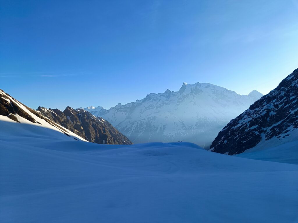
Image Source: Somenath Mondal
About Bali Pass Trek
Bali Pass is one of the most thrilling and challenging high-altitude treks in the Garhwal Himalayas of Uttarakhand. Known for its dramatic landscapes, rugged mountain trails, alpine meadows, glacial lakes, and breathtaking Himalayan views, the trek is a dream destination for experienced trekkers and adventure seekers.
Connecting the beautiful Har Ki Dun Valley with the sacred Yamunotri Valley, the Bali Pass Trek offers an unforgettable journey through dense forests, remote villages, river crossings, snow-covered trails, and high mountain passes. Unlike beginner-friendly Himalayan treks, Bali Pass demands stamina, mental strength, and prior trekking experience because of its steep ascents and challenging terrain.
What makes this trek truly special is the constant change in scenery. In just a few days, trekkers pass through lush green valleys, pine forests, alpine meadows, rocky glaciers, and snowfields while witnessing some of the most stunning Himalayan peaks.
Highlights of Bali Pass Trek
The Bali Pass Trek stands at an altitude of around 5,000 meters (16,207 feet) and offers mesmerizing panoramic views of famous Himalayan peaks such as Swargarohini Peaks, Bandarpoonch, and Kala Nag. Trekkers also get a chance to explore pristine campsites, high-altitude lakes, and untouched Himalayan landscapes.
The trek begins from Sankri, a small mountain village that serves as the base camp for several popular treks including Har Ki Dun and Kedarkantha. From here, the trail gradually climbs through scenic villages, thick forests, and riverside paths before entering the alpine zone.
One of the major attractions of the trek is Ruinsara Tal, a beautiful high-altitude lake surrounded by lush meadows and towering mountains. Camping beside the lake under a sky full of stars is an experience trekkers often remember for a lifetime.
Difficulty Level and Best Time to Visit
Bali Pass is considered a difficult-grade trek and is not recommended for beginners. The trail includes steep climbs, snow-covered sections, glacier crossings, and narrow ridges that require good physical fitness and trekking experience. Proper acclimatization is also important because of the high altitude.
The best time to undertake the Bali Pass Trek is from May to June and again from September to October. During these months, the weather remains relatively stable and the mountain views are exceptionally clear. Early summer brings patches of snow on the trail, while post-monsoon months offer lush greenery and vibrant landscapes.
Detailed Bali Pass Trek Itinerary
Day 1 – Arrival at Sankri
The journey begins with a scenic drive from Dehradun to Sankri village in Uttarkashi district. Covering around 220 km, the drive takes approximately 9–10 hours and passes through beautiful mountain roads, rivers, and forests.
Sankri is a charming Himalayan village and a popular base for several trekking routes. There are multiple guesthouses and homestays available for trekkers. Spend the night here and prepare for the adventure ahead.
Day 2 – Sankri to Seema via Taluka
On the second day, drive from Sankri to Taluka, the last motorable point of the trek. The 12 km drive passes through the scenic Govind Pashu Vihar National Park.
From Taluka, begin trekking towards Seema village. The trail runs alongside rivers, wooden bridges, and dense forests filled with pine and oak trees. After trekking approximately 12 km, reach Seema and rest for the night.
Day 3 – Seema to Rain Basera
The trek from Seema to Rain Basera covers around 10 km and usually takes 6–7 hours. The route gradually ascends through forests and mountain landscapes, offering spectacular views along the way.
Rain Basera, located at an altitude of about 10,200 feet, is a peaceful campsite surrounded by nature and mountain beauty.
Day 4 – Rain Basera to Ruinsara Tal
The trail to Ruinsara Tal is relatively shorter but incredibly scenic. The 7 km trek takes around 4–5 hours and passes through alpine meadows and pine-covered landscapes.
Camping near the crystal-clear waters of Ruinsara Tal is one of the most memorable parts of the journey. On clear nights, trekkers can enjoy a breathtaking sky full of stars.
Day 5 – Ruinsara Tal to Odari
On this day, the trail becomes steeper as trekkers move towards Odari, situated at an altitude of around 13,100 feet. The trek covers approximately 4 km and takes 3–4 hours.
The changing landscape from green valleys to rocky alpine terrain becomes more visible from this point onward.
Day 6 – Odari to Bali Col Camp
The trek continues towards Bali Col Camp, located at an elevation of approximately 15,100 feet. Although the distance is only around 5 km, the steep terrain and high altitude make the journey physically demanding.
Trekkers usually spend the night here before attempting the Bali Pass summit early the next morning.
Day 7 – Bali Pass Summit and Descent to Yamunotri
This is the most challenging and exciting day of the trek. Trekkers attempt to cross Bali Pass at an altitude of nearly 16,200 feet. From the summit, the panoramic views of Bandarpoonch, Kala Nag, and Swargarohini peaks are absolutely spectacular.
The descent towards Yamunotri Temple is steep and technical, often requiring guidance from experienced trek leaders. The trail passes through snowfields and rocky terrain before finally reaching the sacred Yamunotri Valley.
Things to Carry for Bali Pass Trek
Since Bali Pass is a high-altitude trek, proper gear is extremely important. Trekkers should carry warm clothing, waterproof jackets, trekking poles, gloves, sunglasses, sturdy trekking shoes, energy snacks, and essential medicines. Layered clothing is highly recommended because temperatures can change rapidly in the mountains.
Maps and Locations
FAQs
Is Bali Pass Trek suitable for beginners?
No, Bali Pass is considered a difficult trek and is recommended only for experienced trekkers with good physical fitness.
What is the height of Bali Pass?
Bali Pass is situated at an altitude of approximately 5,000 meters or 16,207 feet.
What is the best time to do the Bali Pass Trek?
The best months for the trek are May–June and September–October.
How many days are required for the Bali Pass Trek?
The trek generally takes around 7–8 days, depending on the itinerary and weather conditions.
Which are the major peaks visible from Bali Pass?
Trekkers can enjoy views of Swargarohini, Bandarpoonch, and Kala Nag peaks.
Is camping allowed near Ruinsara Tal?
Yes, camping near Ruinsara Tal is one of the major highlights of the trek.
Where does the Bali Pass Trek start?
The trek begins from Sankri village in Uttarkashi district of Uttarakhand.
Is a guide necessary for Bali Pass Trek?
Yes, hiring an experienced guide or joining a trekking group is strongly recommended because of the difficult terrain and technical descent.


