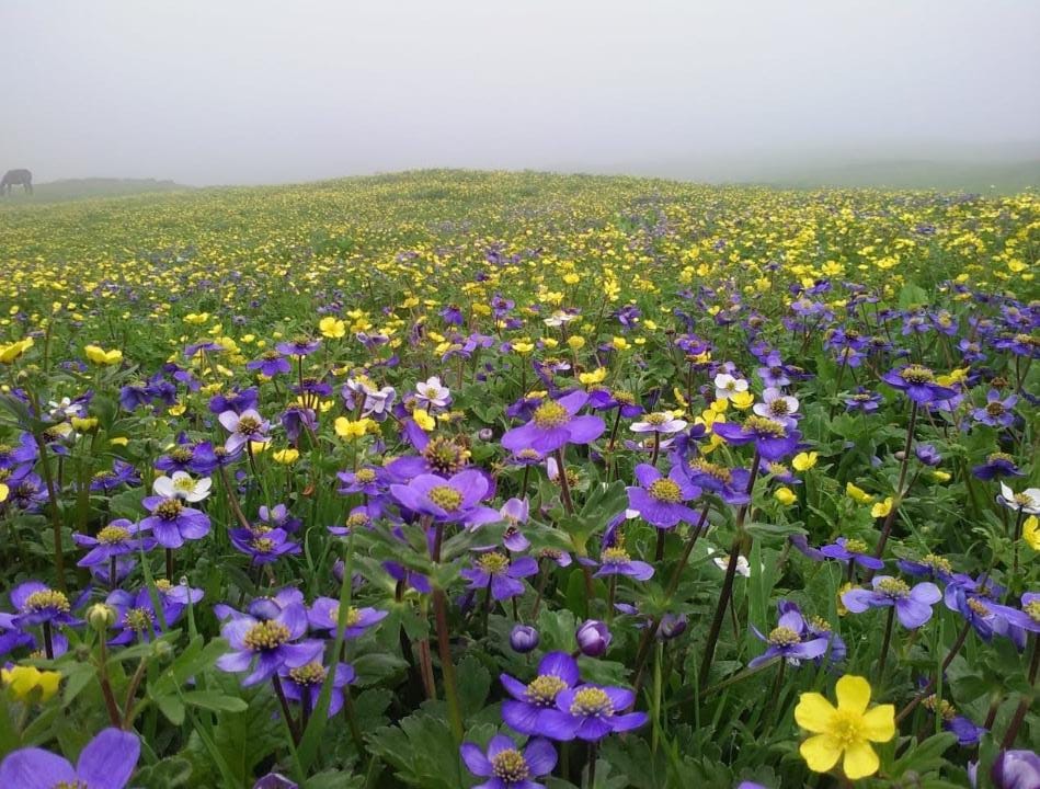
Credit: Sandeep
Gidara Bugyal, one of the largest alpine meadows, is situated in the Uttarkashi district of Uttarakhand. Though not as popular as Dayara Bugyal, the meadows hold a great potential for becoming a favorite tourist destination in future. It is situated at a great altitude on a mountain ridge that divides between the valleys of Yamuna and Ganga. The meadow is surrounded by the peaks on the top, which, in order from south to north, are Mukta top, Siyari top, Dayara top, Surya top, and Gidara top. While below, the lower side is carpeted with green forest.
Best time to trek
The best time to trek Gidara Bugyal is during the pre monsoon season between the months of May and June, when the snow is melting. The post monsoon season of September and October is another window opportunity when the landscape is fully turned into green.
Itinerary
Day 1
On Day 1, travel to the village of Bhaneli, which is a small hamlet located in Uttarkashi district. It is just 190 km from Dehradun and takes around 8 hours. If you opt for local transportation, do catch up early because taxis and buses leave early in the morning. Take proper rest at night to do trekking .
Day 2 Bhangeli (2300 m) to Rikoda (3310 m) – 5 km
It’s the day when you start trekking to the next village, Rikoda which is at a trekkable distance of 5 km. This section of the trek is blessed with diverse flora and fauna. canopy of maple and oak trees at the beginning of the trek makes the trek pristine. In the later section, the treeline disappears and Himalayan mountain range becomes visible to eyes. Once you reach Rikoda, ,the beautiful meadow in the background of the Gangotri group and Srikanth peaks looks beautiful. Stay in overnight tents and explore a clear galaxy of stars.
Day 3 Rikoda to Dokrani (3720 m) – 3.5 km
Today we trek on the trail towards Dokrani campsite. There is a gradual increase in the slope towards the Thirya river, and then there is a steep increase through the Ok and Bhojpatra forests to reach a clearing, which is the Dokrani campsite, with stunning views of the Gangotri massif opposite your campsite. Relax and retire for the night. Overnight in tents.
On the third day, as you move further into the trail, you move toward Dokrani campsite, Which lies further at a higher elevation of 3720 m. During the enroute, the Thriya River and Bhojpatra Forest will take center stage, creating a scenic environment. Once you reach the campsite after traveling a distance of 3.5 km, you will be amazed by the stunning view of Gangotri massif. Sit and relax for a night here.
Day 4 Thalotya to Thirya (3260 m) via Gidara Top (4240 m) – 10 km
This section of trek is long so you should start the day early. After traveling for some time, you come across Gidara Bugyal, which is endless and absolutely huge. Continuing further, you reach the ridge, which ends at the Gidara top at a height of 4240 meters. Its the highest point on a trek where you get a view of surrounding peaks. After this, you descend toward Dokrani Bugyal and end in Thirya after passing a dense forest.
Day 6 Thirya to Bhangeli (2300 m) – 7 km
On the 6th day, you cross the Thriya River and trek toward the Rikoda campsite that you have traveled to on day 3. Finally, get back to Bhangeli village and make accommodations.
Maps and Location
