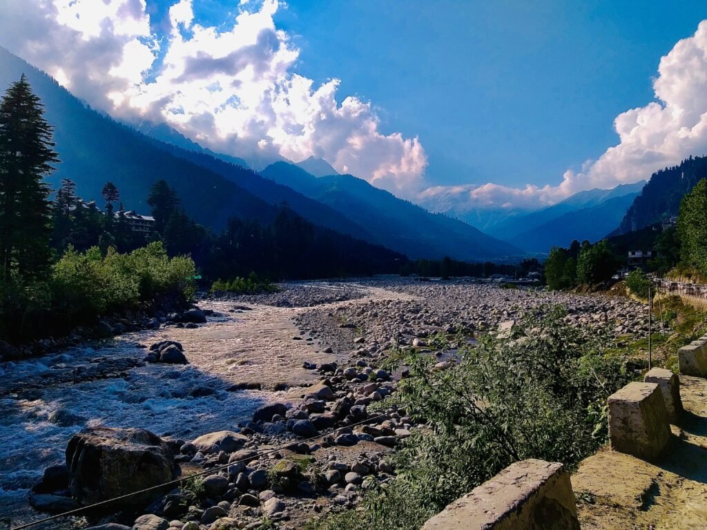
Introduction
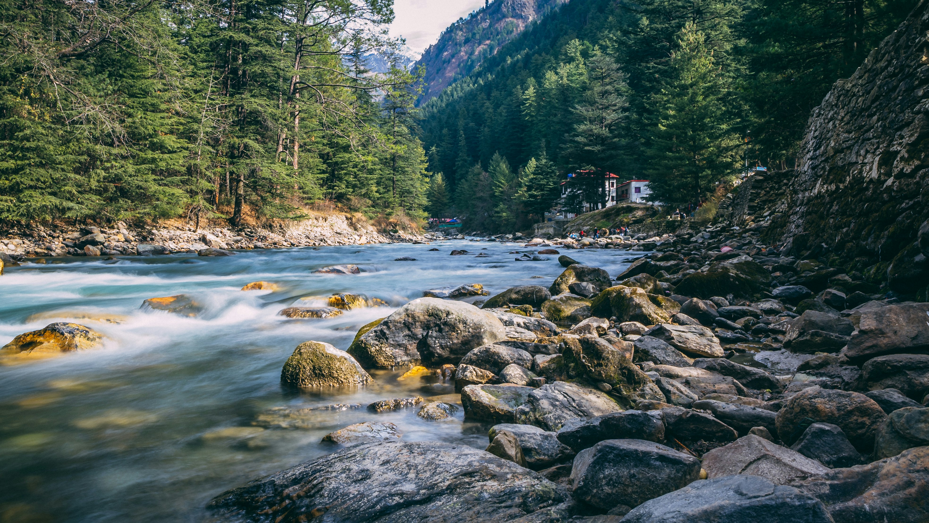
Manali is often associated with snow covered mountains, adventure sports, bustling cafes and popular destinations such as Solang Valley and Rohtang Pass. However, beyond the familiar tourist circuit lies another side of the Kullu Valley, where small Himalayan settlements cling to forested slopes, apple orchards stretch across terraced fields, and traditional temples remain closely connected with everyday village life.
These villages offer a different way to experience the mountains. Instead of spending the day moving between crowded viewpoints, travellers can walk along narrow village lanes, observe traditional wooden houses, visit centuries old temples, watch farmers working in their orchards and enjoy uninterrupted views of the surrounding Himalayan ranges. Some settlements lie just a few kilometres from Manali, while others require a drive into quieter side valleys or a short walk through the countryside.
The region’s cultural landscape is particularly interesting because of its traditional wooden architecture, locally worshipped deities, seasonal agricultural practices and pastoral traditions. In parts of Kullu, the distinctive Kath Kuni building style combines timber and stone, creating houses and temples adapted to the cold mountain climate. Village festivals and temple processions also remain important expressions of local identity.
The following 20 villages and rural settlements around Manali offer opportunities to explore this lesser known side of Himachal Pradesh. They vary considerably in accessibility and character, ranging from historic settlements along the main road to remote hamlets that reward travellers who are willing to slow down.
What Makes These Villages Special?
The appeal of these villages is not limited to mountain scenery. Their value lies in the combination of landscape, history, architecture and everyday life.
Traditional Himalayan architecture: Wooden balconies, stone foundations, slate roofs and timber framed buildings can be found in different parts of the Kullu region. Not every village retains the same amount of traditional architecture, but exploring older residential lanes can reveal details that are easily missed from the main road.
Orchards and farming: Apple orchards, vegetable fields, terraced cultivation and grazing land shape the countryside around Manali. The landscape changes with the seasons, from spring blossoms to summer greenery and the autumn harvest.
Temple traditions: Many villages have temples dedicated to local deities. These are not simply tourist attractions but living religious and community institutions. Visitors should be respectful when entering temple grounds, particularly during festivals or private ceremonies.
Mountain views and quieter walks: Several settlements overlook the Beas Valley or face the surrounding mountain ranges. Others provide access to forests, waterfalls, meadows and trekking routes.
A slower travel experience: These are working villages rather than open air museums. The most rewarding experience often comes from walking quietly, talking respectfully with residents and appreciating the landscape without expecting extensive tourist facilities.
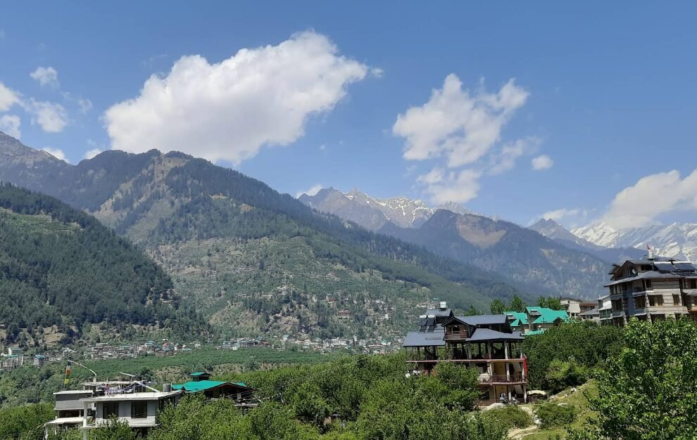
Image Source: Gourav Sharma/ Google Maps
Jagatsukh: The Historic Village That Once Served as the Capital of Kullu
Jagatsukh is one of the most historically significant settlements near Manali. Located approximately 6 kilometres south of Manali on the road towards Naggar, it was once the capital of the Kullu kingdom. Historical accounts associate the village with the earlier name Nast and describe it as an important seat of the ruling family before the capital moved to Naggar and later to Sultanpur, near present day Kullu. Source: Himachal Tourism.
The village is particularly interesting for travellers who enjoy exploring the historical architecture of the Himalayas. Its most notable attraction is the Gaurishankar Temple, a historic stone temple dedicated to Lord Shiva. The nearby Gayatri Temple adds to the religious importance of the settlement. The older temple structures provide a glimpse into the artistic and religious traditions that developed in the Kullu Valley long before modern tourism became important.
Jagatsukh also makes a pleasant place to observe the contrast between the cultivated valley floor, traditional residential areas and the mountains rising in the distance. The surrounding countryside includes orchards and agricultural land, making the village suitable for a leisurely walk rather than a hurried sightseeing stop.
How to reach Jagatsukh: From Manali, follow the road towards Naggar and Kullu. Jagatsukh lies along this route, making it one of the easiest villages to visit independently. Local buses and taxis may be available from Manali, while travellers with their own vehicle can stop near the village and explore on foot.
Best for: History, temple architecture, photography and a short cultural excursion from Manali.
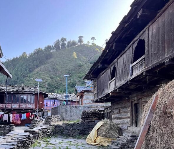
Image Source: Vivek K/ Google Maps
Nashala: A Quiet Countryside Escape
Nashala is a lesser explored settlement for travellers interested in the quieter rural landscape around Manali. Rather than offering a single major tourist attraction, its appeal lies in the surrounding countryside, cultivated slopes and views across the valley.
The experience here is best approached slowly. Older village houses, small agricultural plots and the changing colours of the surrounding hills offer opportunities to observe rural life away from the busier hotel districts. Depending on the exact walking route, visitors may encounter orchards, wooded slopes and views towards the wider Kullu landscape.
Nashala is better suited to travellers who enjoy wandering through residential lanes and observing the countryside than those looking for organised activities, large cafes or developed viewpoints. As with many small settlements in the region, the character of a visit depends on the season and the route taken through the village.
How to reach Nashala: First confirm the precise village location on a map, as similarly named rural places and small hamlets can be confusing. Travel from Manali by local taxi or private vehicle, following the road to the settlement identified by your map. Ask the driver about the final approach and suitable parking before setting out on foot.
Best for: Rural photography, quiet walks and exploring beyond the main sightseeing circuit.
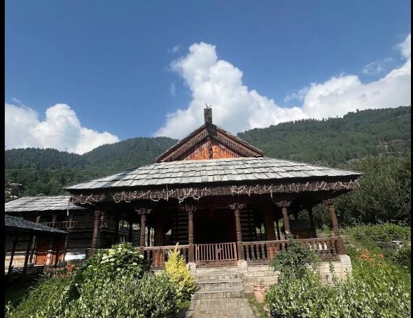
Image Source: Tezin Vedant/ Google Maps
Shanag: Village Life Above Old Manali
Shanag is an appealing option for travellers who want to explore the countryside above the familiar streets of Old Manali. The settlement offers a more residential atmosphere, with mountain views, village houses and access to the wooded slopes surrounding the town.
Its location makes it particularly useful for travellers who want to combine a short village excursion with time in Old Manali. Rather than spending the entire day in cafes and shops, visitors can explore the quieter roads and walking paths above the main tourist area.
Shanag is also a reminder that the landscape around Manali is not uniformly urbanised. Within a relatively short distance of busy commercial streets, the surroundings can become quieter and more agricultural. The best experience is often a relaxed walk, with time to appreciate the views rather than treating the village as a checklist attraction.
How to reach Shanag: Travel from Manali towards Old Manali and ask locally for the correct road into Shanag. Depending on the starting point, some sections may be more suitable for walking than driving. Confirm the condition of narrow village roads before taking a car into residential areas.
Best for: Short village walks, mountain views and travellers staying in Old Manali.
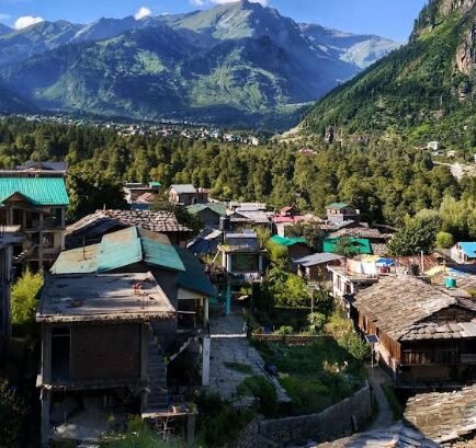
Image Source: Rohan Mahanta/ Google Maps
Goshal: A Rural Settlement Above the Manali Tourist Belt
Goshal offers another opportunity to explore the agricultural landscape surrounding Old Manali. Its appeal is associated with its village setting, cultivated land and the quieter atmosphere found away from the main tourist roads.
The settlement is worth considering for travellers who want to understand how communities live alongside Manali’s growing tourism economy. Orchards, vegetable cultivation, traditional houses and narrow access roads form part of the rural character of this area, although the exact features visible will vary from one part of the settlement to another.
A visit to Goshal is best combined with an unhurried walk. Travellers should avoid assuming that every lane is a public sightseeing route, as many lead directly to homes and private agricultural land.
How to reach Goshal: Start from Old Manali and confirm the village approach with a local resident or taxi driver. Walking may be the most enjoyable way to explore the final stretch, particularly where roads are narrow.
Best for: Slow travel, rural landscapes and photography away from busy commercial areas.
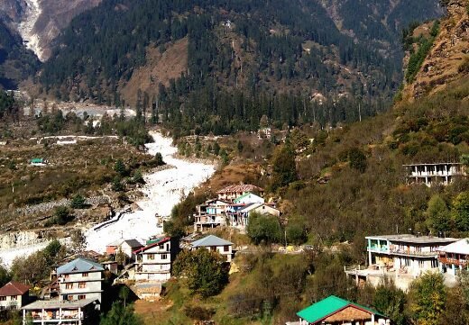
Image Source: Archana Prasad Google Maps
Palchan: A Village at the Gateway to the Upper Beas Valley
Palchan lies on the road beyond Manali towards Solang Valley and the route to Rohtang Pass. Although travellers pass through the area on their way to higher elevations, the settlement itself can be overlooked when the main objective is snow, skiing or mountain viewpoints.
The surrounding landscape is one of the village’s greatest attractions. The valley narrows as the road moves towards the higher mountains, while forested slopes and the changing course of the Beas River help create the scenery associated with this part of Himachal Pradesh.
Palchan is not as isolated as some of the other settlements in this guide, but it offers a convenient opportunity to pause and appreciate the inhabited landscape of the upper valley. Travellers should remember that the village is a living community, not simply a viewpoint along a tourist route.
How to reach Palchan: From Manali, take the main road towards Solang Valley and continue towards the Rohtang Pass approach. Palchan lies along this corridor. Local transport and taxis can be used, but traffic and road restrictions may affect travel during busy seasons.
Best for: Valley scenery, short stops and exploring the upper Manali region.
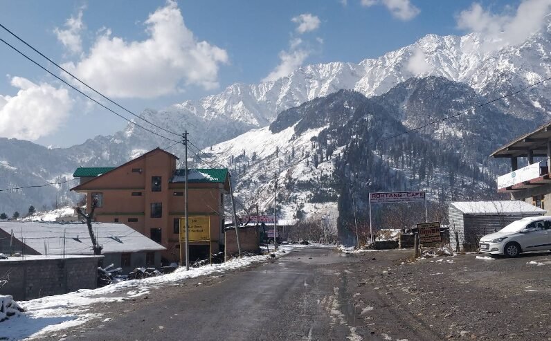
Image Source: Aatur Sharma /Google Maps
Kothi: Mountain Views Above the Beas Gorge
Kothi is located on the road from Manali towards Rohtang Pass and is known for its dramatic mountain setting. The surrounding terrain becomes increasingly rugged, with steep slopes and deep sections of the Beas Valley creating a very different landscape from the more open agricultural areas near Manali.
Although Kothi is an established stop for some visitors, many travellers pass through quickly on their way to higher mountain destinations. Spending additional time in the area allows visitors to appreciate the changing terrain and the relationship between the road, the river valley and the surrounding mountains.
Kothi is particularly appealing to photographers and travellers who enjoy dramatic landscapes. However, steep slopes, exposed road edges and changing weather require care. Visitors should remain well away from unstable edges and avoid entering restricted or unsafe areas.
How to reach Kothi: Follow the main road north from Manali towards Palchan and continue along the Rohtang Pass road. The exact time needed depends on traffic, weather and road restrictions. Check current conditions before travelling beyond Manali.
Best for: Mountain photography, dramatic valley scenery and short roadside excursions.
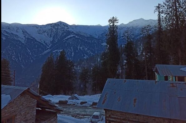
Image Source: Saweza Hashmi /Google Maps
Sethan: A High Mountain Hamlet Above the Hamta Valley
Sethan is one of the most distinctive rural destinations near Manali. Located above the main valley at an elevation commonly reported at around 2,700 metres, it is associated with a small Buddhist community and expansive mountain views. The settlement faces the surrounding Himalayan ranges and offers a quieter atmosphere than Manali’s central tourist districts.
One reason Sethan attracts independent travellers is its changing appearance through the seasons. During warmer months, the surrounding slopes provide opportunities for walks and mountain photography. In winter, snowfall can transform the landscape, and the area has developed a reputation for snow based activities such as skiing and snowboarding when conditions permit.
Sethan is also connected with local stories about the Pandavas, including traditions associated with a place known as Pandu Ropa. Such accounts belong to the region’s local folklore and should be understood as cultural traditions rather than independently verified historical events.
The village’s remote character is part of its appeal, but it also means that access can be more demanding. The road is steep and can be rough, particularly during winter weather. Travellers should not assume that an ordinary low clearance vehicle can comfortably negotiate every section.
How to reach Sethan: From Manali, travel towards Prini and take the uphill road leading towards the Hamta area. Sethan is approximately 12 kilometres from Manali by road, although journey times vary considerably with road conditions. Hiring a local taxi is a practical option. Check whether any local entry permission or vehicle restrictions apply before departure.
Best for: Snow scenery, mountain photography, quiet stays and seasonal outdoor activities.
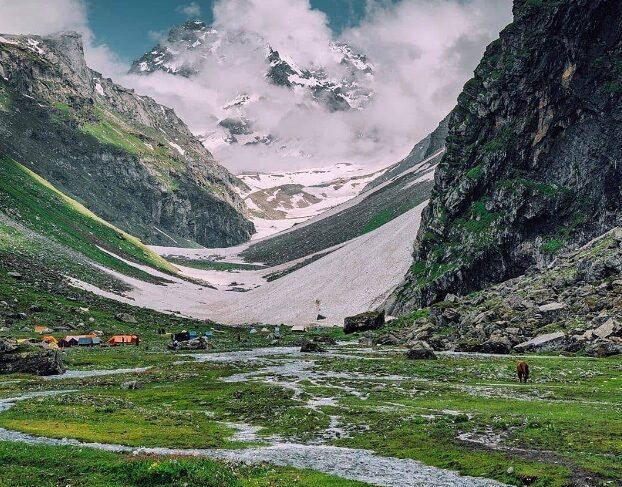
Image Source: Rudra Gajre /Google Maps
Hamta Village and the Hamta Valley Approach
The name Hamta is most widely associated with Hamta Pass, a popular trekking route connecting the Kullu side of Himachal Pradesh with the Lahaul region. However, the surrounding area also contains smaller settlements, agricultural land and access roads that are worth exploring independently of the famous trek.
For travellers interested in rural landscapes, the approach towards Hamta offers a chance to see how the cultivated lower valley gradually gives way to steeper mountain terrain. Depending on the route and season, the landscape may include orchards, forests, streams and open mountain slopes.
It is important to distinguish the broader Hamta area from the actual Hamta Pass trekking route. Reaching the lower valley does not mean that a visitor has reached the high mountain pass, which requires a separate trek and appropriate preparation.
How to reach the Hamta area: Travel from Manali towards Prini and follow the road towards the Hamta Valley. Confirm the intended settlement or trailhead with a local driver before setting out, as the name Hamta refers to a wider geographical area rather than one single village attraction.
Best for: Mountain scenery, rural landscapes and travellers interested in the geography behind the Hamta Pass trek.
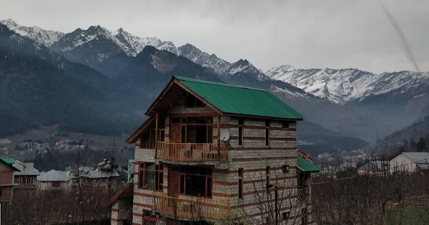
Image Source: Gautham Reddy /Google Maps
Prini: A Village at the Edge of Manali
Prini lies close to Manali and is a useful place to explore if you want to experience a more residential side of the region without travelling far from town. Its location also makes it an important access point for routes leading towards the Hamta area and Sethan.
The village is surrounded by the mountain landscape characteristic of the Kullu Valley. Depending on where you walk, you may encounter local houses, cultivated plots and views across the surrounding slopes. The contrast between Prini’s quieter residential areas and Manali’s busy commercial centre is part of what makes the settlement worth considering.
Prini is particularly convenient for travellers who want to explore the area without organising a full day trip. It can be combined with other nearby destinations, provided the route and available time are planned sensibly.
How to reach Prini: From central Manali, travel south towards the Kullu side of town and follow the road into Prini. A local taxi or private vehicle is convenient, although the final approach may involve narrow residential roads.
Best for: A short rural excursion, access to Sethan and exploration around the Hamta approach.
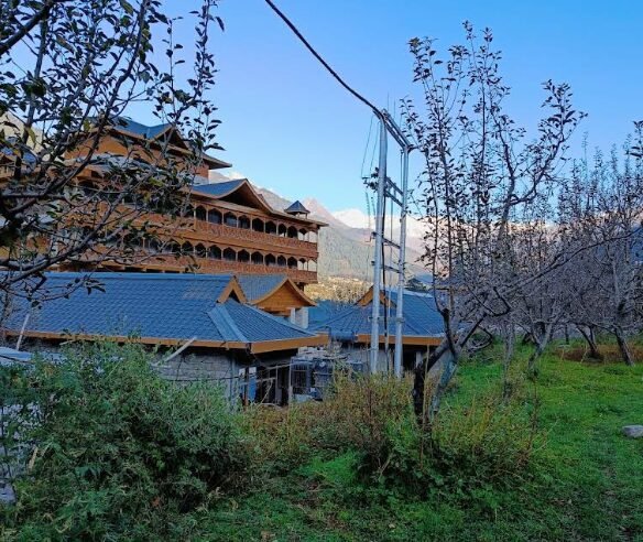
Image Source: Hodophile /Google Maps
Shuru: A Village on the Naggar Road
Shuru, also spelled Shuru or Shooru in some references, lies along the road between Manali and Jagatsukh. It is an interesting stop for travellers exploring the historical and religious landscape south of Manali.
The area is associated with the entrance to the Hamta Nullah region and the historic Sharvali Devi Temple. This gives the settlement a cultural interest beyond its rural surroundings. Visitors who enjoy exploring local religious architecture can use Shuru as part of a broader excursion that includes Jagatsukh’s historic temples.
As in other villages around Manali, the experience is not necessarily centred on a single developed tourist attraction. It is better approached as a short stop on a wider route through the countryside.
How to reach Shuru: Follow the Manali to Naggar road towards Jagatsukh. Confirm the temple’s precise location locally before walking into the surrounding residential area.
Best for: Temple visits, regional history and a combined Jagatsukh excursion.
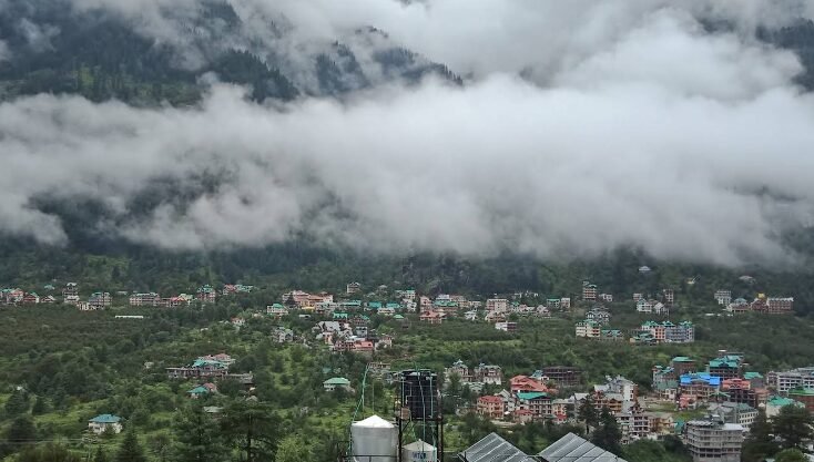
Image Source: Armaan Khan/Google Maps
Bran: A Small Settlement for Rural Exploration
Bran is included here as a lesser explored rural settlement for travellers who prefer agricultural landscapes and quiet village surroundings to commercial tourist attractions.
Small settlements in the wider Kullu Valley often provide opportunities to see terraced fields, orchards, traditional houses and the network of local roads that connects communities across the slopes. The character of a visit depends on the exact location and the season, so Bran is best approached as a rural exploration stop rather than a destination with a guaranteed list of attractions.
Because smaller place names can be difficult to distinguish on maps, travellers should verify the exact Bran they intend to visit before making a dedicated journey. It is especially important to confirm the route with a local driver if the destination is not clearly identified by a mapped road.
How to reach Bran: Confirm its precise location in relation to Manali before departure. Once the correct settlement is identified, use a local taxi or private vehicle and ask about road conditions and suitable parking.
Best for: Travellers interested in small settlements and everyday rural life, provided the destination is verified in advance.
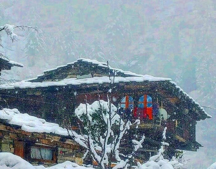
Image Source: Hallan Valley 1 Museum/Google Maps
Hallan Valley: A Quieter Side Valley of the Kullu Region
Hallan is better understood as part of a rural side valley than simply as an isolated village. It is among the more interesting options for travellers looking to move away from the main Manali tourist corridor and explore the countryside towards the Kullu side of the region.
The valley’s appeal lies in its small settlements, agricultural landscapes and mountain surroundings. Rather than focusing on one major attraction, visitors can explore the road into the valley, observe local farming and appreciate the quieter pace of life. Accommodation and visitor facilities are more limited than in Manali, so a little advance planning is useful.
Hallan is particularly suited to independent travellers who are comfortable with basic facilities and do not need a tightly organised sightseeing programme. Those intending to stay overnight should confirm accommodation availability directly with a local host.
How to reach Hallan Valley: From Manali, travel towards Kullu along the old Kullu to Manali road and take the turn for Hallan Road at the locally confirmed junction. The valley is generally accessed by road, but travel time depends on the exact destination within the valley and road conditions.
Best for: Rural exploration, quiet countryside and travellers looking for an alternative to the busy Manali to Solang corridor.
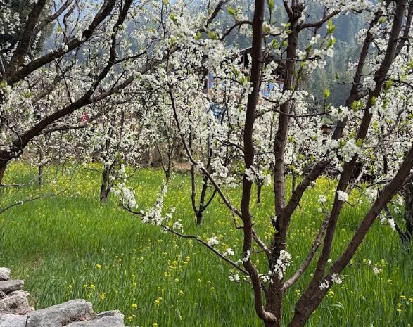
Image Source: Amit Nabh/Google Maps
Soil or Soyal: Forests and Streams Near Manali
Soyal, sometimes written as Soil, is a small rural destination associated with the countryside along the Manali to Kullu side of the valley. It is attractive to travellers who enjoy forest surroundings, streams and short walks rather than formal sightseeing attractions.
The surrounding landscape can provide a refreshing change from the traffic and commercial development of Manali. Depending on the season and the route, the area may offer opportunities for photography, quiet walks and appreciation of the local natural environment.
Visitors should be careful not to confuse the village with similarly spelled place names. The exact location matters when planning transport, particularly if travelling by taxi or using an online map.
How to reach Soil or Soyal: Travel south from Manali along the Naggar Road corridor and confirm the correct turn for the village. A private vehicle or local taxi is usually more convenient than relying on infrequent local transport.
Best for: Forest scenery, streams and short excursions into the rural landscape.
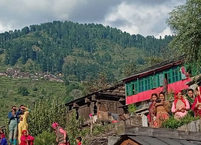
Image Source: ISHWAR SONI/Google Maps
Kais: Forested Countryside Near Kullu
Kais lies in the wider Kullu region, south of Manali, and is worth considering for travellers who want to explore beyond the immediate Manali tourist zone. Its appeal is associated with the forested landscape and the broader countryside of the Kullu Valley.
The nearby Kais Wildlife Sanctuary is an important reason nature enthusiasts may be interested in this part of the region. However, the sanctuary and the village should not be treated as interchangeable destinations. Wildlife sightings are never guaranteed, and access to particular forest areas may be restricted.
Kais is best suited to travellers who enjoy rural roads, forest scenery and a broader understanding of the geography between Manali and Kullu. It can be combined with other stops on the southbound journey, depending on the available time.
How to reach Kais: Travel from Manali towards Kullu and confirm the correct approach to Kais locally. If your main interest is the wildlife sanctuary, check the current access arrangements with the relevant forest authorities before planning a walk.
Best for: Nature enthusiasts, forest landscapes and exploring the wider Kullu region.
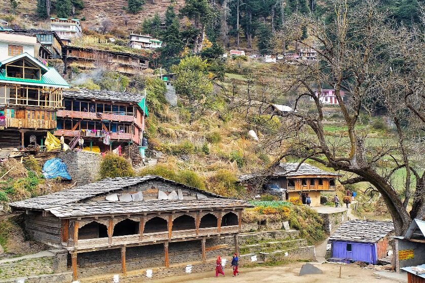
Image Source: Ashtvinayak /Google Maps
Jana: A Village Known for Its Waterfall and Himachali Food
Jana is one of the more rewarding rural excursions from the Naggar area, especially for travellers interested in combining a natural attraction with local food. The village is known for Jana Waterfall, which lies in a forested setting and attracts visitors looking for a quieter excursion away from the main Manali sightseeing circuit.
The waterfall is an important part of the experience, but the surrounding village adds to its appeal. Travellers can enjoy the changing landscape along the approach road, explore the immediate countryside and try traditional Himachali dishes at local eateries when they are open.
Siddu, a steamed bread traditionally prepared with a filling, is one of the regional foods worth looking for. Availability varies by establishment and season, so it is sensible to ask locally rather than assume every eatery serves it.
The waterfall’s appearance changes with the weather. After periods of rain, the flow may be stronger, but trails and roads can also become slippery. Visitors should remain on safe paths and avoid climbing on wet rocks.
How to reach Jana: From Manali, travel towards Naggar and follow the road to Jana village. The excursion is commonly approached from the Naggar side, and the waterfall usually involves a short walk from the accessible parking area. Confirm local road and walking conditions before visiting.
Best for: Waterfall photography, village scenery and traditional Himachali food.
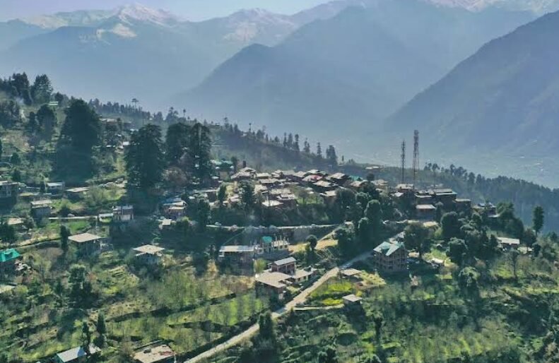
Image Source: Ashtvinayak/Google Maps
Rumsu: A Traditional Village and Trekking Gateway Near Naggar
Rumsu is an excellent choice for travellers who want to combine a village walk with the possibility of exploring the higher mountain landscape. Located near Naggar, it is known as a starting point on the traditional route towards Chandrakhani Pass.
The village offers a glimpse of the rural architecture and forested surroundings of the Kullu region. Walking towards Rumsu can be a rewarding experience in itself, with the landscape changing from cultivated land to wooded slopes. The village also provides a sense of how older mountain routes connected settlements before modern roads transformed travel in the region.
For trekkers, Rumsu is particularly important because the route towards Chandrakhani Pass climbs through forests and high meadows before reaching the mountain pass. This is a proper high altitude trek rather than a casual village walk, and it requires suitable equipment, fitness and attention to weather conditions.
How to reach Rumsu: Travel from Manali to Naggar and continue towards the Rumsu village approach. Rumsu is roughly 4 kilometres from Naggar Castle along the village route. A taxi can take you to the accessible roadhead, while walking is a good way to experience the final stretch.
Best for: Traditional village scenery, forest walks and access to the Chandrakhani Pass trekking route.
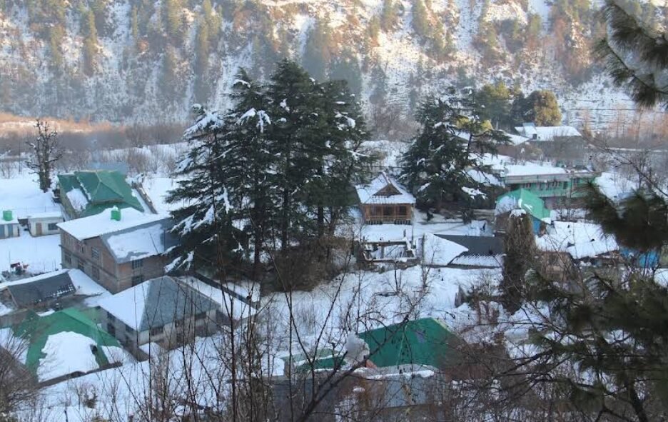
Image Source: Dharam Singh/Google Maps
Pangan: A Lesser Explored Himalayan Settlement
Pangan is included as a rural settlement for travellers interested in the smaller communities scattered across the mountain slopes of the Kullu region.
The attraction of such places is often their ordinary character: houses adapted to the mountain climate, cultivated plots, narrow roads and views that change with the terrain. They provide a different perspective from the resort areas, where the visitor experience is organised around accommodation, restaurants and adventure activities.
However, Pangan’s precise location and the accessibility of its approach should be verified before it is promoted as a standalone tourist destination. Small settlement names are sometimes inconsistently represented on online maps, and the presence of a village does not automatically mean that public facilities or visitor services are available.
How to reach Pangan: Confirm the exact settlement and its road connection with a reliable local map or a driver familiar with the area. Do not begin a dedicated journey until the destination has been positively identified.
Best for: Independent travellers interested in lesser known rural landscapes, with advance route verification.
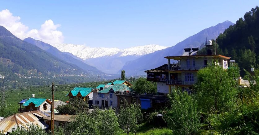
Image Source: Rajesh Sakpal /Google Maps
Gojra: Agricultural Landscape of the Kullu Valley
Gojra is another small settlement that can be considered by travellers interested in the agricultural character of the region. Apple cultivation, vegetable farming and the use of terraced land are important features of rural life across parts of the Kullu Valley, although the crops visible in any particular settlement vary by altitude and season.
For a traveller, the appeal is not necessarily a major monument or a famous viewpoint. Instead, it is the opportunity to observe the relationship between mountain terrain, farming and habitation. This perspective can make even a short drive through a rural area more meaningful.
As with Pangan and Bran, the location should be checked carefully before Gojra is included in a fixed itinerary. A dedicated excursion is only worthwhile if the route and destination are clearly identified.
How to reach Gojra: Verify the exact village location and access road before leaving Manali. A local taxi driver familiar with the relevant settlement can help establish whether it is practical to visit as part of a wider rural excursion.
Best for: Rural landscapes, agricultural scenery and independent exploration.
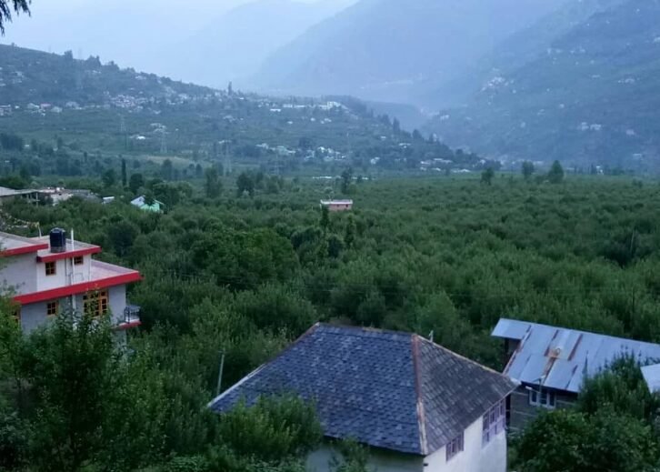
Image Source: Naveen Kumar/Google Maps
Sajla: A Waterfall Excursion Near Naggar
Sajla is an appealing destination for travellers who enjoy combining a village visit with a short nature walk. It is associated with Sajla Waterfall and the countryside around Naggar, offering a different experience from the more commercialised attractions of Manali.
The attraction of the area lies in its wooded surroundings, local settlement and the opportunity to spend time outdoors without committing to a long mountain trek. The waterfall can be particularly attractive for photography when water levels are favourable, although its flow changes throughout the year.
Visitors should remember that a waterfall is a natural feature rather than a managed attraction. Trail conditions, water flow and accessibility can vary after rainfall or during winter. Avoid slippery rocks and do not approach the edge of the waterfall for photographs.
How to reach Sajla: Travel from Manali towards Naggar and confirm the correct road or walking route to Sajla village and its waterfall. Local guidance is useful for identifying the trailhead and checking whether the final stretch is accessible by vehicle.
Best for: Waterfall photography, short walks and a quiet excursion around Naggar.
How to Reach the Villages Around Manali
Manali is the main transport base for exploring these settlements. The best approach is to organise the villages into geographical clusters rather than attempting to visit all 20 in one day.
By road
Manali is connected to the wider region through the Kullu Valley road network. Visitors travelling from Delhi, Chandigarh or other northern Indian cities can reach Manali by bus, private vehicle or taxi. The nearest airport serving Manali is Bhuntar Airport, near Kullu, while rail travellers generally need to combine train travel with road transport. The exact transport options depend on the season and current services. Source: Himachal Tourism.
By local taxi
A taxi is often the most practical option for visiting several small villages in one day, especially where buses are infrequent or the final road is narrow. Agree on the route, waiting time and return arrangements before departure. For destinations such as Sethan, confirm that the vehicle is suitable for the road conditions.
By local bus
Buses can be useful for villages located along the main Manali to Kullu road. However, service frequency and the distance between a bus stop and the village centre can vary. Check the latest local timetable and ask about the return journey before travelling.
On foot
Walking is one of the best ways to explore villages such as Jagatsukh, Rumsu and the settlements around Old Manali. It allows visitors to notice older buildings, agricultural plots and the changing landscape that may be missed from a vehicle.
Some walks involve steep gradients or uneven surfaces. Carry water, wear suitable footwear and avoid entering private land or restricted forest areas.
Suggested Routes for Exploring the Villages
Instead of travelling randomly between settlements, organise your excursions around the main road corridors.
Route 1: Historic villages south of Manali
Manali → Shuru → Jagatsukh → Naggar → Rumsu.
This route combines historic temples, traditional village scenery and the possibility of a short forest walk. Rumsu can be visited as a separate excursion if you want more time to explore on foot.
Route 2: Upper Manali and the Solang corridor
Manali → Palchan → Burua and nearby settlements → Solang Valley → Kothi.
This route is suitable for travellers interested in the upper Beas Valley, mountain scenery and villages located close to the road towards Rohtang Pass. Road conditions and traffic may affect the order of stops.
Route 3: Prini and the Hamta side
Manali → Prini → Hamta area → Sethan.
This route explores the countryside above Manali and provides access to the higher settlement of Sethan. Check road conditions carefully, particularly during snowfall or after heavy rain.
Route 4: Rural excursions from Naggar
Naggar → Jana village and waterfall → other confirmed village stops around the Naggar countryside.
This is a useful option for travellers who want to combine a waterfall visit, local food and rural scenery without spending the entire day on the main tourist circuit.
These are suggested geographical groupings rather than guaranteed driving itineraries. Verify the exact road connections before departure, as some villages require separate access roads or a walk from the nearest motorable point.
Best Time to Visit
The best time depends on what you want to experience.
March to June: Spring and early summer are suitable for village walks, orchard scenery and exploring the countryside as temperatures become more comfortable. Higher settlements may still experience cold weather.
July to September: The monsoon brings greenery and can improve the appearance of streams and waterfalls. However, heavy rain can also cause landslides, slippery paths and road closures. Check conditions before travelling.
October to November: Autumn often provides clearer mountain views and an opportunity to observe the agricultural landscape during the harvest season. Temperatures fall as winter approaches.
December to February: Snow can transform higher settlements such as Sethan. However, snowfall may restrict access, and not every village is suitable for a winter excursion. Confirm road status before travelling and avoid attempting steep, icy roads in an unsuitable vehicle.
Weather conditions in the Himalayas can change quickly, so the best season for sightseeing is not necessarily the safest season for every route.
Responsible Travel in Traditional Himachali Villages
Visiting smaller villages comes with a responsibility to respect the people who live there. These settlements are not simply attractions created for visitors; they are homes, agricultural communities and places of worship.
Walk quietly through residential lanes, ask permission before photographing people or private property, and follow local instructions at temples. Do not enter orchards or fields without permission, leave litter behind or disturb livestock.
Travellers should also avoid assuming that every village has restaurants, public toilets, petrol stations or medical facilities. Carry essentials from Manali, keep some cash available and plan the return journey before exploring remote areas.
Supporting locally run homestays and eateries, where available, can help visitors contribute directly to the regional economy. At the same time, it is important to understand that some settlements may not be prepared to accommodate unplanned tourist visits.
Conclusion
The villages around Manali reveal a side of the Kullu Valley that is easily overlooked when a trip revolves around Solang Valley, Rohtang Pass and the town’s popular cafes. Jagatsukh offers historical and architectural interest, Rumsu provides access to forest walks and the Chandrakhani Pass route, Jana combines waterfall scenery with regional food, and Sethan offers a distinctive high mountain setting.
Other settlements are better approached as quiet rural excursions than as destinations with established tourist attractions. Their appeal lies in the landscapes, agricultural traditions and everyday life that make the Kullu Valley more than a collection of sightseeing stops.
For the most rewarding experience, choose a few villages that fit your interests, verify their locations and access roads, and allow enough time to explore without rushing. In these quieter corners of Himachal Pradesh, the journey through the countryside can be just as memorable as the destination itself.