Image source: Vignesh . P
About Thalaiyar Falls
Thalaiyar Falls, popularly known as Rat Tail Falls, is one of the most spectacular waterfalls in Tamil Nadu. Located in the Dindigul district near Kodaikanal, this magnificent waterfall plunges from a height of approximately 297 metres (975 feet), making it the highest waterfall in Tamil Nadu and one of the tallest waterfalls in India. From a distance, the narrow stream resembles the tail of a rat, which is how the waterfall earned its unique nickname.
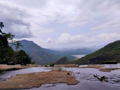
Fed by the Manjalar River, which originates in the lush Palani Hills, Thalaiyar Falls cascades dramatically down steep cliffs into a rocky valley below. Surrounded by dense forests, rugged mountains, and breathtaking landscapes, the waterfall remains largely untouched due to its remote location. Its pristine environment and panoramic views attract trekkers, photographers, and nature lovers seeking an offbeat adventure.
Although there is a rocky pool at the base of the falls, visitors should exercise caution as the terrain is slippery and water levels can rise unexpectedly, especially during the monsoon season. The journey to the waterfall is as rewarding as the destination itself, offering scenic views of valleys, cliffs, and rich biodiversity throughout the trek.
Best Time to Visit
The ideal time to visit Thalaiyar Falls is between October and February, when the weather is cool and comfortable for trekking. The waterfall is also at its most impressive during and just after the monsoon season (June to September), although trekking may become difficult or restricted due to heavy rainfall. It is advisable to check local weather conditions before planning your visit.
How to Reach
By Road: Thalaiyar Falls is located around 40 km from Kodaikanal, 35 km from Batlagundu, and about 95 km from Dindigul. Visitors can drive or hire a taxi to the nearest trekking point. The waterfall itself cannot be reached by vehicle.
By Trek: Reaching the base of Thalaiyar Falls requires a 6-kilometre trek through dense forests, rocky paths, and hilly terrain. The trek is moderately challenging and is recommended for experienced trekkers or those accompanied by local guides. Carry sufficient drinking water, snacks, sturdy trekking shoes, and essential supplies, as there are no facilities along the trail.
By Train: The nearest major railway station is Dindigul Junction, approximately 95 km away. From there, taxis and buses are available to Batlagundu or Kodaikanal.
By Air: The closest airport is Madurai International Airport, around 120 km from the trekking point. Visitors can hire taxis or take buses to reach Batlagundu or Kodaikanal before continuing the journey.
Nearby Attractions
Dum Dum Rock Viewpoint: One of the best places to admire Thalaiyar Falls from a distance, this viewpoint is located on the scenic ghat road between Batlagundu and Kodaikanal. It offers breathtaking views of the waterfall, deep valleys, and surrounding mountains without requiring a trek.
Kodaikanal Lake – 40 km: The iconic star-shaped lake is perfect for boating, cycling, horse riding, and leisurely walks. It is one of Kodaikanal’s most popular attractions.
Silver Cascade Falls – 35 km: Formed by the overflow of Kodaikanal Lake, this picturesque waterfall is located along the Kodaikanal road and is a popular stop for travellers.
Berijam Lake – 55 km: Surrounded by dense forests, Berijam Lake is known for its crystal-clear waters, peaceful atmosphere, and abundant wildlife. Entry is regulated through forest department permits.
Pillar Rocks – 42 km: These towering rock formations rise dramatically above the valleys and provide one of the most spectacular viewpoints in Kodaikanal.
Manjalar Dam – 28 km: Situated amidst scenic hills and agricultural fields, Manjalar Dam is a peaceful picnic spot offering beautiful views of the surrounding landscape.
Maps
FAQs
1. Why is Thalaiyar Falls called Rat Tail Falls?
The waterfall appears as a long, thin stream when viewed from a distance, resembling the tail of a rat, which gave rise to its popular nickname.
2. Is trekking mandatory to reach the waterfall?
Yes. The base of Thalaiyar Falls is accessible only through a trek of approximately 6 km. However, visitors who do not wish to trek can enjoy distant views from Dum Dum Rock Viewpoint.
3. Is the trek suitable for beginners?
The trek is moderately difficult, involving rocky terrain and forest trails. It is better suited for physically fit visitors or those accompanied by experienced guides.
4. Can visitors swim or bathe in the waterfall?
Bathing is generally not recommended due to slippery rocks, strong currents during the rainy season, and the absence of safety infrastructure.
5. What should I carry for the trek?
Wear sturdy trekking shoes and carry drinking water, light snacks, sunscreen, insect repellent, a first-aid kit, and a fully charged mobile phone or power bank.
6. What is the best viewpoint to see Thalaiyar Falls without trekking?
Dum Dum Rock Viewpoint offers one of the finest panoramic views of Thalaiyar Falls and the surrounding valleys, making it ideal for visitors who prefer sightseeing over trekking.