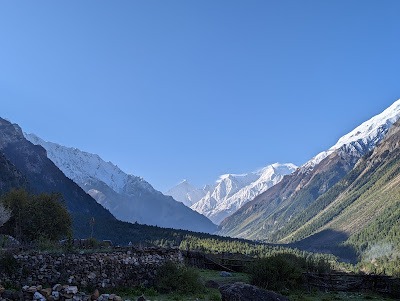
Image Source: Jay Deep
About Vyas Valley
Hidden in the remote northeastern corner of Uttarakhand, close to the Indo-Tibetan frontier, Vyas Valley is one of the most dramatic and geographically complex landscapes in the Indian Himalayas. Unlike a single river valley with clearly defined boundaries, Vyas Valley is actually a network of interconnected high-altitude valleys shaped by the upper reaches of the Kali River, ancient glaciers, snowfields, and centuries of geological transformation. It is a place where nature still dominates the rhythm of life, and where every rise in altitude brings a visible change in terrain, climate, vegetation, and human settlement.
The valley begins beyond Dharchula and stretches toward some of the most isolated Himalayan regions near the border with Nepal and China. What makes Vyas Valley remarkable is not only its beauty but also the way it reveals the gradual transition from forested middle Himalayas to barren trans-Himalayan terrain. The journey through the valley feels less like traveling through a destination and more like moving through different ecological worlds layered one above another.
The landscape may initially appear rugged and empty, but a closer look reveals a highly dynamic geographical system. Rivers carve through steep mountain walls, glacial streams braid across valley floors, alpine meadows briefly bloom during summer, and isolated villages survive through generations of adaptation to harsh environmental conditions. Vyas Valley is not simply remote; it is a living example of how geography shapes human existence in extreme Himalayan environments.
The Lower Vyas Valley: Entering the High Himalaya
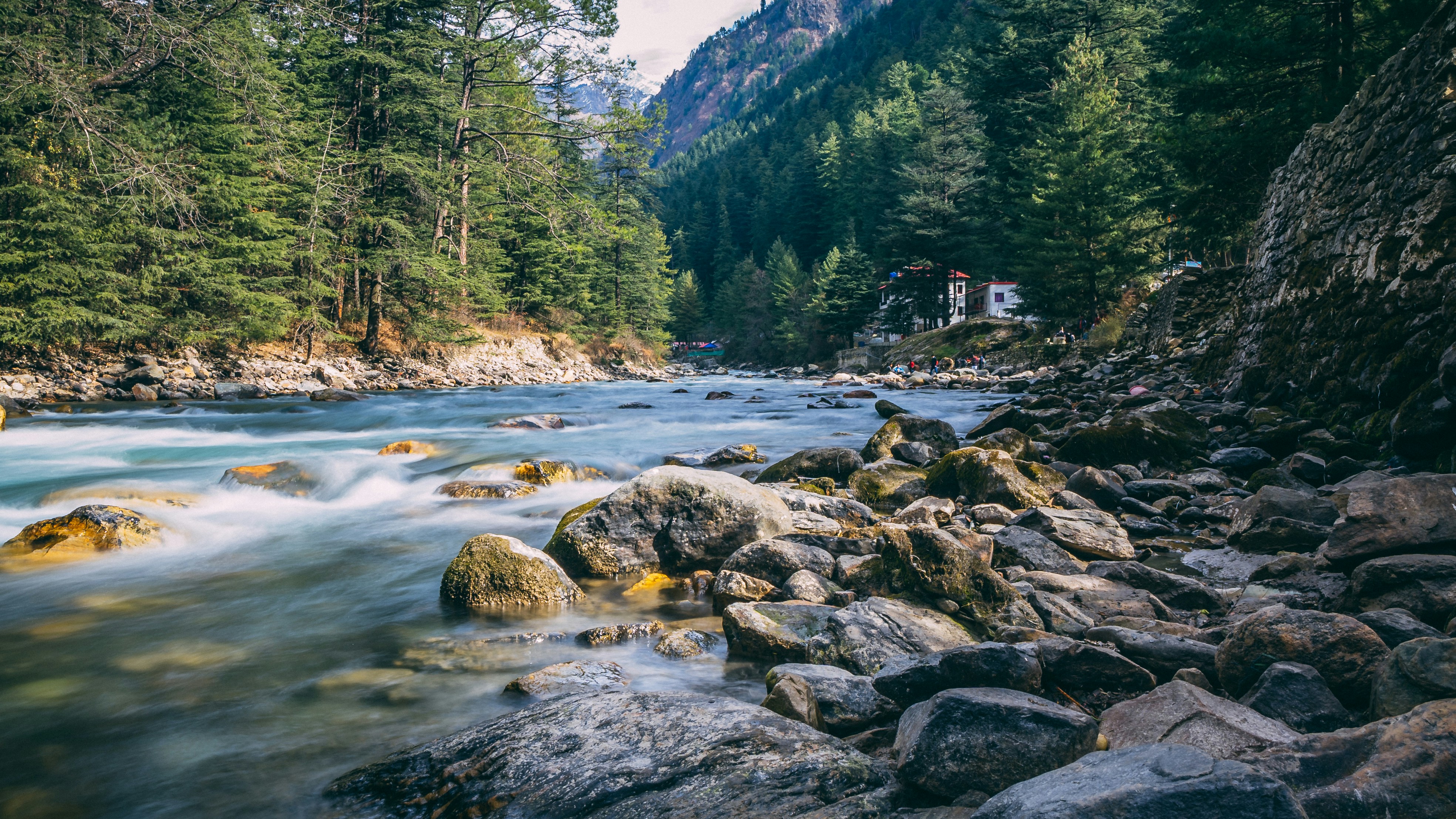
The approach to Vyas Valley begins north of Dharchula, where the terrain slowly starts changing character. In the lower section of the valley, the mountains are steep but still carry greenery across their slopes. Pine forests, shrubs, and terraced patches of cultivation continue to appear along the hillsides, while the Kali River flows powerfully through the narrow valley below.
This region marks the important geographical transition from the middle Himalayas to the higher Himalayan belt. Rainfall still plays a major role here, but snowmelt increasingly begins contributing to the river system. The air grows thinner and cooler, and the once-dense vegetation gradually starts giving way to alpine landscapes.
Despite the difficult terrain, this lower zone remains extremely important for life and movement in the region. It acts as the logistical gateway to the upper valley systems. Supplies, transportation routes, acclimatization stops, and seasonal trade activities all depend heavily on these lower settlements. Without this transition zone, access to the higher reaches of Vyas Valley would be nearly impossible.
The villages here also reflect the early stages of adaptation to mountain life. Traditional stone houses, carefully constructed footpaths, and small agricultural plots demonstrate how local communities have learned to live with steep slopes, landslides, and unpredictable weather patterns.
Gunji: The Central Nerve of Vyas Valley
Further upstream lies Gunji, one of the most important settlements in the entire valley system. Though small in size, Gunji holds immense geographical significance. It sits at a strategic point where multiple side valleys converge, creating a relatively stable and habitable pocket within an otherwise hostile mountain environment.
The terrain around Gunji opens slightly compared to the narrow river gorges below. This wider valley floor allows better water distribution, more stable ground conditions, and patches of alpine grassland suitable for seasonal grazing. These factors have historically made Gunji a natural center for habitation and movement.
For centuries, the village served as a crossroads for traders, pilgrims, shepherds, and travelers moving toward Tibet and other Himalayan passes. Even today, routes from Gunji branch toward Kuti, Nabi, and Kalapani, making it an essential base for expeditions and high-altitude travel.
The climate here remains severe for much of the year, yet it is comparatively milder than the regions farther north. During the short summer season, alpine meadows around the village briefly turn green, supporting livestock and seasonal agricultural activities. In winter, however, snow and freezing temperatures isolate much of the region.
Gunji also illustrates how geography directly shapes settlement patterns in the Himalayas. Villages survive only where the terrain allows a rare balance between water availability, stable landforms, and manageable climatic conditions.
Kuti Valley: A Landscape Sculpted by Ice
Branching away from Gunji is the remote and hauntingly beautiful Kuti Valley. This valley carries clear evidence of its glacial past. Wide U-shaped valley profiles, scattered moraines, rocky debris fields, and braided meltwater channels all point toward the powerful glaciers that once dominated the region.
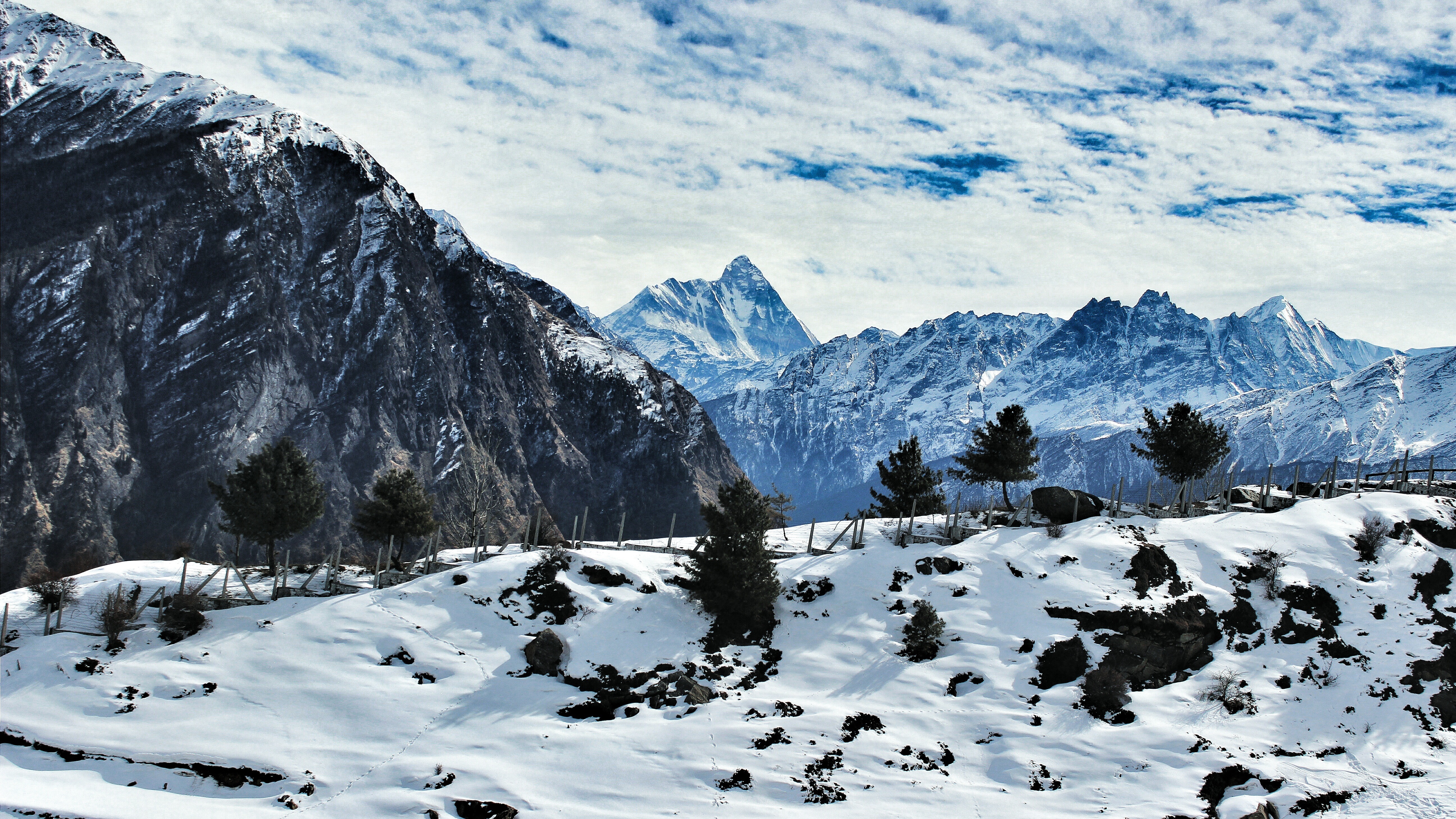
Unlike the greener lower valley, Kuti Valley feels colder, quieter, and far more exposed. Snow remains on the surrounding slopes for long periods, and the growing season lasts only a few brief months. Agriculture is extremely limited, and human settlement has always remained sparse due to the harsh environmental conditions.
The hydrology of Kuti Valley is closely tied to glaciers and seasonal snowmelt. Streams swell during warmer months as ice melts at higher elevations, feeding the Kali River system downstream. In many ways, the valley acts as a natural water storage zone for the broader Himalayan landscape.
Traveling through Kuti Valley reveals how strongly glaciers have shaped the Himalayas. Massive boulders transported by ancient ice flows remain scattered across the terrain, while flattened valley floors indicate areas once occupied by thick glacial sheets. The geography here feels ancient and unfinished, as though the mountains are still being carved in slow motion.
Despite the difficult conditions, small seasonal settlements continue to survive through pastoral traditions and deep environmental knowledge passed down over generations. Life here depends entirely on understanding weather cycles, snow conditions, and the fragile mountain ecosystem.
Nabi Valley: Survival in a Fragile Landscape
Another branch of the Vyas Valley system leads toward Nabi Valley, a harsher and more constrained environment where nature leaves very little room for error. Compared to Kuti Valley, Nabi Valley is steeper, narrower, and more enclosed by rugged mountain walls.
The valley floor is limited, soils are thin, and vegetation remains sparse for most of the year. Strong winds frequently sweep through the region, while streams depend almost entirely on melting snow rather than rainfall. Water scarcity becomes more noticeable by late summer, making survival increasingly difficult.
Yet human communities have managed to persist here for centuries through careful adaptation. Seasonal migration, livestock grazing, and limited agriculture form the backbone of local livelihoods. Houses are traditionally designed to conserve heat and withstand harsh mountain weather, reflecting generations of practical experience with high-altitude living.
Nabi Valley highlights an important reality of Himalayan geography: survival in these mountains is rarely about abundance. Instead, it depends on balance, restraint, and a deep understanding of environmental limits. Every resource—water, grassland, fuel, and arable land—must be carefully managed.
The stark beauty of the valley also creates a powerful sense of isolation. Towering barren ridges, icy winds, and vast silent landscapes give the region an almost otherworldly atmosphere rarely experienced in more accessible Himalayan destinations.
Kalapani: The Source Region of the Valley
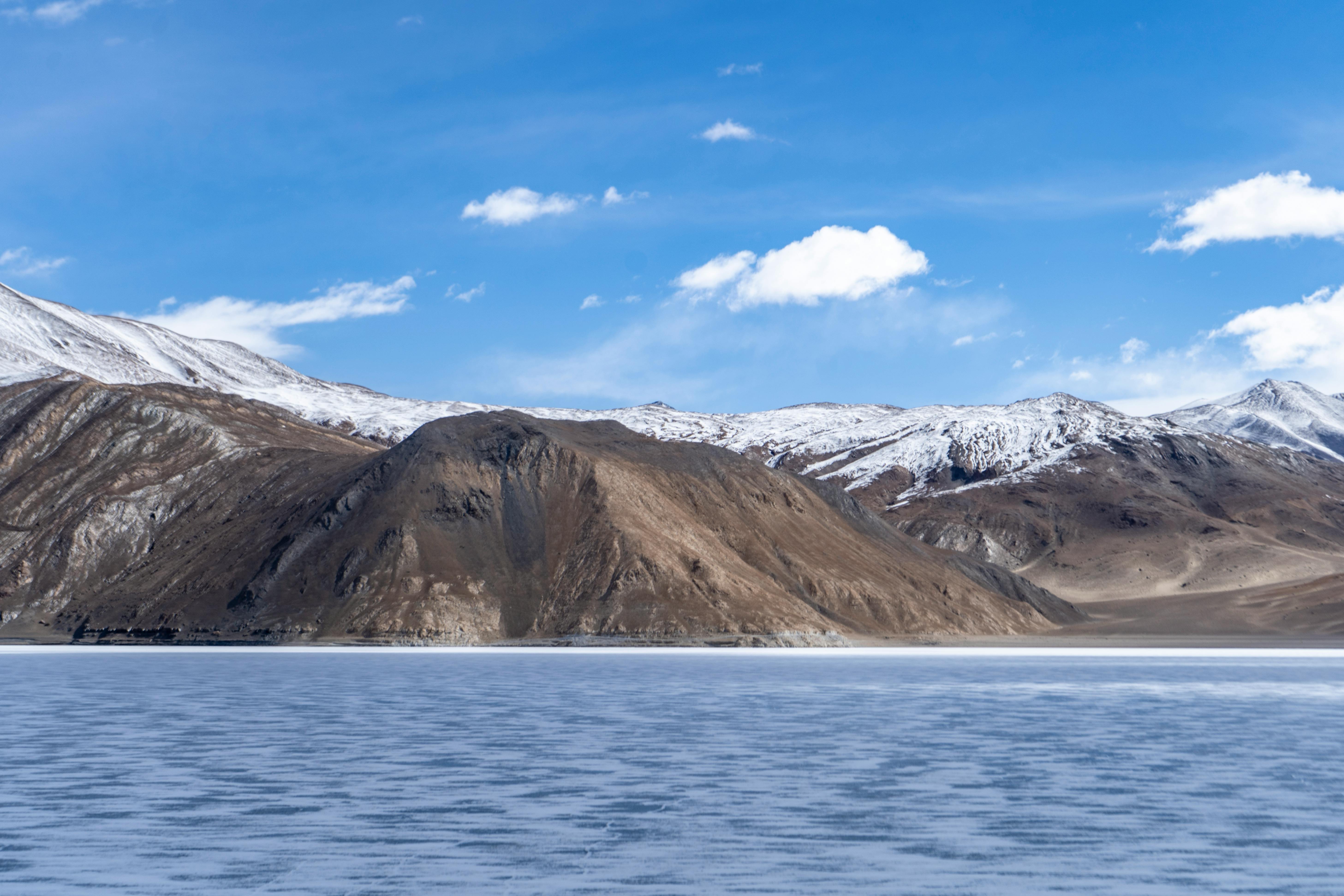
Beyond the inhabited parts of the valley lies Kalapani, one of the most geographically significant zones of the upper Himalayas. Here, the landscape begins losing its human scale entirely. Vegetation becomes minimal, the air grows thinner, and the terrain transforms into a cold desert shaped by frost, wind erosion, and glacial activity.
Kalapani is widely known as one of the source regions associated with the Kali River. Springs, snowfields, and glacial meltwater combine to form the river system that later cuts through the valleys below. The area functions as a hydrological origin zone, storing winter snow and gradually releasing water during warmer months.
The environment here resembles the Tibetan Plateau more than the forested Himalayas of lower Uttarakhand. Rocky plains, barren slopes, and sudden weather changes dominate the landscape. Snowstorms can occur unexpectedly even during relatively stable seasons, while temperatures fluctuate sharply between day and night.
Human presence in Kalapani remains temporary and strategic rather than permanent. The terrain is too extreme for large settlements, and survival becomes increasingly difficult with rising altitude. Still, the region holds enormous geographical, ecological, and cultural significance because it represents the upper threshold of life within the Vyas Valley system.
Standing in Kalapani, one begins to understand the raw forces that shape the Himalayas. Here, rivers are born, glaciers retreat and advance, and the mountains exist in their most elemental form.
Climate and Seasonal Changes in Vyas Valley
The climate of Vyas Valley changes dramatically with altitude. Lower areas experience relatively moderate Himalayan weather with monsoon rainfall, while the upper regions remain cold and dry for much of the year. Winters are long and severe, often cutting off settlements due to heavy snowfall and frozen routes.
Summer, though brief, transforms the valley completely. Snow begins melting, alpine meadows emerge, and migratory pastoral activities resume. This short season is crucial for agriculture, grazing, trade, and travel. Wildflowers bloom across some of the higher grasslands, creating a striking contrast against the rocky mountain backdrop.
Monsoon conditions can also make the lower valley unstable due to landslides, swollen rivers, and road blockages. Because of this, movement through the region always depends heavily on weather and seasonal timing.
Culture and Human Adaptation
The communities living in and around Vyas Valley have historically maintained close cultural and economic connections with trans-Himalayan trade routes. Traditional lifestyles revolve around seasonal migration, livestock rearing, small-scale farming, and trade-based movement across mountain passes.
Architecture in the region reflects adaptation to extreme weather. Stone-built homes with compact designs help retain heat, while settlements are positioned carefully to avoid avalanche zones and unstable slopes. Food storage, water conservation, and fuel management are all critical parts of survival.
The valley is also spiritually important, especially because routes toward sacred Himalayan pilgrimage sites pass through this region. For local communities, the mountains are not merely physical landscapes but deeply respected living environments tied to tradition, memory, and belief.
Why Vyas Valley Is Geographically Unique
What makes Vyas Valley truly extraordinary is the way it compresses multiple Himalayan worlds into a single connected system. Within a relatively short distance, one can witness the transition from forested valleys to alpine meadows, glacial landscapes, and finally cold desert terrain.
The valley demonstrates the interconnected relationship between glaciers, rivers, climate, ecology, and human survival. Every settlement exists because geography briefly allows it, and every river depends on snow and ice stored high in the mountains.
Unlike commercial hill destinations, Vyas Valley remains raw, isolated, and deeply shaped by natural processes. It is less about tourism and more about understanding the Himalayas in their purest form—a place where geology, climate, water, and human endurance come together in one of the most remote corners of India
FAQs
Where is Vyas Valley located?
Vyas Valley is located in the northeastern part of Uttarakhand, mainly in the Pithoragarh district near the borders of Nepal and China.
Why is Vyas Valley important?
The valley is geographically important because it contains major glacial systems, source regions of the Kali River, and ancient Himalayan trade and pilgrimage routes. It is also significant for understanding high-altitude Himalayan ecology and human adaptation.
Which river flows through Vyas Valley?
The upper course of the Kali River flows through the valley and shapes much of its landscape.
What are the main settlements in Vyas Valley?
Important settlements and regions include Gunji, Kuti Valley, Nabi Valley, and Kalapani.
What is the best time to visit Vyas Valley?
The best time to visit is generally between May and September, when snow begins melting and roads become more accessible. Winters are extremely harsh and many routes remain closed.
Is Vyas Valley suitable for regular tourism?
Vyas Valley is better suited for experienced travelers, trekkers, researchers, and those interested in remote Himalayan geography. Infrastructure is limited, and the terrain can be physically demanding.
What kind of landscape is found in Vyas Valley?
The valley includes river gorges, alpine meadows, glacial valleys, rocky plains, and cold desert terrain. The landscape changes rapidly with altitude.
Why is Gunji considered important in the valley?
Gunji acts as the central junction where several valley routes converge, making it the main logistical and geographical hub of the region.