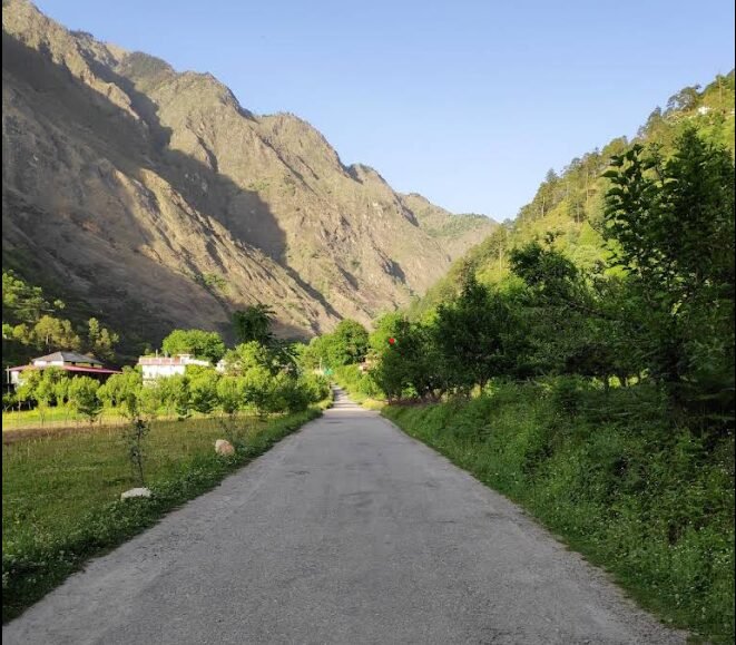
Image Source: Deepti Kala/ Google Maps
Introduction
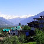
Nagini is one of the quieter riverside settlements in the beautiful Tirthan Valley of Himachal Pradesh. Located a few kilometres from Gushaini along the Tirthan River, this small hamlet has gradually become a popular base for travellers exploring the valley’s forests, mountain villages and trekking routes. Surrounded by forested slopes, terraced fields and the sound of flowing water, Nagini offers a combination of nature tourism, rural culture and access to the Great Himalayan National Park (GHNP) region.
Unlike the busier hill stations of Himachal Pradesh, Nagini is known for its relaxed atmosphere and small scale of tourism. Homestays, riverside cottages and camps allow visitors to stay close to the landscape rather than in a large commercial town. The settlement is particularly suitable for travellers who want to spend time beside the river, take short walks through the surrounding countryside or use the village as a base for exploring other parts of Tirthan Valley.
Nagini is not completely untouched by tourism. Accommodation businesses have developed along the river road, and during busy holiday periods the area can attract a steady flow of visitors. Nevertheless, it retains a more village-oriented character than many heavily developed mountain destinations.
Geographic Setting
Nagini lies in the Tirthan River valley in the Banjar area of Kullu district, Himachal Pradesh. It is situated on the river road between the Sai Ropa area and Gushaini, making it a convenient stop for travellers heading deeper into the valley. The surrounding landscape consists of steep mountain slopes, forested ridges, small settlements and cultivated land.
The valley floor in this part of Tirthan is broadly around 1,600 metres above sea level, although the exact elevation of an individual property or settlement point can vary. The often quoted figure of 1,600–1,700 metres should therefore be treated as an approximate regional elevation rather than a surveyed measurement for all of Nagini.
The landscape around the village includes:
- River terraces and small stretches of relatively level land beside the Tirthan River.
- Forested slopes with a mixture of conifers and broadleaf trees.
- Terraced agricultural fields, orchards and scattered houses.
- Small seasonal streams and drainage channels flowing down from the surrounding hills.
The wider Tirthan Valley has a close geographical connection with the Great Himalayan National Park Conservation Area, a UNESCO World Heritage property known for its mountain ecosystems and biodiversity. According to the official Great Himalayan National Park website, the Tirthan River originates near Hanskund Peak and receives water from ice deposits, snowmelt and other sources before flowing downstream towards the Beas River system.
It is worth distinguishing the wider valley from the protected park itself. Nagini is a settlement in the surrounding inhabited landscape, not a village located inside the national park’s core area. The precise boundaries of the park, its eco-zone and other protected areas matter when planning walks or treks.
The Tirthan River is one of the defining features of Nagini. Its cold mountain water, rocky banks and changing flow give the village much of its character. However, the river should not automatically be described as pollution-free or ecologically healthy simply because the water looks clear. Water quality can vary with season, rainfall, upstream activity and local infrastructure. Visitors should also remember that the river can become dangerous during heavy rain or sudden rises in water level.
Village Settlement and Demography
Like many settlements in the western Himalayas, Nagini is better understood as a small riverside hamlet than as a compact town. Houses and accommodation properties are spread along the valley road and nearby slopes, with agricultural plots and orchards occupying the more accessible land.
The settlement pattern reflects the terrain. Flat land is limited in a steep river valley, so buildings tend to occupy available terraces, roadside plots and small areas of relatively gentle ground. The river, road, cultivated fields and surrounding slopes together shape how people live and move through the area.
Village life in the Banjar region has traditionally depended on agriculture, livestock, local religious institutions and community relationships. Tourism has added another source of income. Some households have established homestays, guesthouses, camps and small hospitality businesses, while others continue to rely on farming and related activities.
Although census records are available for villages across Kullu district, general statements about the population or household structure of Nagini should not be presented as specific census findings without identifying the relevant village entry and census year. The settlement’s scattered character is visible in the landscape, but its exact population and demographic profile require separate verification.
For visitors, this mix of traditional village life and tourism is part of Nagini’s appeal. A stay here can provide opportunities to interact with local hosts, learn about seasonal work and understand how mountain communities are adapting their livelihoods to changing travel patterns.
Traditional Architecture
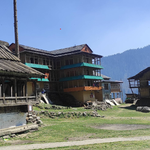
The architecture of Nagini belongs to the wider building tradition of the Kullu and western Himalayan region. Traditional houses in this part of Himachal Pradesh have historically used locally available stone and timber, with construction methods adapted to steep terrain, cold winters and earthquake risk.
One important regional technique is Kath-Kuni architecture, which uses alternating layers of stone masonry and wooden beams, often interlocked at the corners. The arrangement creates a distinctive pattern of horizontal timber and stone. Traditional buildings made this way can provide useful insulation and structural flexibility when properly designed and maintained.
Kath-Kuni is well documented in the Kullu region, including at the nearby heritage settlement of Chehni Kothi. The technique should not, however, be assumed to characterise every older house in Nagini. Modern concrete buildings, metal-sheet roofs and newer construction methods are also found across tourist villages in the valley.
Traditional Himalayan houses may feature sloping roofs, timber balconies, stone walls and practical layouts suited to mountain life. The precise materials depend on the age of the building, local resources, household needs and renovation history. Slate has been used traditionally in parts of Himachal Pradesh, but roof materials vary and should not be generalised across the entire village.
For travellers interested in vernacular architecture, Nagini can be a starting point for observing how the built environment changes along the valley. Those wanting to see a more widely recognised example of traditional Kullu architecture can also consider a visit to Chehni Kothi and the surrounding village.
Agriculture and Rural Economy
Agriculture remains an important part of the rural landscape around Nagini. Terraced fields and small cultivated plots occupy the land available between houses, orchards, the river and the rising slopes. Farming in a mountain valley is shaped by the limited availability of level ground, seasonal rainfall, irrigation access and the time required to reach individual fields.
Maize, wheat, barley and seasonal vegetables are grown in parts of the wider Kullu and Banjar region, although the crops cultivated by a particular household depend on altitude, exposure, soil and local conditions. Fruit cultivation is also an important feature of the regional economy. Apples and stone fruits such as plums can be found in suitable locations, while the mix of crops changes with elevation and growing conditions.
It is better not to assume that every Nagini household grows apples, plums and apricots, or that all listed crops are grown in the same fields. The agricultural landscape varies from one part of the valley to another.
Livestock can contribute to household livelihoods through milk, manure and other products. Farming, orchard work, construction, transport and small local businesses may all form part of the rural economy.
Tourism has created additional opportunities. Family-run homestays, riverside accommodation, food services and guided activities allow some residents to earn income from visitors. This diversification can help households manage the limitations of mountain agriculture, although tourism also brings challenges such as seasonal employment, waste management, water demand and pressure on land beside the river.
Travellers can support the local economy by choosing locally operated accommodation, eating at small establishments, asking permission before photographing residents and following the host’s advice about village customs.
Nature Trails and Forest Walks
Nagini is well suited to travellers who enjoy short walks and unhurried exploration. The river road connects the settlement with nearby parts of Tirthan Valley, while smaller paths and local routes lead towards houses, fields and forested slopes. These walks provide a chance to observe the everyday landscape rather than treating the village only as a place to sleep.
Typical walking options include:
- Riverside walks: Follow accessible stretches beside the Tirthan River, staying on established paths and away from unstable banks.
- Village and orchard walks: Explore local lanes and cultivated terraces, taking care not to enter private fields without permission.
- Forest walks: Ask your accommodation host about suitable local paths and current trail conditions before setting out.
- Excursions towards nearby waterfalls: Chhoie Waterfall is commonly associated with the Nagini area and offers an additional outing for visitors who want more than a riverside stroll.
The walk to Chhoie Waterfall is often described as a relatively short excursion, but the actual time depends on the starting point, walking pace, recent weather and trail condition. Some sections can be steep or slippery, so suitable footwear is advisable. Ask locally about the current route rather than relying entirely on an online map.
The wider valley also provides access to longer hikes and trekking routes associated with the Great Himalayan National Park region. These should not be confused with casual village walks. Some routes require a guide, permission or advance planning, and journeys into higher elevations can involve substantial changes in terrain, weather and difficulty. Check the official GHNP website for information about park access and trekking.
A useful way to experience Nagini is to keep the first day simple: take a walk along the river, explore the immediate village surroundings and ask local hosts about the conditions of nearby trails. This allows visitors to choose a longer excursion based on the season and their level of fitness.
Wildlife and Birdwatching
Nagini lies within the wider ecological landscape of the Tirthan Valley, which forms part of a region recognised for its diverse Himalayan habitats. Forests across the valley include broadleaf woodland and coniferous stands, while the surrounding protected landscape extends through temperate forests, subalpine vegetation and alpine habitats at higher elevations.
These habitats support a range of birds and mammals. Birdwatchers exploring the wider region may encounter forest birds, woodpeckers, flycatchers and pheasants. The Great Himalayan National Park landscape is also known for conservation-priority species, including the western tragopan and Himalayan tahr. However, these species are not guaranteed sightings around Nagini itself, and some are associated with particular habitats or elevations.
Mammals such as barking deer and Himalayan goral inhabit parts of the broader Himalayan landscape, but sightings near the village are unpredictable. Animals may avoid roads and settled areas, especially when there is frequent human activity.
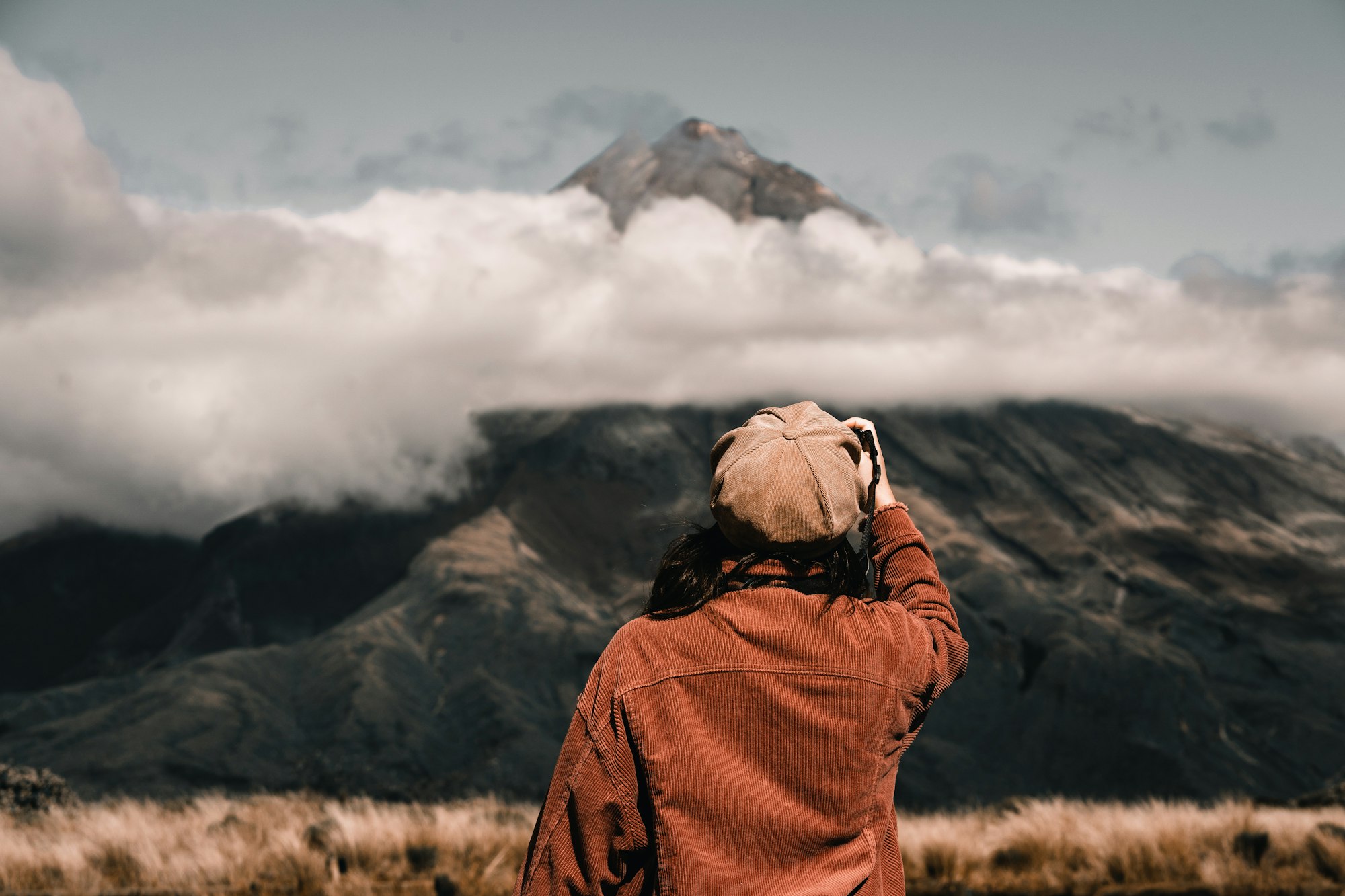
For a more rewarding birdwatching experience, walk quietly in the early morning, avoid loud music and give birds plenty of distance. Binoculars can be useful, and a field guide or bird identification application may help identify unfamiliar species. Do not use playback calls excessively or approach nests and resting animals.
The ecological value of the Tirthan region is not limited to rare wildlife. The combination of flowing water, forest cover, mountain slopes and human settlements creates a landscape where small changes in land use can have wider effects. Visitors can help by carrying waste back, avoiding detergents in natural water bodies and choosing accommodation that manages sewage and rubbish responsibly.
Tourism and Homestays
Over the past several years, Nagini has developed as an accommodation base for travellers exploring Tirthan Valley. Its location along the river road makes it convenient for visitors who want to stay close to the water while remaining within reach of Gushaini and the wider valley.
Accommodation in and around Nagini includes family-run homestays, guesthouses, camps and riverside cottages. Facilities vary from property to property. Some focus on simple rooms and home-cooked meals, while others offer private cottages, landscaped grounds or organised outdoor activities.
Depending on the property, visitors may find:
- Rooms or cottages overlooking the river, forest or surrounding hills.
- Home-style meals featuring local and familiar Indian dishes.
- Help arranging local walks and trekking support.
- Outdoor seating areas where guests can relax beside the river.
- Opportunities to learn about village life and the surrounding landscape.
The term eco-lodge should be used carefully. A property being located beside a forest or river does not automatically make it environmentally sustainable. Visitors interested in responsible tourism can ask about waste disposal, sewage treatment, water use, heating arrangements and the source of food and building materials.
Nagini can be a good choice for travellers who prefer a quieter stay rather than a busy market area. However, the river road is not completely isolated, and the atmosphere changes with the season, weekends and public holidays. Anyone seeking complete silence should check the property’s exact location, road access and proximity to other accommodation before booking.
A riverside room also does not mean that swimming is safe. The Tirthan is a cold mountain river with variable currents, submerged rocks and sudden changes in water level. Enjoy the river from a safe distance unless a suitable activity is being conducted under qualified local supervision.
Cultural Traditions
Nagini belongs to the wider cultural landscape of the Kullu region, where village deities, temples, seasonal fairs and community gatherings remain important parts of local life. In many settlements across Kullu, traditional religious institutions help organise festivals and maintain relationships between neighbouring villages.
During local celebrations, communities may gather for religious ceremonies, music, processions and folk performances. The timing and form of these events vary from village to village, and it would be inaccurate to assume that every festival or ritual associated with Kullu is observed in the same way in Nagini.
Visitors can learn about local customs by asking hosts whether a village festival, temple or community event is open to visitors. Religious spaces should be approached respectfully, and photography should only be undertaken when permitted. During processions or ceremonies, it is important not to obstruct participants or treat sacred objects as tourist props.
The region’s cultural identity is also expressed through its food, traditional building practices, agricultural calendar and relationship with the surrounding landscape. For travellers, these everyday details can be just as informative as a major festival. A conversation with a local host about farming seasons, fruit harvests or village life may offer a more grounded understanding of the area than a hurried sightseeing schedule.
How to Reach Nagini
Nagini is reached by road through the Banjar area of Kullu district. Travellers generally approach the valley from the Aut side, which connects with the main road network leading towards Kullu and Mandi. From Banjar, the route follows the Tirthan River upstream, passing through the Sai Ropa area before reaching Nagini and continuing towards Gushaini.
The final approach follows a mountain road, so travel times depend on traffic, weather, roadworks and the vehicle being used. During heavy rain, landslides or road damage can affect access. Check local road conditions before travelling, particularly during the monsoon and winter months.
Travellers using public transport can look for buses serving Banjar and the Tirthan Valley, then confirm locally whether a bus stops at Nagini or whether a taxi or short transfer is needed. Services and schedules can change, so do not rely on an unverified timetable when planning a tight connection.
If driving, allow extra time for the narrow valley road and avoid stopping at unsafe bends to take photographs. Before booking accommodation, confirm whether the property has parking and whether the final approach involves a steep lane or a walk from the road.
Best Time to Visit Nagini
Nagini can be visited in different seasons, but the experience changes considerably throughout the year.
Spring, from March to April, brings milder daytime weather and the return of fresh greenery. It can be a pleasant period for village walks and exploring the surrounding landscape, although nights may remain cold.
Summer, from May to June, is generally attractive for travellers escaping the heat of the plains. The river and forested valley provide a refreshing setting, and this is a popular period for outdoor activities. Accommodation may need to be booked ahead during holidays.
The monsoon, from July to September, makes the valley lush but brings the possibility of heavy rain, slippery trails, landslides and rising river levels. Outdoor plans should remain flexible, and visitors should avoid walking close to swollen streams or unstable riverbanks.
Autumn, from October to November, often offers clearer skies and comfortable conditions for walking, depending on the weather. It can be a rewarding period for photography and a quieter stay after the main summer rush.
Winter, from December to February, can bring cold nights and chilly mornings. Snowfall is possible in the higher surrounding areas, but it should not be assumed that Nagini itself will be covered in snow. Check forecasts and accommodation heating arrangements before travelling.
For most visitors interested in gentle walks, village scenery and a riverside stay, spring, early summer and autumn are sensible periods to consider. Weather conditions, however, are more important than a fixed seasonal calendar.
Nearby Places to Explore
Nagini’s location makes it a useful base for exploring several other places in Tirthan Valley and the Banjar region.
Gushaini is one of the best-known settlements in Tirthan Valley and a starting point for exploring the wider river valley and routes associated with the Great Himalayan National Park. It also has local shops and accommodation options.
Sai Ropa is associated with the Great Himalayan National Park area and is useful for travellers seeking information about park access and trekking arrangements. Check official guidance before planning a protected-area excursion.
Chhoie Waterfall is a nature outing commonly linked with the Nagini area. The path and walking time should be checked locally, especially after rain.
Chehni Kothi is a worthwhile excursion for travellers interested in traditional architecture and heritage villages. Its historic tower and Kath-Kuni construction provide a more distinctive architectural experience than a general drive through the valley.
Jibhi lies in the neighbouring branch of the Banjar region and is known for its forest setting, village accommodation and waterfall. It can be combined with Tirthan Valley in a wider trip, but road journeys and local conditions should be checked before setting out.
These places offer different experiences, from riverside relaxation and short nature walks to architecture and longer trekking excursions. Rather than trying to cover them all in a single day, travellers can use Nagini as a base and explore according to the time available.
Responsible Travel Tips
Nagini’s appeal depends partly on its river setting and relatively small scale. Visitors can help preserve this character through a few simple choices.
Carry reusable water bottles and avoid leaving plastic, food packaging or cigarette waste along the river. Do not wash utensils, clothes or yourself with soap directly in the river. Keep a safe distance from the water, especially during the monsoon, and never assume a calm-looking stretch is safe for swimming.
Respect private property, cultivated fields and village customs. Ask before photographing residents, and keep noise low in the evening. If you plan a forest walk or a longer trek, check the route with a local host and follow any park entry or guide requirements that apply.
When choosing accommodation, favour businesses that explain their waste management and water practices and that employ local people where possible. These decisions can help tourism contribute to village livelihoods without placing unnecessary pressure on the environment.
Conclusion
Nagini represents the quieter, riverside side of Tirthan Valley. Its setting beside the Tirthan River, access to short nature walks and proximity to forested mountain landscapes make it appealing to travellers who prefer a slower holiday over a packed sightseeing itinerary.
The village is also a useful base for discovering the wider Banjar region, including Gushaini, the Chhoie Waterfall area and routes connected with the Great Himalayan National Park landscape. Traditional architecture, farming and local customs add depth to the experience, although the details vary across individual properties and neighbouring settlements.
For travellers seeking nature, village life and a peaceful Himalayan setting, Nagini offers a rewarding place to pause, explore on foot and experience the everyday landscape of Tirthan Valley. Its greatest attraction is not a single monument or activity, but the opportunity to spend time beside the river and discover the valley at a more relaxed pace.