Image Source: Preetham Gowda
About the Marusudar River and the Warwan Valley
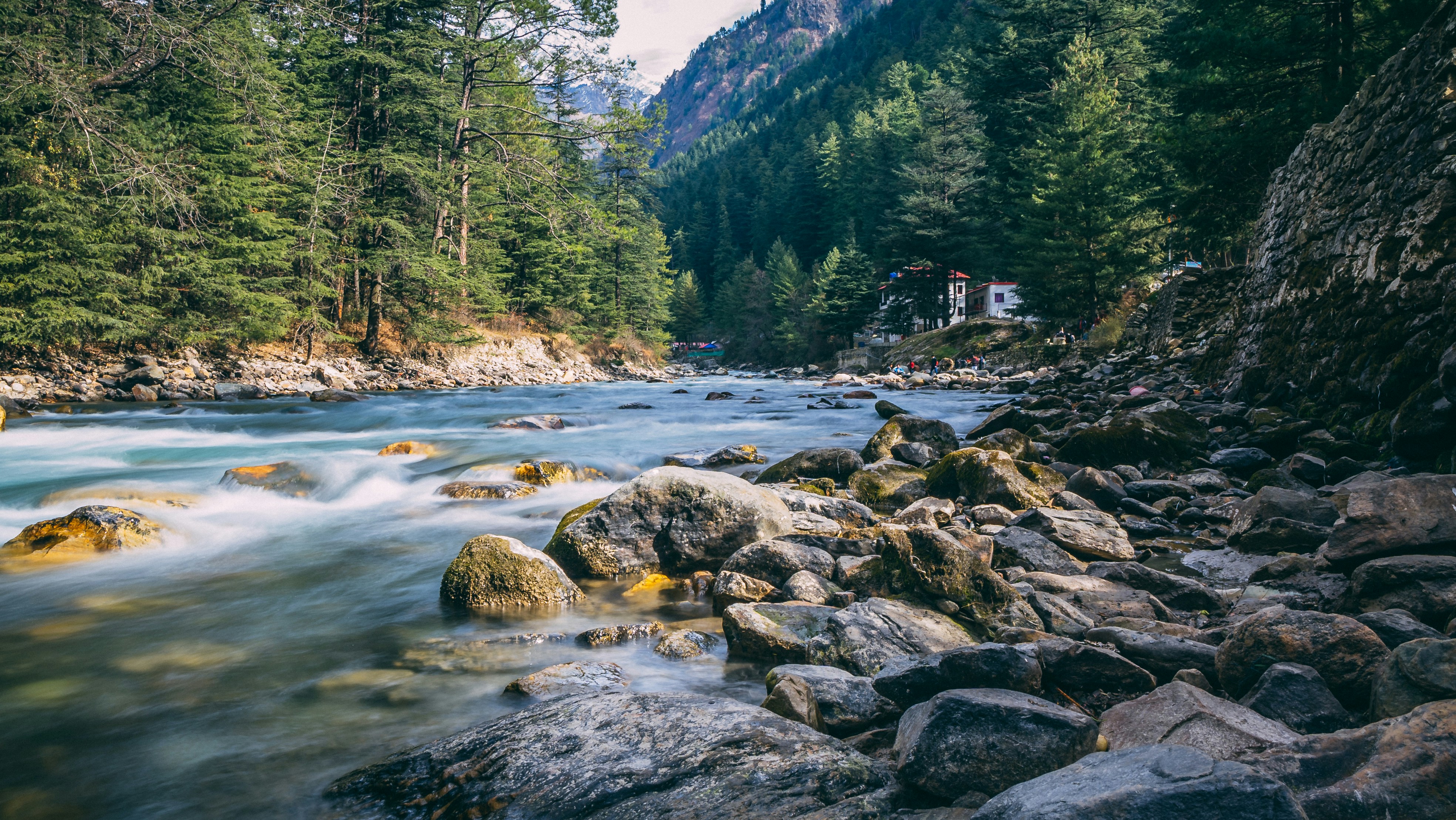
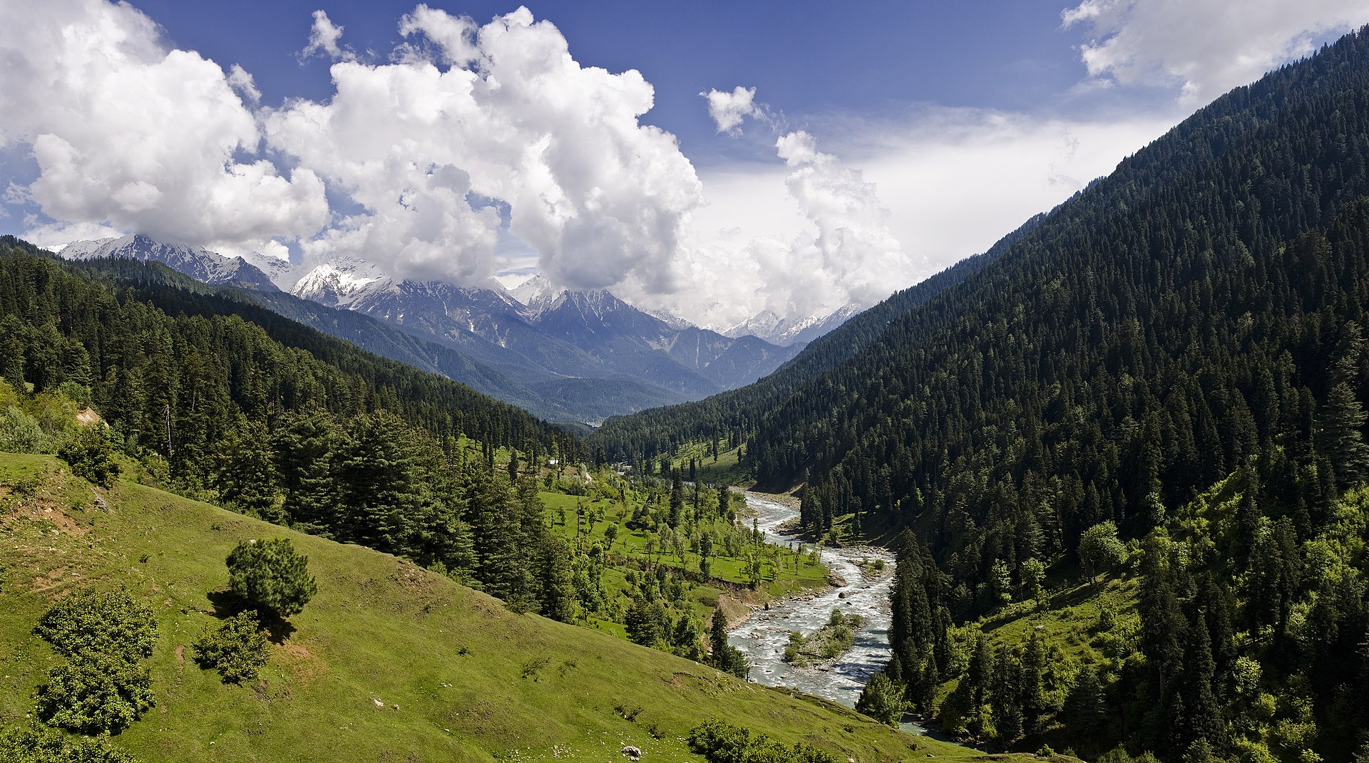
Rising from the icy glaciers near the mighty Nun-Kun Massif, the Marusudar River is one of the most important rivers flowing through the remote and breathtaking landscapes of the Warwan Valley. The twin peaks of Nun and Kun, both towering above 7,000 metres, stand like giant guardians on the border between Ladakh’s Suru Valley and the Kishtwar Himalayas. From these snow-covered heights, countless glacial streams merge together to form the river, which then rushes southward through alpine meadows, rocky gorges, and high-altitude valleys.
The Marusudar is the largest tributary of the Chenab River and travels nearly 133 kilometres before joining the Chenab near Bhandarkoot. Along its journey, the river shapes the lives, culture, and economy of the isolated settlements scattered across the Warwan Valley. Its fast-flowing waters are also important for hydroelectric development. The well-known Pakal Dul Dam, a major 1000 MW hydropower project, is located on the river, while the ambitious Bursar Hydroelectric Project is currently under construction.
Sukhnai – Gateway to the Warwan Valley
As the river descends from its glacial origins, it first reaches the peaceful village of Sukhnai, often considered the northern gateway to the Warwan Valley. Perched at an elevation of around 3,000 metres, Sukhnai is surrounded by dense conifer forests, rolling alpine grasslands, and snow-fed streams that create a postcard-like landscape.
Sukhnai is among the first major inhabited settlements encountered along the river’s course. Traditional wooden homes with sloping roofs reflect the region’s adaptation to heavy snowfall and harsh winters. Life here moves slowly and remains deeply connected to nature. The local population consists of Kashmiri- and Dardic-speaking communities who continue to preserve old customs, seasonal traditions, and mountain lifestyles.
During the summer months, the surrounding meadows become grazing grounds for sheep, goats, and horses. Shepherds move with their livestock across the high pastures, following a centuries-old practice of seasonal migration. The calm atmosphere, fresh mountain air, and untouched scenery make Sukhnai one of the most beautiful villages in the upper valley.
Inshan – The Cultural Heart of Upper Warwan
Further downstream lies Inshan, a larger and more developed settlement that serves as the cultural and economic centre of upper Warwan. Compared to Sukhnai, the village feels livelier, with broader agricultural fields and more visible human activity.
Terraced farms stretch across the hillsides, while walnut and apricot trees add colour and beauty to the landscape during the warmer seasons. Agriculture and livestock remain the backbone of the local economy, with villagers cultivating crops such as barley, peas, and potatoes in the fertile mountain soil.
Inshan is also widely known among trekkers and adventure enthusiasts. The village acts as a starting point for several high-altitude trekking routes leading toward remote glacier regions and mountain passes such as Kaintal Pass and Asti Gali. These trails pass through dramatic valleys, wildflower meadows, and rugged Himalayan terrain, attracting experienced trekkers looking for unexplored routes.
Despite its remoteness, Inshan plays an important role in connecting nearby villages and preserving the traditional culture of the valley.
Margi and Basmina – Settlements of the Middle Valley
As the Marusudar River gathers more water from side streams and glacial channels, it reaches the middle stretches of the valley near the villages of Margi and Basmina. Here, the river widens slightly, forming gravel banks and calmer side channels that contrast with the rougher upper sections.
Margi is a quiet and sparsely populated hamlet surrounded by open fields and mountain slopes. The peaceful environment and scenic riverbanks make it one of the most serene parts of the valley. The village remains largely untouched by modern development, giving visitors a glimpse into traditional Himalayan rural life.
Nearby Basmina is comparatively more populated and better connected. Basic facilities such as schools and healthcare services are available here, making it an important local centre for nearby settlements. Irrigation canals fed by the river support the cultivation of buckwheat, peas, and potatoes, which are among the staple crops grown in the valley.
However, life along the river is not always easy. In the past, sudden glacial melting and cloudbursts have caused flooding in these middle-valley regions. Such events highlight the unpredictable nature of Himalayan rivers and the challenges faced by mountain communities living close to them.
Afti and Warwan – The Central Region of the Valley
Further south, the river reaches Afti and the main settlement of Warwan, often referred to as Warwan proper. This is the most populated and administratively significant region of the valley. Compared to the smaller villages upstream, the central valley appears broader and more active, with larger cultivated areas and better access to public facilities.
The Marusudar River plays a vital role in agriculture here. Its wider riverbed and easier water access allow villagers to cultivate larger fields, supporting crops and orchards across the valley floor. The riverbanks also serve as gathering places during local fairs, markets, and religious celebrations, making the river central not only to daily survival but also to social and cultural life.
Schools, health centres, and village administrative offices are concentrated in this part of the valley, making it an important hub for surrounding communities. Even today, however, the region remains relatively isolated during winter months when heavy snowfall cuts off road connectivity.
Nawapachi and Dool – The Lower Warwan Region
As the Marusudar River continues toward its final stretch, it flows through Nawapachi and Dool in the lower Warwan Valley. The terrain gradually changes here, becoming slightly less rugged while the river itself grows stronger and faster.
Nawapachi is known for its fertile agricultural land and flatter terrain. The river develops deeper pools and faster rapids in this section, creating a more dramatic landscape. The surrounding fields remain an important source of livelihood for local families.
Further downstream lies Dool, the last major settlement before the Marusudar merges with the Chenab River. Located near the confluence of several tributaries, the river becomes significantly wider and more powerful here. Dense pine forests, steep mountainsides, and roaring river currents give this region a wild and untouched beauty.
Although the area possesses enormous tourism potential for trekking, camping, fishing, and nature exploration, it remains largely underdeveloped. Limited infrastructure and difficult accessibility have helped preserve its raw Himalayan charm, making it one of the least explored yet most scenic regions of Jammu and Kashmir.
Importance of the Marusudar River
The Marusudar River is much more than a mountain river flowing through the Himalayas. It is the lifeline of the Warwan Valley. From agriculture and livestock to transportation and hydroelectric projects, the river supports nearly every aspect of life in the region.
The river also holds ecological importance, sustaining alpine forests, wildlife habitats, and fragile Himalayan ecosystems. Its glacial origins make it especially sensitive to climate change, with changing snowfall patterns and glacier retreat already affecting water flow in some areas.
For travellers and explorers, the Marusudar Valley offers a rare opportunity to experience untouched Himalayan landscapes, traditional mountain culture, and remote villages that still remain far from mass tourism.
Nearby Attractions to Nun–Kun Massif
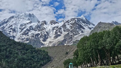
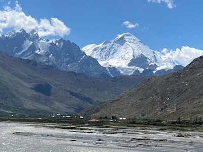
The Nun–Kun Massif is one of the most spectacular mountain groups in the Indian Himalayas, located in the Suru Valley of the Kargil district in Ladakh. Comprising two towering peaks—Nun (7,135 m) and Kun (7,077 m)—the massif is the highest mountain group in the Zanskar Range and one of India’s most sought-after destinations for mountaineers and adventure enthusiasts. Visible from many parts of Suru Valley, the snow-covered peaks dominate the skyline and create some of the most breathtaking landscapes in Ladakh.
Apart from mountaineering, the region around Nun–Kun offers glaciers, remote villages, Buddhist monasteries, alpine meadows, and dramatic Himalayan scenery.
Suru Valley
Suru Valley is one of the greenest and most scenic valleys in Ladakh. Known for its fertile fields, traditional villages, glaciers, and stunning mountain views, the valley serves as the primary gateway to the Nun–Kun Massif.
Rangdum
Located along the Kargil–Padum road, Rangdum is a picturesque high-altitude settlement surrounded by glaciers, mountains, and vast meadows. It is a popular stop for travelers heading toward Zanskar.
Rangdum Monastery
Perched on a hill overlooking the valley, Rangdum Monastery is a centuries-old Buddhist monastery belonging to the Gelugpa sect. The monastery offers panoramic views of the surrounding Himalayan landscape.
Parkachik Village
Parkachik is one of the best places to view the Nun–Kun peaks. The village is surrounded by green fields and provides direct views of glaciers descending from the massif.
Parkachik Glacier
Located near Parkachik village, Parkachik Glacier is one of the most accessible glaciers in Ladakh. Visitors can observe massive ice formations and glacial streams from close range.
Panikhar
Panikhar is a scenic village in Suru Valley known for its traditional lifestyle, lush agricultural fields, and spectacular views of the Nun–Kun Massif.
Sankoo
Often referred to as the “Gateway to Suru Valley,” Sankoo is famous for its green meadows, apricot orchards, and beautiful mountain scenery.
Kargil
Kargil is the second-largest town in Ladakh and serves as the main base for travelers exploring Suru Valley, Zanskar, and the Nun–Kun region.
Penzi La Pass
Penzi La is a high mountain pass that marks the gateway between Suru Valley and Zanskar. The pass offers magnificent views of glaciers, snowfields, and rugged Himalayan terrain.
Drang Drung Glacier
Visible from Penzi La, Drang Drung Glacier is one of the largest glaciers in Ladakh. Its immense size and dramatic setting make it one of the most photographed glaciers in the region.
Zanskar Valley
Beyond Penzi La lies Zanskar Valley, a remote Himalayan region known for its monasteries, rivers, dramatic canyons, and ancient Buddhist culture.
Sani Monastery
Sani Monastery is one of the oldest religious sites in Ladakh and is believed to predate the spread of Tibetan Buddhism in the region.
Karsha Monastery
The largest monastery in Zanskar, Karsha Monastery is famous for its hilltop setting, ancient murals, and panoramic valley views.
Pensi La Lakes
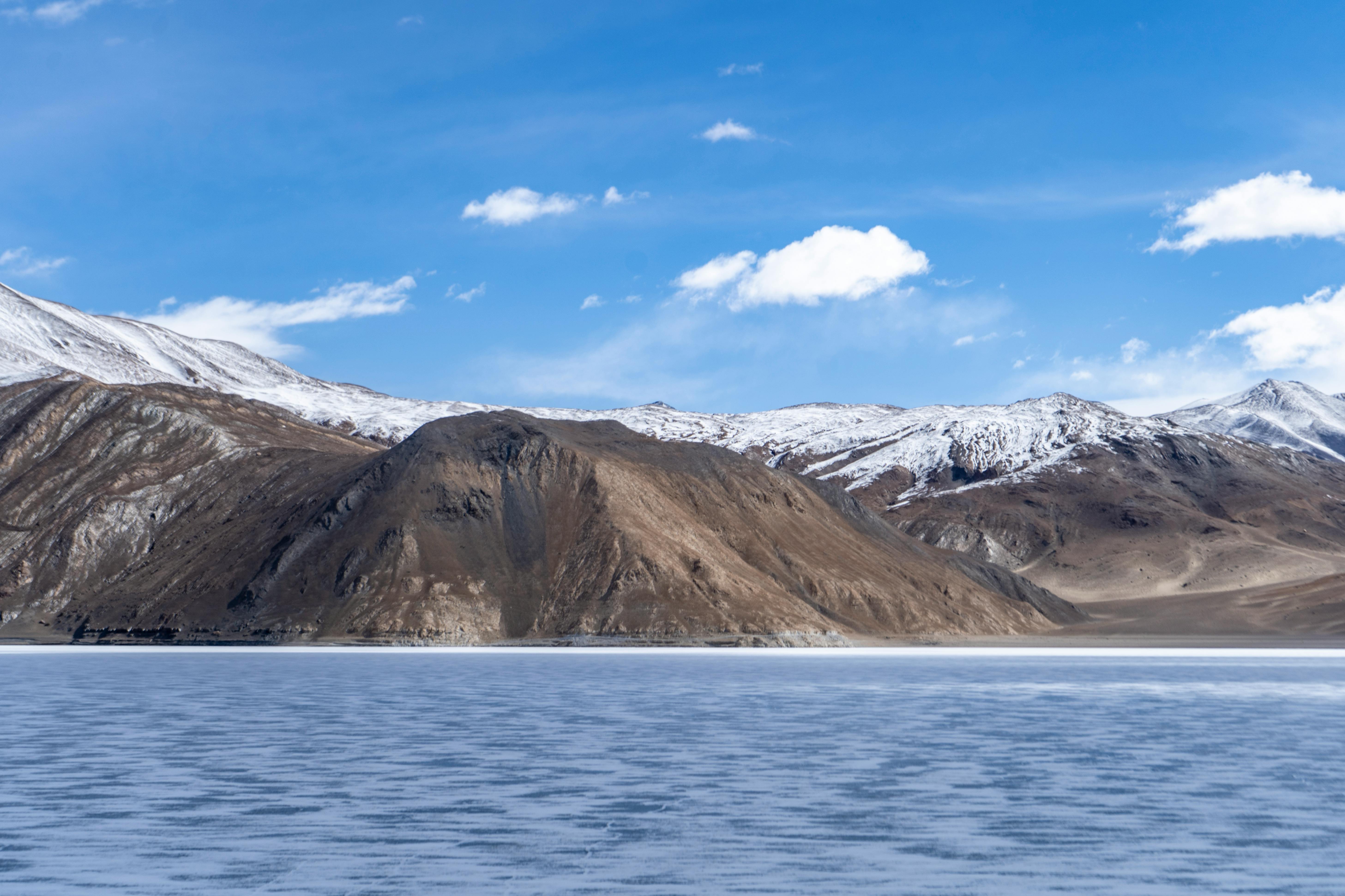
Near Penzi La Pass, visitors can see a series of small high-altitude lakes surrounded by barren mountains and glacial landscapes, providing excellent photography opportunities.
Doda Peak
Located close to the Nun–Kun region, Doda Peak is a popular mountaineering objective and trekking destination for adventure enthusiasts.
Shafat Glacier
Shafat Glacier is another impressive glacier in the Suru Valley region and serves as a route for several mountaineering expeditions toward the Nun–Kun Massif.
Umba La Pass
Connecting Suru Valley with the Drass region, Umba La Pass offers stunning views of the Himalayas and provides an alternative route for exploring western Ladakh.
Google Maps
FAQs
Where does the Marusudar River originate?
The Marusudar River originates from glaciers near the Nun-Kun massif in the high Himalayas between Ladakh’s Suru Valley and the Kishtwar region.
Which river does the Marusudar join?
The Marusudar River is the largest tributary of the Chenab River and merges with it near Bhandarkoot.
Why is the Warwan Valley famous?
The Warwan Valley is famous for its untouched natural beauty, alpine meadows, glaciers, trekking routes, traditional mountain villages, and remote Himalayan landscapes.
What is the elevation of Sukhnai village?
Sukhnai is situated at an elevation of approximately 3,000 metres above sea level.
Which hydropower projects are located on the Marusudar River?
The Pakal Dul Hydroelectric Project and the under-construction Bursar Hydroelectric Project are located on the Marusudar River.
Is the Warwan Valley suitable for trekking?
Yes, the Warwan Valley is considered one of the best offbeat trekking destinations in the Himalayas. Routes from villages like Inshan lead to remote passes, glaciers, and alpine landscapes.
What crops are commonly grown in the Warwan Valley?
Villagers commonly grow potatoes, peas, buckwheat, barley, and other high-altitude crops using irrigation channels connected to the river.
Why is the region still less explored by tourists?
The valley remains relatively isolated due to difficult terrain, seasonal road closures, and limited tourism infrastructure, which has helped preserve its natural beauty and traditional lifestyle.