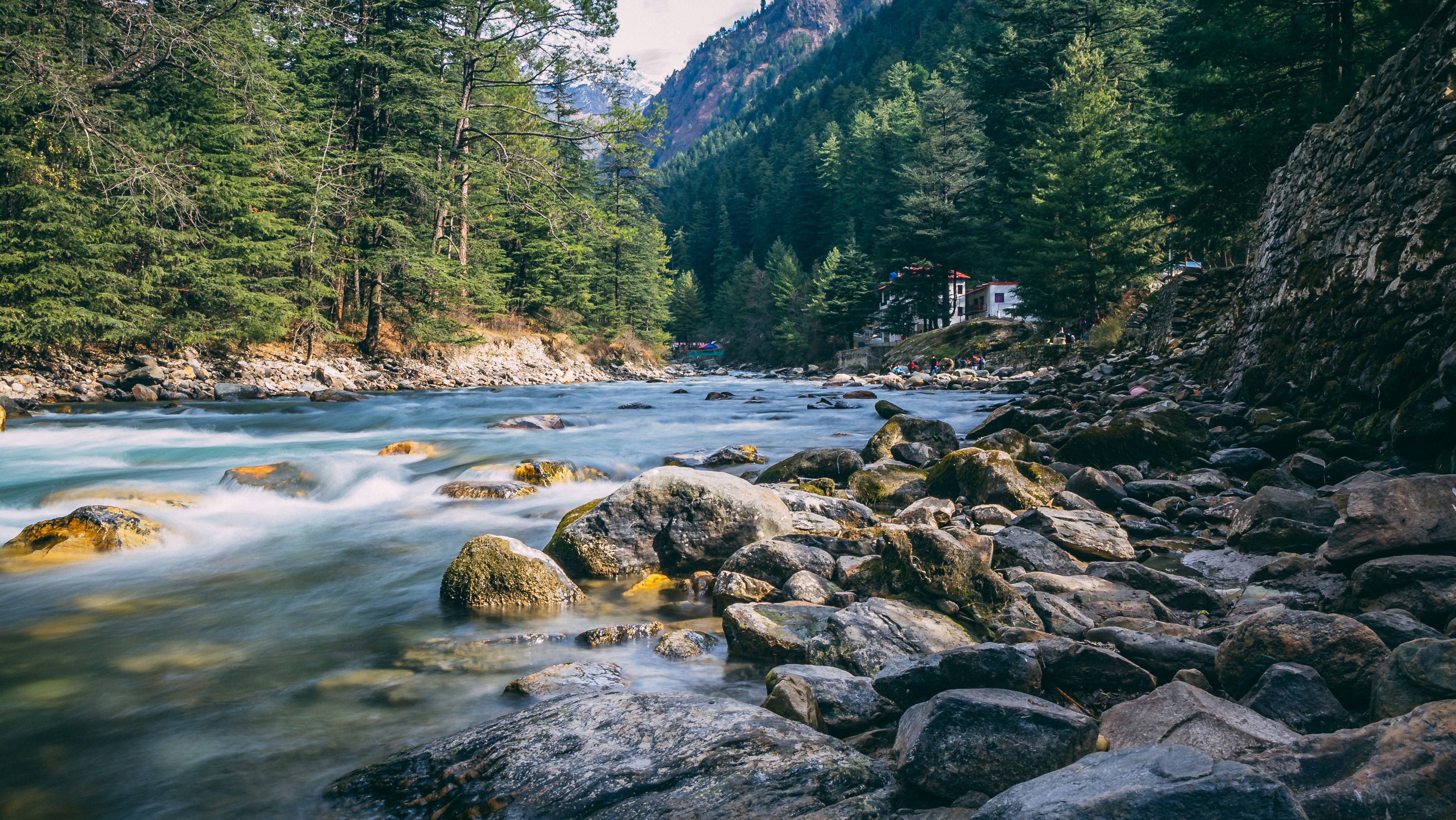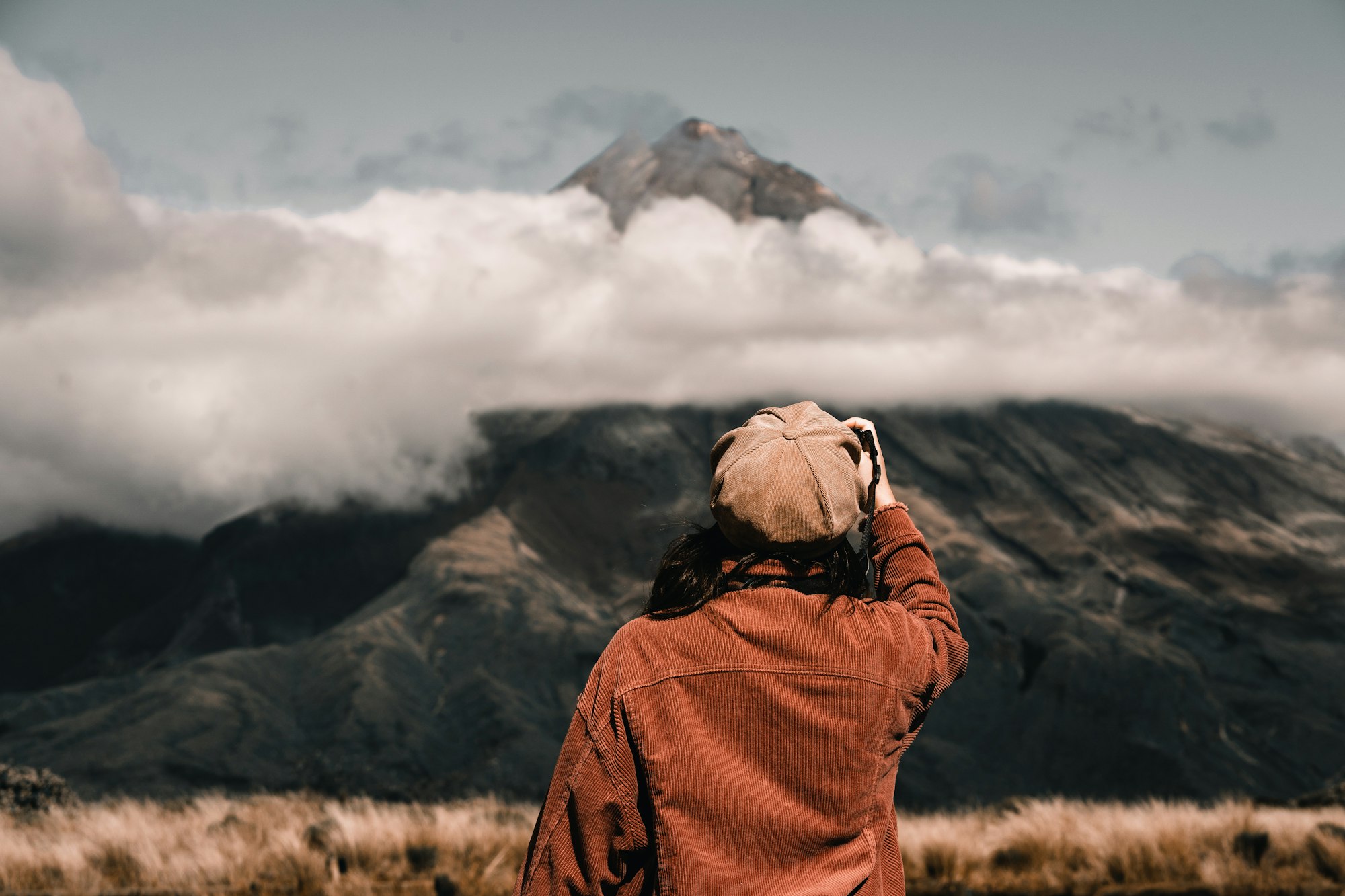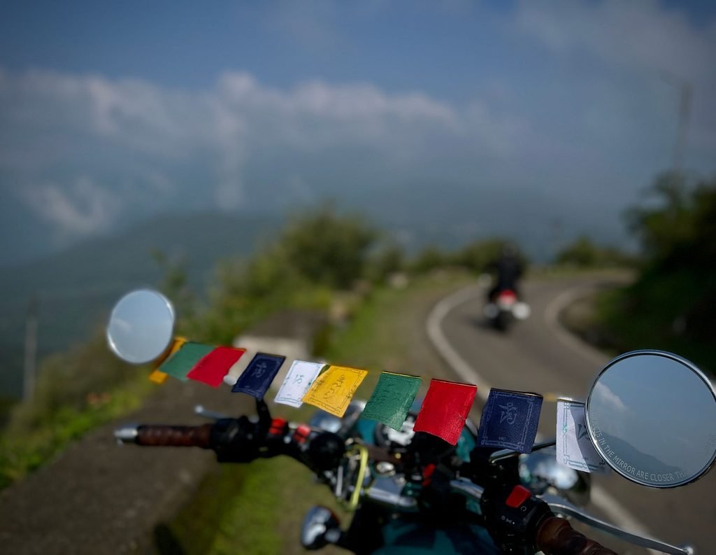
Beyond the famous highways to Rohtang and Spiti, there are several quiet mountain roads and village routes around Manali that offer a different perspective on the Kullu Valley. These routes pass through traditional villages, cedar forests, apple orchards, mountain streams and open viewpoints. They are particularly appealing to travellers who want a peaceful Himalayan riding experience away from the busiest tourist roads.
However, road conditions around Manali change with altitude and season. A paved village road, a rough forest track and a trekking trail are three different things. Before setting out, confirm which sections are open to motorcycles, particularly after snowfall, heavy rain or road damage.
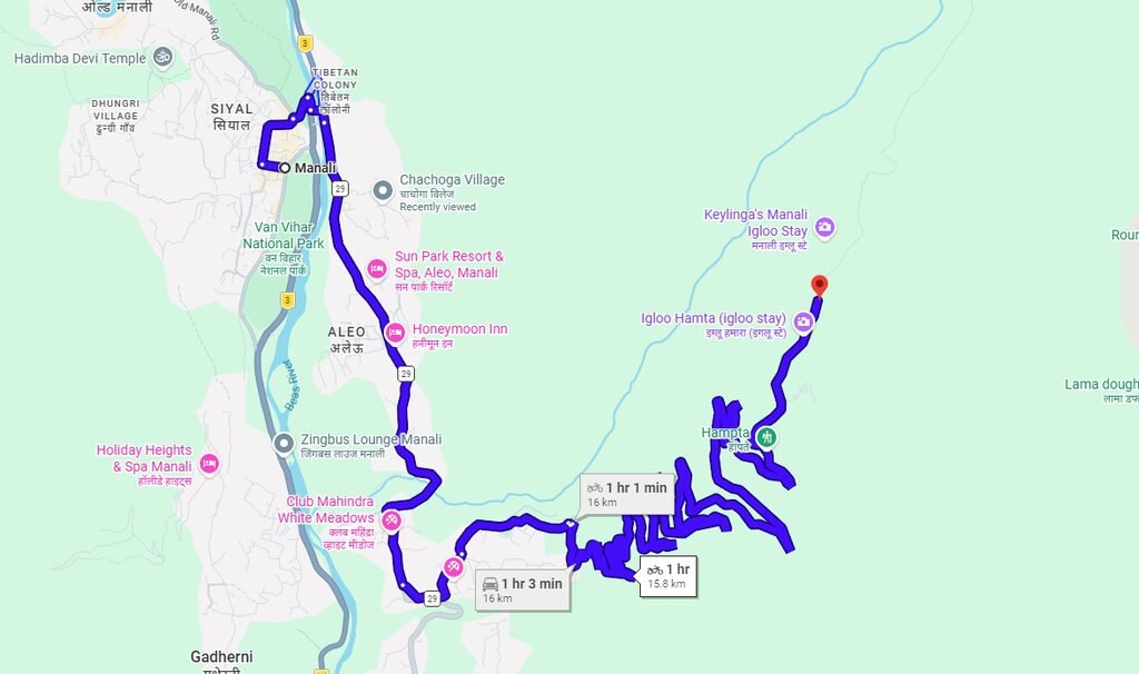
Manali – Sethan – Hamta Valley
Distance: Approximately 18–20 km one way, depending on the starting point and road taken.
This little-known road climbs above Manali towards the Buddhist village of Sethan. The route branches off near Prini and climbs steeply through forests and apple orchards.
Sethan is a small mountain settlement above the Kullu Valley, associated with a Buddhist community and the wider Hamta region. Its elevated location offers views of surrounding mountain slopes and the Hamta Pass landscape. The settlement has also become known for winter tourism, including snow activities when conditions permit.
The road journey is an experience in itself. As the motorcycle climbs away from the main Manali area, the scenery shifts from built-up settlements to orchards, forested slopes and increasingly open mountain views. The steep gradients and bends make this a more engaging ride than a straightforward valley road.
In winter, Sethan can become a popular snow destination, although snowfall does not guarantee that the road will remain accessible. In summer, visitors can explore the village, enjoy the mountain scenery and use the area as a starting point for suitable local walks.
Why it’s special
- Wide Himalayan views.
- Snow fields in winter, when weather and access allow.
- Peaceful Buddhist village atmosphere.
- A short mountain ride with a noticeable change in scenery.
Additional facts and riding advice
Sethan is also associated with access to the wider Inderkilla and Hamta trekking landscape. These trekking routes extend beyond the village and should not be confused with the public road accessible by motorcycle.
The road is steep in places, so use lower gears and avoid aggressive acceleration around blind bends. During winter, ice and compacted snow can make the ascent dangerous. After heavy rain, check for damaged surfaces and loose gravel.
Best time to ride: Summer and early autumn generally provide more predictable road conditions. Winter is attractive for snow scenery but requires extra caution and confirmation of current access.
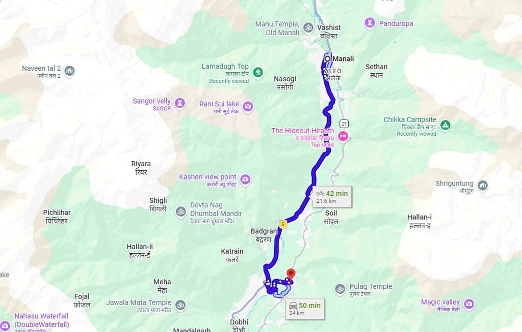
Manali – Nashala – Rumsu – Naggar
Distance: Approximately 25 km for the proposed circuit or detour, depending on the exact route and starting point.
Instead of taking the main highway, riders can explore the quieter upper mountain road connecting Manali to Naggar.
The route is intended to take in villages such as Nashala and Rumsu, which offer a different perspective on rural life in the Kullu Valley. Traditional houses, orchards, forested slopes and old village paths form part of the broader landscape around Naggar.
Eventually, the journey reaches Naggar, one of the most important heritage destinations in the region. The village is known for Naggar Castle, traditional temples and the Roerich Estate, associated with Russian artist Nicholas Roerich. Naggar served as the seat of the Kullu rulers before the capital shifted to the present Kullu town area.
The attraction of this journey is not simply the distance covered. It is the chance to explore the settled mountain landscape, stop at heritage sites and experience the quieter side of the valley.
Highlights
- Apple orchards and cedar forests.
- Quiet mountain villages.
- Views of the Beas Valley.
- Naggar Castle and local cultural heritage.
- Traditional temples and village architecture.
Additional facts and riding advice
Naggar is approximately 20–25 km from Manali by commonly used road routes. The exact distance depends on the starting point and whether the journey follows the main road or a village detour.
The specific connection through Nashala and Rumsu should be checked before departure. Do not assume every map-marked village lane creates a continuous, paved route between Manali and Naggar. Some local roads may be narrow, steep or unsuitable for larger motorcycles.
Allow time to explore Naggar Castle and the Roerich Estate if you are interested in history and art. These are established attractions and make the ride more rewarding than treating Naggar as simply a turnaround point.
Best time to ride: Spring, summer and autumn are generally attractive for village exploration. In winter, check for snow, ice and road restrictions before taking smaller mountain roads.
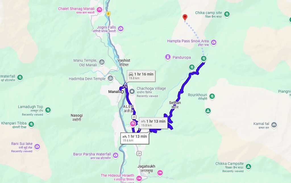
Manali – Vashisht – Jogini Waterfall Trail Road
Distance: Approximately 5–7 km for the local excursion, depending on the starting point and how far you travel by road.
A short but scenic ride leads from Manali to the ancient village of Vashisht, known for its hot springs and temples.
The village is located above the Beas Valley and is one of the best known cultural stops near Manali. Its temple complex and hot springs draw visitors throughout the year. The narrow village lanes, traditional buildings and views across the valley create a different atmosphere from central Manali.
From here, small roads and paths lead towards the hills below Jogini Waterfall. The approach passes through village surroundings, orchards and patches of forest before the walking trail continues towards the waterfall.
Jogini Waterfall is a recognised walking destination, but the distinction between the road and the trail is important: you cannot ride a motorcycle all the way to the waterfall itself. Park in a permitted location near Vashisht or the appropriate trail access point, then continue on foot.
Highlights
- Temple village atmosphere.
- Views of Manali town and the Beas Valley.
- Short scenic ride.
- Hot springs and local heritage.
- A walking trail through the landscape towards Jogini Waterfall.
Additional facts and riding advice
Vashisht is only a few kilometres from central Manali, making it suitable for a short outing. The village can become congested, so parking and walking may be more practical than riding through its narrowest lanes.
The waterfall walk takes additional time beyond the motorcycle journey. Trail conditions can become slippery during or after rainfall, and the time required depends on your walking pace and the exact viewpoint you choose.
Visitors should respect the religious character of the village, follow local rules at the bathing facilities and avoid leaving rubbish along the trail.
Best time to ride: Most of the year, when the road is accessible. For the waterfall walk, dry and clear conditions are generally more comfortable than periods of heavy rain.
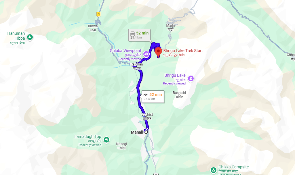
Manali – Gulaba – Bhrigu Lake Base Meadows
Distance: Approximately 22 km one way, depending on the starting point and current road access.
North of Manali on the Rohtang road lies Gulaba, where many tourists stop during winter. But beyond the main parking area there are smaller paths and trekking routes used by shepherds and trekkers heading towards the meadows below Bhrigu Lake.
These high alpine meadows offer views of the surrounding mountain ranges and the Beas Valley below. Their appearance changes through the seasons: snow can cover the upper slopes earlier in the year, while the warmer months reveal grassland and mountain streams.
Gulaba is a recognised access point for the Bhrigu Lake trek. The trekking route climbs from the roadhead through forest and meadow terrain, with established overnight stops such as Rola Kholi on the way to the lake. The lake itself lies at a much higher elevation and requires a substantial walk.
Highlights
- Vast alpine meadows.
- Views of high Himalayan peaks.
- A mountain road away from central Manali.
- Access to the Bhrigu Lake trekking landscape.
- Seasonal snow and changing mountain scenery.
Additional facts and riding advice
The road to Gulaba forms part of the route towards Rohtang Pass. It is a mountain road with bends, gradients and traffic that can increase during busy travel periods. Gulaba is not always accessible under the same conditions: snow, landslides, road work and local traffic restrictions can affect the journey.
Important: The higher meadows and Bhrigu Lake are trekking destinations. Do not ride onto shepherd paths, loose dirt tracks or meadow trails unless motor vehicle access is explicitly permitted. These tracks may be unsuitable for motorcycles and may cross fragile grazing land.
Check current road status and any applicable access or permit requirements before leaving Manali. If your main objective is the meadow scenery rather than the trek, confirm how much of the route can be reached legally and safely by road.
Best time to ride: Summer and early autumn usually offer better access, but current road and weather conditions should determine the final decision.
Quick Overview of Hidden Routes
| Route | Approximate distance | Best feature |
|---|---|---|
| Manali – Sethan | 18–20 km | Snow meadows and Buddhist village |
| Manali – Nashala – Rumsu – Naggar | Around 25 km, route dependent | Quiet village scenery and heritage |
| Manali – Vashisht – Jogini area | 5–7 km | Temples, hot springs and waterfall walk |
| Manali – Gulaba | Around 22 km | Alpine meadows and trekking access |
Distances are approximate and should be checked against the exact starting point and chosen road. They are not live navigation measurements.
Travel Tip: When to Start Your Ride
These routes are best explored early in the morning when visibility is often better and traffic may be lighter. An early start also gives you more time to stop at villages, visit temples and return before dark.
However, morning conditions are not always safer. In colder months, shaded bends can remain icy, and fog or rain can reduce visibility. Check the forecast before leaving and avoid rushing to complete the route.
For mountain riding around Manali, carry warm and waterproof clothing, a charged phone, offline maps and basic repair equipment. Ride slowly through villages, use low gears on steep descents and never stop in blind bends for photographs.
Conclusion
These five routes offer different ways to experience the mountains around Manali. Sethan provides a steep climb towards a high mountain settlement, Jagatsukh introduces riders to the older history of the Kullu Valley, and the proposed Nashala and Rumsu detour offers an opportunity to explore smaller villages around Naggar. Vashisht combines a short ride with cultural attractions and a waterfall walk, while Gulaba gives access to the mountain scenery along the Rohtang road.