Image Source: Rashmi Rawat
About Dodital–Darwa Pass Trek
The Dodital–Darwa Pass Trek is one of Uttarakhand’s most rewarding yet lesser-explored Himalayan trails. Nestled in the Uttarkashi district, this trek connects the beautiful valleys of Gangotri and Yamunotri while taking trekkers through dense forests, alpine meadows, crystal-clear lakes, and breathtaking mountain viewpoints. Covering approximately 40–45 km over several days, the trek is ideal for nature lovers, photographers, birdwatchers, and adventure enthusiasts seeking a peaceful alternative to the state’s more crowded trekking routes.
One of the biggest highlights of the trek is the pristine Dodital Lake, a freshwater lake situated at an altitude of around 3,024 meters. Surrounded by dense oak, pine, rhododendron, and deodar forests, the lake is renowned for its calm waters that beautifully reflect the surrounding peaks. Dodital is also the source of the Asi Ganga River, a tributary that eventually merges with the Bhagirathi River near Uttarkashi.
Apart from its natural beauty, Dodital carries immense religious significance. According to Hindu mythology, the lake is believed to be the birthplace of Lord Ganesha. Locally, it is often referred to as Ganesh-ka-Tal, and a small temple dedicated to Lord Ganesha stands near its shore. Pilgrims and trekkers alike visit the temple to seek blessings before continuing their journey into the higher Himalayas.
During winter, heavy snowfall transforms the lake into a frozen wonderland, while the surrounding forests remain blanketed in snow. In spring and summer, vibrant wildflowers bloom across the meadows, birds become more active, and the entire landscape turns lush green. The peaceful atmosphere, combined with the sound of flowing streams and chirping birds, makes Dodital one of the most picturesque high-altitude lakes in Uttarakhand.
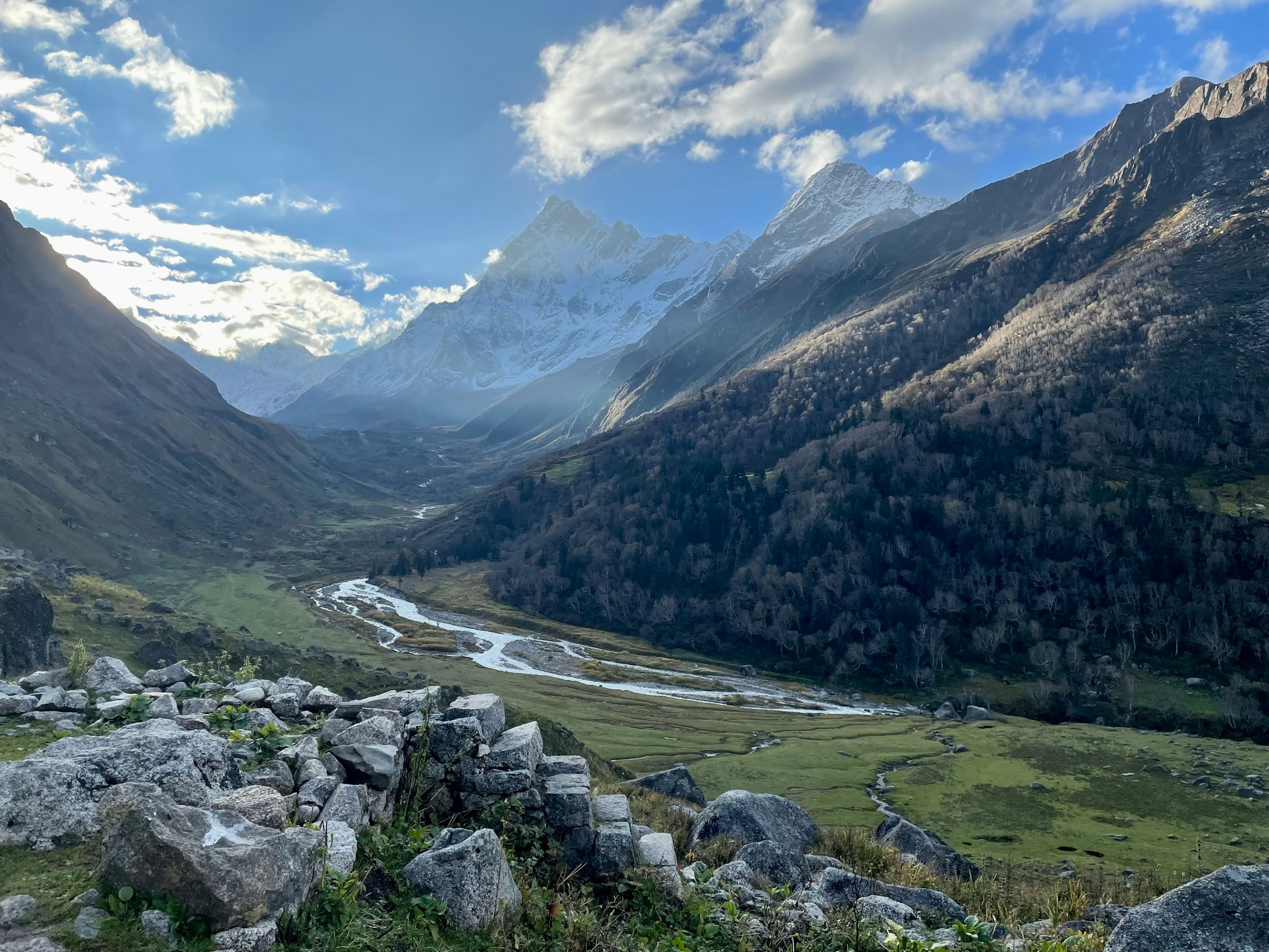
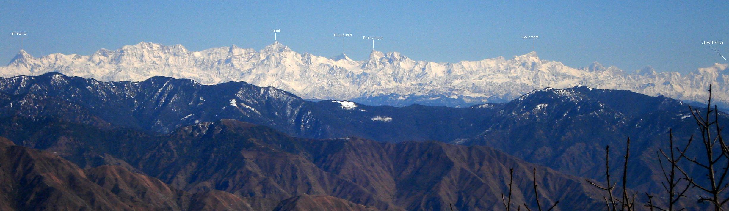
Beyond Dodital lies the challenging climb to Darwa Pass (also spelled Darwa Top), located at an elevation of approximately 4,151 meters. This section of the trek demands good physical fitness and proper acclimatization, as trekkers gain more than 1,100 meters in elevation over a relatively short distance. However, the effort is richly rewarded. From the pass, trekkers are treated to spectacular panoramic views of several majestic Himalayan peaks, including Bandarpoonch, Srikanth, Draupadi Ka Danda, Jaonli, Deoli, and Black Peak (Kala Nag). On clear mornings, the snow-covered mountain ranges stretch endlessly across the horizon, creating one of the finest viewpoints in the Garhwal Himalayas.
Best Time to Visit
The best time to undertake the Dodital–Darwa Pass Trek is during April to June and late September to early December. These months offer pleasant weather, stable trekking conditions, and excellent mountain views.
Spring and early summer paint the forests with blooming rhododendrons, while alpine meadows become carpeted with colorful wildflowers. Daytime temperatures remain comfortable, making trekking enjoyable even for beginners with reasonable fitness.
After the monsoon, the landscape becomes incredibly fresh and green, with crystal-clear skies offering outstanding visibility of the surrounding Himalayan peaks. Autumn is considered one of the best seasons for photography because of its vibrant colors and crisp weather.
Winter transforms the trail into a snow-covered paradise. Dodital Lake often freezes completely, creating a magical setting for experienced trekkers. However, heavy snowfall may make Darwa Pass inaccessible, so trekkers should always check weather conditions before planning a winter expedition.
The monsoon season from July to early September is generally avoided due to slippery trails, landslides, overflowing streams, and poor visibility.
Trek Itinerary
Day 1: Dehradun – Uttarkashi – Sangamchatti – Agoda
The journey begins from Dehradun, from where you travel approximately 165 km to the small mountain village of Agoda via Uttarkashi and Sangamchatti. The drive takes around 7–8 hours and gradually leaves behind the busy plains for the peaceful Garhwal Himalayas.
As you travel through Mussoorie Road and Dharasu Bend, the scenery changes dramatically. The emerald waters of the Bhagirathi River accompany you for much of the drive, while pine-covered hills, apple orchards, and traditional Garhwali villages create a memorable introduction to the region.
Near Sangamchatti, where the Asi Ganga and Varna streams meet, the road narrows into a picturesque mountain route leading uphill to Agoda, the starting point of the trek. The village offers stunning views of surrounding forests and traditional stone houses, making it an excellent place to experience authentic Garhwali village life before beginning the trek.
Day 2: Agoda to Manjhi
After breakfast, the trek officially begins with a gradual ascent through dense forests of oak, pine, and rhododendron. The well-marked trail passes through Bhebra village, where small wooden houses, terraced farms, and friendly villagers offer a glimpse into life in the remote Himalayas.
As you continue climbing, the forest becomes thicker and cooler. Numerous mountain streams cross the trail, while birds such as Himalayan monals, pheasants, and woodpeckers can often be spotted among the trees.
After trekking for several hours, you arrive at Manjhi, located at an altitude of approximately 2,880 meters. Surrounded by forests and open meadows, Manjhi is a peaceful campsite where trekkers spend the night beneath a sky filled with countless stars.
Day 3: Manjhi to Dodital
The third day offers one of the most enjoyable sections of the trek. The trail maintains a relatively gentle gradient and winds through beautiful mixed forests, with numerous streams flowing alongside the path.
As you approach Dodital, the landscape gradually opens up. The final stretch descends gently toward the sacred Annapurna Temple before reaching the tranquil surroundings of Dodital Lake. Close to the lake stands the revered Lord Ganesha Temple, where pilgrims offer prayers throughout the trekking season.
The serene atmosphere, mirror-like reflections in the lake, and surrounding snow-capped peaks create an unforgettable setting. Many trekkers spend the evening walking around the lake, watching trout swim in its crystal-clear waters, or simply enjoying the silence of the Himalayan wilderness.
How to Reach
The trek begins from Agoda Village, which is reached via Sangamchatti in Uttarkashi district.
By Air: The nearest airport is Jolly Grant Airport in Dehradun, about 190 km from Agoda. Taxis are readily available from the airport to Uttarkashi or Sangamchatti.
By Train: The nearest railway stations are Dehradun Railway Station and Rishikesh Railway Station. Both are well connected to Delhi and other major Indian cities. From there, buses and shared taxis operate to Uttarkashi.
By Road: Regular buses and shared jeeps connect Dehradun, Rishikesh, Haridwar, and Uttarkashi. From Uttarkashi, local taxis travel to Sangamchatti, and a short uphill drive leads to Agoda, where the trek starts. The drive itself is scenic, passing river valleys, mountain villages, and dense pine forests.
Nearby Attractions
Dodital Lake: A sacred freshwater lake famous for its crystal-clear waters, trout fish, and mythology associated with Lord Ganesha.
Darwa Pass: A high-altitude viewpoint offering magnificent panoramic views of Bandarpoonch, Black Peak, Srikanth, Jaonli, and other Himalayan peaks.
Dayara Bugyal: One of Uttarakhand’s most beautiful alpine meadows, located a few hours’ drive from Uttarkashi and known for trekking, camping, and winter snow.
Uttarkashi: A major pilgrimage town on the banks of the Bhagirathi River, home to the ancient Kashi Vishwanath Temple, Shakti Temple, and Nehru Institute of Mountaineering.
Gangotri: One of the Char Dham pilgrimage sites and the origin point for treks to Gaumukh Glacier, located around 100 km from Uttarkashi.
Harsil Valley: A picturesque Himalayan valley known for apple orchards, pine forests, traditional villages, and spectacular mountain scenery.
Maps
FAQs
1. What is the total distance of the Dodital–Darwa Pass Trek?
The complete trek covers approximately 40–45 km, depending on the chosen route and campsite locations.
2. How difficult is the trek?
It is considered a moderate to difficult trek. While the route to Dodital is relatively easy, the climb to Darwa Pass is steep and requires good physical fitness.
3. What is the altitude of Darwa Pass?
Darwa Pass stands at approximately 4,151 meters (13,619 feet) above sea level.
4. Is the trek suitable for beginners?
Beginners with good fitness can comfortably trek to Dodital. However, reaching Darwa Pass is recommended only for those who are physically prepared for high-altitude trekking.
5. Is camping allowed near Dodital Lake?
Yes. Designated camping areas are available near Dodital, but camping regulations should always be followed to protect the fragile ecosystem.
6. What permits are required?
Forest entry permits are generally required since the trail passes through protected forest areas. These can usually be obtained at the forest check post or through authorized trekking operators.
7. What wildlife can be seen during the trek?
The forests are home to Himalayan monals, musk deer, barking deer, Himalayan black bears (rarely seen), pheasants, and numerous bird species.
8. Is there mobile network coverage on the trek?
Mobile connectivity is available around Uttarkashi and occasionally near Agoda, but most sections of the trek have little or no network coverage.