Image Source: MIRAZUL ISLAM
About the Yarlung Tsangpo–Siang Confluence
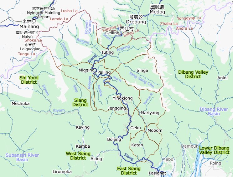
Hidden deep within the remote landscapes of the Eastern Himalayas, the Yarlung Tsangpo–Siang Confluence is one of the most extraordinary river transitions in the world. Near the small border village of Gelling in Arunachal Pradesh’s Upper Siang district, the mighty Yarlung Tsangpo River enters India from Tibet and gradually takes on a new identity as the Siang River. Farther downstream, this same river becomes the Brahmaputra, one of Asia’s great rivers.
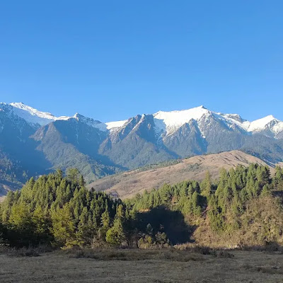
What makes this place so fascinating is not just the geography, but the dramatic setting in which it unfolds. Massive forested mountains, mist-covered valleys, roaring waters, and isolated tribal settlements create an atmosphere that feels untouched by modern time. For travellers seeking raw Himalayan beauty, cultural depth, and genuine adventure, this region offers an experience unlike anywhere else in India.
The confluence is often referred to as the “Gateway of the Brahmaputra” because it marks the river’s entry into India before it journeys across Assam and eventually flows into Bangladesh. Standing near the riverbanks here, it is easy to understand why explorers, geographers, and spiritual seekers have long been drawn to this powerful landscape.
The Dramatic Transformation of the River
The Yarlung Tsangpo begins its journey near Mount Kailash in Tibet, flowing across the Tibetan Plateau at one of the highest elevations of any major river on Earth. Before entering India, the river curves around the eastern edge of the Himalayas through what is known as the “Great Bend” — a gigantic gorge considered among the deepest river gorges in the world.
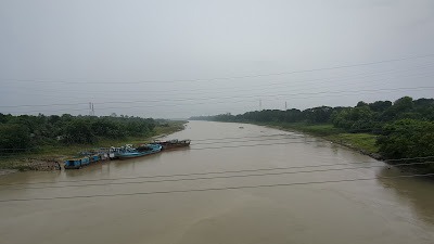
As the river descends into Arunachal Pradesh near Gelling, the terrain changes dramatically. The cold, wide Tibetan river narrows and gains force as it cuts through steep Himalayan valleys. Once inside India, the river becomes known as the Siang. This transformation is not marked by a single visible line but by a gradual geographical and cultural shift that travellers can witness firsthand.
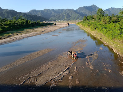
The sheer scale of the river, combined with the silence of the surrounding mountains, creates a powerful and unforgettable atmosphere. During clear weather, the turquoise and blue-green shades of the water contrast beautifully against dense forests and rocky cliffs.
Scenic Beauty and Natural Landscape
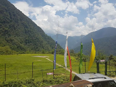
The region surrounding the confluence is incredibly rich in natural beauty. Dense subtropical forests blanket the hillsides, while bamboo groves, hanging bridges, waterfalls, and cloud-covered ridges define the landscape. Because the area remains relatively unexplored compared to other Himalayan destinations, the scenery feels pristine and authentic.
Sunrise and sunset are especially magical here. Early morning mist rises slowly from the river valley, while the mountains glow under golden Himalayan light. Birdsong echoes through the forests, and the constant sound of rushing water creates a calming backdrop throughout the day.
The remoteness of the region also means minimal pollution and almost no commercial tourism infrastructure. For many travellers, that untouched quality becomes the highlight of the journey.
Unique Experiences and Activities
Trek to the Confluence Viewpoint
One of the most rewarding experiences is trekking to viewpoints overlooking the river’s entry into India. The trail passes through bamboo forests, suspension bridges, steep mountain paths, and small tribal settlements. Though moderately challenging, the trek offers spectacular panoramic views of the valley and river below.
The journey itself becomes part of the adventure, especially for travellers who enjoy offbeat Himalayan trekking routes.
Photography and Drone Exploration
The landscape around Gelling and Tuting is a paradise for photographers. The dramatic mountain terrain, changing river colours, misty valleys, and traditional tribal villages provide endless visual opportunities.
Drone photography, where permitted, captures the scale of the river valley beautifully. Aerial views of the winding Siang cutting through the mountains are especially breathtaking.
Homestay Experiences with Local Tribes
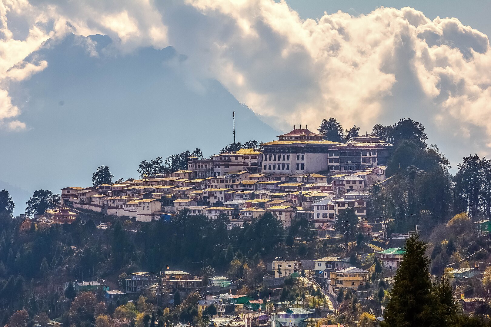
Staying in a local homestay is one of the best ways to understand the culture of the region. Many visitors stay with Adi tribe families in villages like Gelling and Tuting. These homestays offer warm hospitality, traditional food, and insight into local customs.
Travellers can witness bamboo craftsmanship, weaving traditions, folk stories, and everyday mountain life that remains deeply connected to nature and the river.
Beginning Point for Siang River Rafting
Tuting is also famous as the starting point for some of India’s most thrilling river rafting expeditions. Adventure enthusiasts travel here to raft through the powerful upper stretches of the Siang River.
The rapids in this section are intense and suited mainly for experienced rafters. Multi-day rafting journeys often pass through remote forests, tribal villages, and dramatic gorges.
Exploring the Himalayan Borderlands
The area’s proximity to the Indo–China border gives it a unique atmosphere. Military posts, restricted mountain roads, and visible Tibetan cultural influences add a sense of remoteness and intrigue.
Travelling here feels less like visiting a tourist destination and more like entering a frontier landscape shaped by geography, history, and culture.
Cultural and Spiritual Importance
For centuries, the Yarlung Tsangpo has held spiritual importance in Tibetan traditions. Many believe the river originates from the sacred region surrounding Mount Kailash, making it deeply revered in Buddhist culture.
For the Adi communities of Arunachal Pradesh, the river is more than just a water source. Known locally as the Dihang or Siang, it is regarded as a life-giving force that sustains agriculture, forests, traditions, and local identity. Songs, folklore, and oral histories connected to the river continue to be passed down through generations.
Historically, the river valley also served as part of ancient trade and cultural routes between Tibet and the eastern Himalayan tribes. Pilgrims, traders, and travellers once moved through these mountain corridors long before modern borders existed.
The river’s “Great Bend” upstream has fascinated explorers and geographers since colonial times because of its dramatic geography and immense hydropower potential.
How to Reach the Yarlung Tsangpo–Siang Confluence
By Air
The nearest major airport is in Dibrugarh, Assam. From there, travellers continue by road toward Pasighat and further into Arunachal Pradesh.
By Road
The road journey is long but incredibly scenic. The usual route is:
Pasighat → Yingkiong → Tuting → Gelling
This drive may take multiple days depending on weather and road conditions. Mountain roads in the region can be rough, narrow, and prone to landslides, especially during the monsoon season.
By Trek
Some sections near the confluence viewpoint require trekking from the nearest accessible roadhead. Hiring local guides is highly recommended because trails can be isolated and weather conditions change quickly.
Best Time to Visit
October to April
This is considered the best time to visit the region. The skies remain clearer, river conditions are safer, and mountain views are more spectacular. Temperatures are pleasant during the day, though nights can become quite cold.
Winter also provides excellent visibility for photography and trekking.
May to September
The monsoon season brings heavy rainfall to Arunachal Pradesh. Rivers swell rapidly, roads may become dangerous, and landslides are common. While the landscape turns intensely green during this period, travel becomes more challenging and unpredictable.
Nearby Attractions of Yarlung Tsangpo–Siang Confluence
The Yarlung Tsangpo–Siang region marks the point where the mighty Yarlung Tsangpo River from Tibet enters India and becomes the Siang River in Arunachal Pradesh. Located near Tuting in Upper Siang district, this remote Himalayan landscape is renowned for its dramatic gorges, pristine forests, tribal culture, and breathtaking river scenery.
1. Tuting
Tuting is the closest major destination to the Yarlung Tsangpo–Siang entry point. Surrounded by towering mountains, dense forests, and the roaring Siang River, it serves as the primary base for exploring the region. Visitors can enjoy scenic viewpoints, river walks, and insights into the culture of the Adi tribe.
2. Gelling Village
Situated near the Indo-China border, Gelling is among the first Indian settlements touched by the Siang River after it enters Arunachal Pradesh. The village offers stunning views of deep river gorges, snow-clad peaks, and untouched Himalayan wilderness. It is one of the most scenic and remote destinations in the state.
3. Siang River Viewpoints
Several viewpoints around Tuting and Gelling provide spectacular panoramas of the emerald-green Siang River winding through steep mountains. These locations are particularly popular with photographers and nature enthusiasts.
4. Yingkiong
The headquarters of Upper Siang district, Yingkiong is known for its beautiful river valleys, traditional Adi villages, and scenic landscapes. It serves as a gateway for travelers exploring the upper reaches of the Siang basin.
5. Mouling National Park
Located south of Tuting and Yingkiong, this protected area is one of Arunachal Pradesh’s biodiversity hotspots. Dense forests, rare orchids, red pandas, clouded leopards, and numerous bird species make it a paradise for wildlife lovers and trekkers.
6. Pangin
Pangin is famous for the spectacular confluence of the Siang and Siyom rivers. The contrasting colors of the two rivers create a mesmerizing sight, making it one of the most photographed locations in Arunachal Pradesh.
7. Adi Tribal Villages
The villages around Tuting and Yingkiong provide opportunities to experience the traditional lifestyle, architecture, festivals, and handicrafts of the Adi community. Cultural interactions are often a highlight of any trip to the region.
8. Hanging Bridges of Siang
Traditional suspension bridges made from bamboo, cane, and modern materials span several sections of the Siang River. These bridges not only connect remote villages but also offer spectacular views of the river valley.
9. Pasighat
Known as the gateway to Arunachal Pradesh, Pasighat lies downstream along the Siang River. The town offers riverfront views, adventure sports, cultural attractions, and access to wildlife sanctuaries.
10. Daying Ering Memorial Wildlife Sanctuary
Located near Pasighat, this riverine sanctuary is famous for migratory birds, wetlands, grasslands, and rich biodiversity. It is an excellent destination for birdwatching and eco-tourism.
Travel Tips for Visitors
Carry valid Inner Line Permits (ILP) required for entering Arunachal Pradesh.
Keep extra travel days in your itinerary because weather and road conditions can cause delays.
Mobile connectivity is limited in many parts of Upper Siang.
Pack warm clothing even during relatively mild seasons.
Respect local tribal customs and always seek permission before photographing people or religious spaces.
Travel with experienced local drivers familiar with mountain roads.
FAQs
Where does the Yarlung Tsangpo become the Siang River?
The transition occurs near Gelling village in Arunachal Pradesh’s Upper Siang district, close to the Indo–China border.
Is the Siang River the same as the Brahmaputra?
Yes. The river is known as Yarlung Tsangpo in Tibet, Siang or Dihang in Arunachal Pradesh, Brahmaputra in Assam, and Jamuna in Bangladesh.
Do travellers need permits to visit the region?
Yes. Indian travellers require an Inner Line Permit (ILP) for Arunachal Pradesh, while foreign nationals need Protected Area Permits (PAP).
Is the region safe for tourists?
The area is generally safe, but the remoteness, difficult terrain, and unpredictable weather require careful planning. Travelling with local guides and experienced drivers is recommended.
Can beginners try rafting on the Siang River?
Some stretches may be suitable for beginners, but the upper Siang near Tuting is known for powerful rapids and is usually recommended for experienced rafters.
What is special about the “Great Bend” of the river?
The Great Bend is a massive curve where the Yarlung Tsangpo turns around the eastern Himalayas before entering India. It is famous for its deep gorges, dramatic geography, and scientific significance.
Which nearby villages are best for staying?
Tuting and Gelling are the most popular villages for travellers exploring the region. Homestays here offer cultural experiences and beautiful river views.