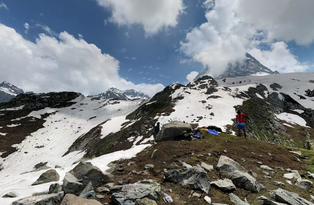
Image Source: Cajetan Barretto/ Google Maps
INTRODUCTION
The Kolahoi Glacier Trek is one of the most remarkable high mountain journeys in the Kashmir Himalaya. Located in the upper Lidder Valley of Anantnag district, the glacier lies beneath the dramatic mountain landscape surrounding Kolahoi Peak. The trek takes visitors through the meadows of Aru and Lidderwat, dense coniferous forests, remote shepherd settlements, alpine valleys, glacial streams and high altitude lakes before reaching a viewpoint overlooking the glacier.
Kolahoi Glacier is particularly important because it is one of the principal sources of the Lidder River, which eventually joins the Jhelum River system. It is also regarded as the largest glacier in the Kashmir Valley. Its importance extends beyond trekking and tourism because the glacier contributes to the water resources of the surrounding valleys and agricultural areas.
The journey is not simply about reaching a glacier. It offers an opportunity to understand the geography of the upper Lidder basin, the traditional pastoral lifestyle of Kashmir’s Gujjar and Bakarwal communities, and the environmental changes affecting Himalayan glaciers.
The trek generally begins at Aru, near Pahalgam, and follows the Lidder River towards Lidderwat and the upper glacial valleys. Depending on the itinerary, trekkers visit Dudhsar Lake and Satlunjan before reaching a safe viewpoint overlooking Kolahoi Glacier.
GEOGRAPHICAL LOCATION AND LANDSCAPE
Kolahoi Glacier lies in the Greater Himalayan region of Kashmir, in the upper reaches of the Lidder Valley. The surrounding mountain landscape falls within Anantnag district of Jammu and Kashmir.
The glacier is associated with Kolahoi Peak, a prominent mountain in the region. Published elevation figures for the peak vary. Jammu and Kashmir Tourism lists it at approximately 5,734 metres, while other geographical and mountaineering references give different elevations. These differences should be considered when interpreting published route information.
The glacier occupies a high altitude mountain basin surrounded by steep rocky slopes, snowfields and glacially shaped valleys. Meltwater from the glacier feeds streams that contribute to the Lidder River system.
The trekking landscape changes considerably along the route. Near Aru, the valley is characterised by green meadows, coniferous forests and traditional settlements. Further upstream, the forest gradually gives way to open alpine grasslands, rocky slopes and streams flowing from the surrounding mountains.
Lidderwat is one of the most beautiful sections of the journey. It is a broad alpine meadow surrounded by forested slopes and mountains. During summer, shepherds bring their livestock into the valley, creating a landscape where traditional pastoral activity continues alongside trekking.
At higher elevations, the scenery becomes increasingly rugged. Large boulders, glacial streams, patches of snow and steep mountain walls dominate the terrain. The upper valley eventually opens towards the landscape surrounding Kolahoi Glacier.
THE IMPORTANCE OF KOLAHOI GLACIER
Kolahoi Glacier is one of the most important natural features of the Kashmir Himalaya. Its significance comes from its position within the upper Lidder and Sind river catchments and its contribution to regional water resources.
Scientific studies have examined the glacier using historical records, topographical maps, satellite imagery and field observations. Research published in Environmental Monitoring and Assessment in 2017 estimated that the glacier retreated approximately 3.4 kilometres between 1857 and 2014. The same study found that its area decreased from approximately 14.46 square kilometres in 1962 to 11.28 square kilometres in 2014.
A separate study published in the journal Water in 2020 examined changes between 1962 and 2018. It estimated that the glacier lost approximately 23.6 percent of its area during that period. The research also identified changes in the glacier’s structure, including the fragmentation of some ice sections. PubMed+1
These figures represent different research periods and measurement methods, so they should not be treated as interchangeable measurements of current glacier dimensions.
The retreat of Kolahoi Glacier is important for the wider Kashmir Valley. Glacier melt contributes to streamflow, particularly during warmer months when snowmelt and ice melt support downstream water availability. Changes in glacier size and seasonal melt patterns can therefore influence river discharge, agriculture, horticulture and other water dependent activities.
For visitors, the glacier is an extraordinary natural feature. For scientists and local communities, however, it is also an important indicator of environmental change in the western Himalaya.
HISTORY OF GLACIAL FORMATION
The landscape around Kolahoi Glacier was shaped by repeated glacial advances and retreats over thousands of years. During colder climatic periods, extensive ice masses occupied valleys and mountain basins that are now partly covered by grasslands, streams and rocky terrain.
A 2025 research paper in the Journal of Maps presented a detailed glacial geomorphological map of the Kolahoi Glacier valley. The researchers identified features such as glacially shaped bedrock, ice marginal deposits and other landforms created by moving ice. Their interpretation suggests that the glacier system advanced approximately 20 kilometres beyond its present snout position during the Last Glacial Maximum. DOI
These landforms explain why the upper Lidder Valley contains broad valleys, steep mountain walls, rocky deposits and distinctive glacial basins. The trekking route passes through a landscape that has been shaped by both ancient ice movements and more recent climatic changes.
THE KOLAHOI GLACIER TREK ROUTE
The traditional approach to Kolahoi Glacier begins at Aru and follows the Lidder Valley upstream. Jammu and Kashmir Tourism describes a Pahalgam to Kolahoi Glacier to Pahalgam journey of approximately six days and 60 kilometres. Its route information identifies Aru and Lidderwat as important stages of the approach.
A commonly described trekking itinerary follows Aru, Lidderwat, the upper Dudhsar valley, Kolahoi Glacier viewpoint and Satlunjan before returning towards Aru.
The following is an indicative route description. Exact camp locations, stream crossings and access conditions can change with weather and local regulations.
1. Aru to Lidderwat
The journey begins at Aru, a small mountain settlement approximately 12 kilometres from Pahalgam. Located beside the Lidder River, Aru is surrounded by meadows, forests and snow covered mountain slopes.
The trail leaves the settlement and gradually follows the river upstream. The initial section passes through agricultural land, open grassland and clusters of coniferous trees. As the route progresses, the valley becomes broader and the landscape increasingly pastoral.
Trekkers encounter small Gujjar settlements and seasonal shepherd shelters along the way. These settlements are associated with the traditional movement of livestock towards high altitude grazing grounds during summer.
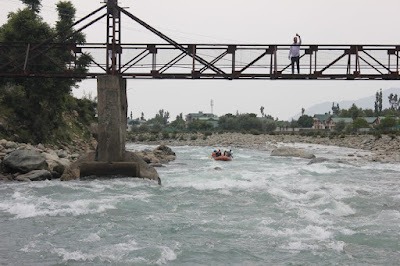
The trail eventually reaches Lidderwat, a beautiful meadow surrounded by forests and mountain slopes. Streams flow through the grassland, and the Lidder River passes through the valley.
Lidderwat is an important camping and resting location for trekkers exploring the upper Lidder Valley. It also serves as a starting point for routes towards Kolahoi Glacier, Tarsar Lake and Marsar Lake. The Anantnag district administration specifically identifies it as a base for these mountain journeys. India
2. Lidderwat to the Upper Dudhsar Valley
Beyond Lidderwat, the trail continues towards the upper valley through a landscape of coniferous forest, alpine grassland and mountain streams.
The route follows the drainage channels that descend from the surrounding mountain slopes. Several streams join the main valley system, creating a network of watercourses that eventually contribute to the Lidder River.
The trail gradually gains elevation. The forest becomes less continuous, while rocky terrain and open meadows become more prominent.
Dudhsar Lake is one of the notable geographical features associated with this upper trekking region. The lake lies in a remote mountain basin surrounded by grassy slopes, rocky terrain and snow covered peaks.
The landscape around the lake provides a striking contrast to the dense forests encountered near Aru and Lidderwat.
3. Dudhsar Lake to Kolahoi Glacier Viewpoint
The section towards Kolahoi Glacier is the most important part of the journey. From the upper valley, trekkers move towards a designated viewpoint overlooking the glacier.
The approach involves rocky ground, glacial deposits, streams and steep mountain slopes. The landscape becomes increasingly barren as vegetation becomes limited at higher elevations.
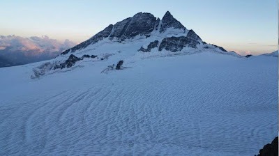
The glacier appears beneath the surrounding mountain walls, with exposed ice, snowfields and debris covered sections creating a dramatic high altitude landscape.
It is important to distinguish between reaching a glacier viewpoint and walking onto the glacier itself. Kolahoi Glacier has undergone substantial retreat and structural changes. Research and trekking safety descriptions highlight the dangers associated with unstable ice and hollowed sections.
Visitors should observe the glacier from a safe, locally approved viewpoint. Walking onto the ice, entering crevasses or approaching unstable glacier edges without specialised mountaineering assessment and equipment can be extremely dangerous.
The purpose of the trekking route is to experience the surrounding glacial landscape, not to climb or cross the glacier.
4. Return towards Satlunjan
After visiting the glacier viewpoint, trekkers retrace their route towards the lower upper valley and Satlunjan.
Satlunjan is an important geographical point along the upper Lidder drainage system. The surrounding landscape contains grasslands, streams, waterfalls and rocky slopes.
The area is characterised by several mountain watercourses descending from different directions. Their confluence creates a landscape of flowing streams and open valleys.
The return section provides another opportunity to observe the glacial valley from a different perspective. The route eventually reconnects with the broader Lidderwat and Aru trekking corridor.
5. Satlunjan to Aru
The final walking section follows the valley downstream towards Aru. The trail passes through open meadows, forests and seasonal shepherd settlements.
The descent is generally easier than the upper mountain sections, although the distance can make it physically demanding. Stream crossings and uneven ground require continued attention.
On reaching Aru, trekkers can return by road towards Pahalgam and Srinagar.
LIDDERWAT: THE PASTORAL LANDSCAPE OF KASHMIR
Lidderwat is one of the most interesting parts of the Kolahoi Glacier Trek because of its natural and cultural landscape.
The valley is used by pastoral communities who move their livestock towards higher grazing grounds during the summer months. Temporary shelters and traditional livestock enclosures can be seen in the surrounding meadows.
Gujjar and Bakarwal communities have long been associated with pastoral activities in Jammu and Kashmir. Their seasonal movements are connected with the availability of grass, water and suitable grazing conditions at different elevations.
During summer, these mountain valleys become important grazing areas for sheep, goats, horses and cattle. The movement of herders between lower settlements and high altitude pastures forms part of a traditional seasonal livelihood system.
For trekkers, Lidderwat offers an opportunity to understand how human activity and mountain ecology are connected. Visitors should respect private shelters, livestock and grazing areas, and avoid disturbing local residents.
THE LIDDER RIVER AND ITS GLACIAL ORIGIN
The Lidder River is one of the important tributaries of the Jhelum River. It originates in the high mountain region around Kolahoi and the surrounding glaciers and alpine valleys.
The river flows through the Lidder Valley, passing areas such as Aru and Pahalgam before continuing towards the broader Kashmir Valley.
Its water supports agriculture, horticulture, settlements and tourism related activities. The river is also known for its clear mountain water and trout fishing areas.
The upper trekking route provides an opportunity to understand the relationship between glaciers, seasonal snowmelt and river systems. Small streams encountered along the route eventually become part of a much larger drainage network.
BEST TIME TO VISIT
June to September is generally the main trekking period for the upper Lidder Valley, although the exact season depends on snow conditions, weather and local access regulations.
June is an attractive period because the upper valleys may still contain snow patches while lower meadows begin to turn green. Some high altitude sections may remain difficult depending on the winter snowfall.
July and August generally offer greener meadows, flowing streams and more accessible high altitude routes. However, rainfall and cloud cover can affect visibility and trail conditions.
September is often suitable for trekking because the monsoon influence is generally lower and the landscape begins transitioning towards autumn. Temperatures also start falling at higher elevations.
October is less reliable for a full glacier trek because early snowfall and colder conditions may affect access to the upper valley.
Winter trekking is not suitable for ordinary visitors attempting the standard summer route. Heavy snowfall, avalanche conditions and limited access can make the region dangerous.
DIFFICULTY LEVEL AND TREKKING PREPARATION
The Kolahoi Glacier Trek is a moderate to challenging high altitude journey, depending on the selected itinerary and the condition of the upper valley.
The initial section from Aru to Lidderwat is relatively gradual, although the distance makes it a substantial walking day. The route beyond Lidderwat involves greater elevation gain, uneven terrain, stream crossings and exposed mountain sections.
The upper glacier viewpoint requires additional preparation because of the altitude and remote location. Trekkers may experience fatigue, headaches, nausea or breathlessness if they ascend too quickly.
A reasonable level of cardiovascular fitness is essential. Regular walking, uphill training and endurance exercises before the journey can help prepare the body.
Proper trekking footwear is important because the route includes muddy trails, loose stones, wet grass and uneven ground. Carry warm clothing, waterproof outer layers, gloves, a hat and sufficient food and drinking water.
Acclimatisation should be treated as an essential part of the journey. Anyone experiencing symptoms of altitude sickness should avoid further ascent and seek appropriate assistance. Severe symptoms require immediate descent and medical attention.
Because the upper valley is remote, trekking with experienced local support and appropriate emergency arrangements is strongly advisable.
GLACIER SAFETY AND ENVIRONMENTAL RESPONSIBILITY
Kolahoi Glacier is a sensitive and changing mountain environment. Its retreat has exposed unstable terrain and altered the structure of the glacier.
A glacier may appear solid from a distance while containing hidden crevasses, internal cavities and unstable ice formations. Meltwater can flow beneath the surface, creating dangerous conditions that are not visible to visitors.
Trekkers should never walk onto the glacier simply to get closer to the ice. They should also avoid approaching the glacier snout or climbing unstable moraine slopes without professional assessment.
The surrounding valleys are equally sensitive. Alpine meadows recover slowly from excessive trampling, while streams and lakes can be affected by waste and careless camping.
Carry all non biodegradable waste back to the settlements. Avoid washing with soap in streams, disturbing wildlife or leaving food waste near campsites.
HOW TO REACH
By Road: Srinagar is the principal starting point for the journey. From Srinagar, visitors travel towards Anantnag and Pahalgam before continuing approximately 12 kilometres to Aru. Aru is the usual roadhead for the traditional trekking route.
By Train: Jammu Tawi is an important railway station for visitors travelling from other parts of India. From Jammu, road travel towards Srinagar and Pahalgam is required. The rail network in the Kashmir Valley also provides access to parts of the region, but visitors should check current train operations and connections.
By Air: Srinagar International Airport is the most convenient airport. From Srinagar, visitors can travel by road towards Pahalgam and Aru.
WHERE TO STAY
Aru is the most convenient accommodation base before beginning the trek. The settlement has guesthouses, homestays and other basic accommodation options.
Pahalgam provides a wider range of hotels, guesthouses and restaurants. Visitors can stay there before travelling to Aru early in the morning.
During the trek, accommodation generally involves camping or locally authorised shelter arrangements at designated locations. Lidderwat is a commonly used resting and camping area. However, camping permissions and the availability of facilities should be confirmed locally.
Trekkers should not assume that camping is permitted anywhere in the forest or alpine meadows. Follow instructions from the relevant authorities and local officials.
NEARBY PLACES TO VISIT
Aru Valley
Aru Valley is one of the most beautiful destinations near Pahalgam. Surrounded by coniferous forests, meadows and mountain peaks, it serves as the starting point for several trekking routes, including Kolahoi Glacier, Tarsar Marsar and Lidderwat. The valley is also known for its traditional settlements and pastoral landscape.
Pahalgam
Pahalgam is an important tourist destination in Anantnag district. Located along the Lidder River, it is surrounded by forested mountains and alpine valleys. Visitors can explore its riverside landscapes, local markets and surrounding attractions before or after the trek.
Betaab Valley
Betaab Valley lies near Pahalgam and is known for its green meadows, forested slopes and the Lidder River. The valley became particularly famous after the filming of the Bollywood movie Betaab. It is a popular excursion for visitors staying in Pahalgam.
Chandanwari
Chandanwari is a mountain destination beyond Pahalgam and an important starting point for the traditional Amarnath pilgrimage route. It is surrounded by high mountain slopes and seasonal snowfields.
Tarsar Lake
Tarsar Lake is another important alpine destination accessible from the Aru region. The lake is known for its distinctive shape, clear water and surrounding mountain meadows. It is part of a separate trekking route and should not be confused with the direct approach to Kolahoi Glacier.
FREQUENTLY ASKED QUESTIONS
1. Where is Kolahoi Glacier located?
Kolahoi Glacier is located in the Greater Himalayan region of Kashmir, in the upper Lidder Valley of Anantnag district, Jammu and Kashmir.
2. What is the starting point of the Kolahoi Glacier Trek?
Aru, near Pahalgam, is the most commonly used starting point for the traditional trekking route.
3. How long is the Kolahoi Glacier Trek?
Jammu and Kashmir Tourism describes the Pahalgam to Kolahoi Glacier to Pahalgam journey as approximately 60 kilometres over six days. Other itineraries starting at Aru vary in duration and distance according to camp locations and route selection.
4. What is the best time for the Kolahoi Glacier Trek?
June to September is generally the main trekking season. Actual access depends on snow conditions, rainfall and local permissions.
5. How difficult is the Kolahoi Glacier Trek?
The trek is moderate to challenging. The upper sections involve high altitude walking, rocky terrain, stream crossings and remote mountain conditions.
6. Is Kolahoi Glacier the source of the Lidder River?
Kolahoi Glacier and the surrounding high mountain snowfields contribute to the headwaters of the Lidder River system.
7. Can trekkers walk on Kolahoi Glacier?
Walking onto the glacier is strongly discouraged for ordinary trekkers. Hidden crevasses, unstable ice and internal cavities can create life threatening conditions. Visitors should observe it from a safe viewpoint.
8. What is Lidderwat famous for?
Lidderwat is a beautiful alpine meadow surrounded by coniferous forests and mountains. It is also an important seasonal grazing area and a base for several high altitude trekking routes.
9. Is the Kolahoi Glacier Trek suitable for beginners?
The lower route towards Lidderwat may be manageable for reasonably fit beginners with proper preparation. The complete glacier trek is more demanding and is better suited to trekkers with previous mountain experience.
10. Why is Kolahoi Glacier important?
It is one of the largest glaciers in the Kashmir Valley and an important source of water for the upper Lidder basin. Scientific research has documented substantial glacier retreat and area loss over recent decades.
OFFICIAL AND RESEARCH REFERENCES
Jammu and Kashmir Tourism, Trekking:
https://jktourism.org/trekking/
Anantnag District Administration, Lidderwat:
https://anantnag.nic.in/tourist-place/lidderwat/
Incredible India, Aru:
https://www.incredibleindia.gov.in/en/rural-tourism/aru
Research paper, Dimensional Changes in the Kolahoi Glacier from 1857 to 2014, Environmental Monitoring and Assessment:
https://pubmed.ncbi.nlm.nih.gov/27921225/
Research paper, Linking the Recent Glacier Retreat and Depleting Streamflow Patterns with Land System Changes in Kashmir Himalaya:
https://www.mdpi.com/2073-4441/12/4/1168
Research paper, Glacial Geomorphology of the Kolahoi Glacier Valley in the Northwestern Himalaya, Journal of Maps, 2025:
https://doi.org/10.1080/17445647.2025.2586604
Indian Space Research Organisation, Space Applications Centre, Monitoring Snow and Glaciers of Himalayan Region:
https://www.sac.gov.in/data/Publication/54/Monitoring_Snow_and_Glacier_of_Himalayan_Region.pdf
RESEARCH NOTE
The Kolahoi Glacier Trek is described through several route variations. Jammu and Kashmir Tourism publishes a six day Pahalgam to Kolahoi Glacier itinerary, while other descriptions use Aru, Lidderwat, Dudhsar Lake and Satlunjan as the main stages. Distances and overnight locations differ between these itineraries, so the route presented here should be treated as a geographical guide rather than a guaranteed current itinerary.
The glacier itself has experienced substantial retreat and structural changes. The final approach should therefore be restricted to a safe viewpoint, with no attempt to walk onto the ice. Current forest permissions, camping arrangements, local access restrictions and weather conditions should be confirmed before departure.