Image Source: Suneel Negi/ Google Maps
Introduction
The Pin Parvati Pass Trek is one of the most demanding high altitude trekking expeditions in Himachal Pradesh. It connects the green, river carved landscapes of Parvati Valley in Kullu district with the rugged, rain shadow terrain of Pin Valley in Spiti. Along the way, trekkers pass through forests, alpine meadows, glacial valleys and remote mountain camps before crossing a high Himalayan pass.
Pin Parvati Pass is commonly listed at approximately 5,319 metres (17,450 feet). The crossing involves steep ascents, loose moraine, snowfields, glacier terrain and potentially difficult river crossings. It is suitable only for trekkers with substantial prior high altitude experience, excellent preparation and support from an experienced expedition team.
The complete journey usually takes around 9 to 12 days, depending on the itinerary, acclimatisation requirements, weather and trail conditions. It should not be treated as a routine six day trek because delays and changes to the route can be necessary in this remote mountain environment. Himachal Tourism.
Overview of the Trek
The trek generally begins near Barshaini in the upper Parvati Valley, reached by road from Kasol and Manikaran. From here, the route follows the Parvati River upstream, passing through Kheerganga, Tunda Bhuj, Thakur Kuan and Odi Thach before reaching Mantalai Lake.
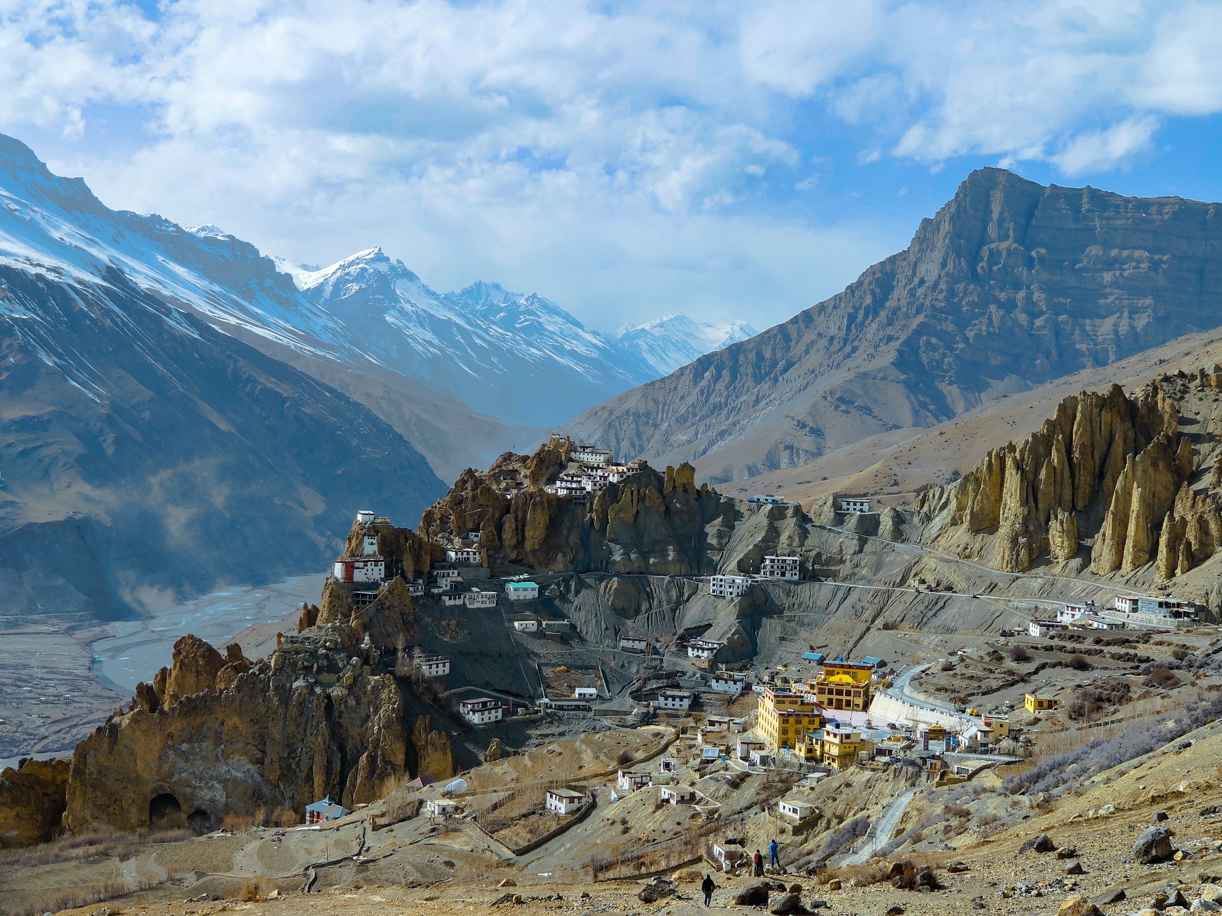
Beyond the lake, the landscape becomes increasingly rocky and glaciated. Trekkers approach the high camp before attempting the crossing of Pin Parvati Pass. The descent leads into the Pin Valley side of Spiti, where the greener vegetation of the Parvati Valley gives way to dry mountain slopes, rocky terrain and the distinctive cold desert landscape.
The expedition typically ends near Mudh village, from where travellers can arrange road transport towards Kaza. The precise campsites and daily stages vary between trekking operators, and some itineraries include additional acclimatisation or weather buffer days.
Best Time for the Pin Parvati Pass Trek
The main trekking window is generally July to September, although the safest dates depend on snow conditions, rainfall, river levels and the state of the glacier. Late July and August can bring monsoon rain to the Parvati Valley, while snow may remain around the pass. September can offer clearer conditions, but fresh snowfall and colder nights become increasingly important considerations later in the season. Himachal Tourism
There is no guaranteed ideal date for crossing the pass. An itinerary planned for September may need to change if snow, bad weather or unsafe river crossings prevent progress.
Before departure, confirm current conditions with an experienced expedition operator familiar with the route. Do not assume that a calendar date alone means the pass is safe or accessible.
Route and Trekking Stages
The Pin Parvati Pass route is best understood as a series of stages through three distinct landscapes: the forested Parvati Valley, the high altitude terrain around Mantalai Lake and the pass, and the dry Pin Valley side.
The following is a broad route overview, not a fixed day by day schedule. Daily distances and camping locations can vary according to weather, acclimatisation, river conditions and the judgement of the expedition team.
Stage 1: Barshaini to Kheerganga
Typical duration: One trekking day
Barshaini is the usual road access point for the expedition. From here, the trail climbs through the lower Parvati Valley towards Kheerganga, a well known meadow associated with natural hot springs and mountain views.
The initial route passes through forested slopes and settlements before entering quieter mountain terrain. Although Kheerganga is a popular destination in its own right, reaching it is only the beginning of the Pin Parvati expedition.
Trekkers should use this early section to settle into a steady walking rhythm and follow the acclimatisation plan rather than rushing to cover distance.
Stage 2: Kheerganga to Tunda Bhuj
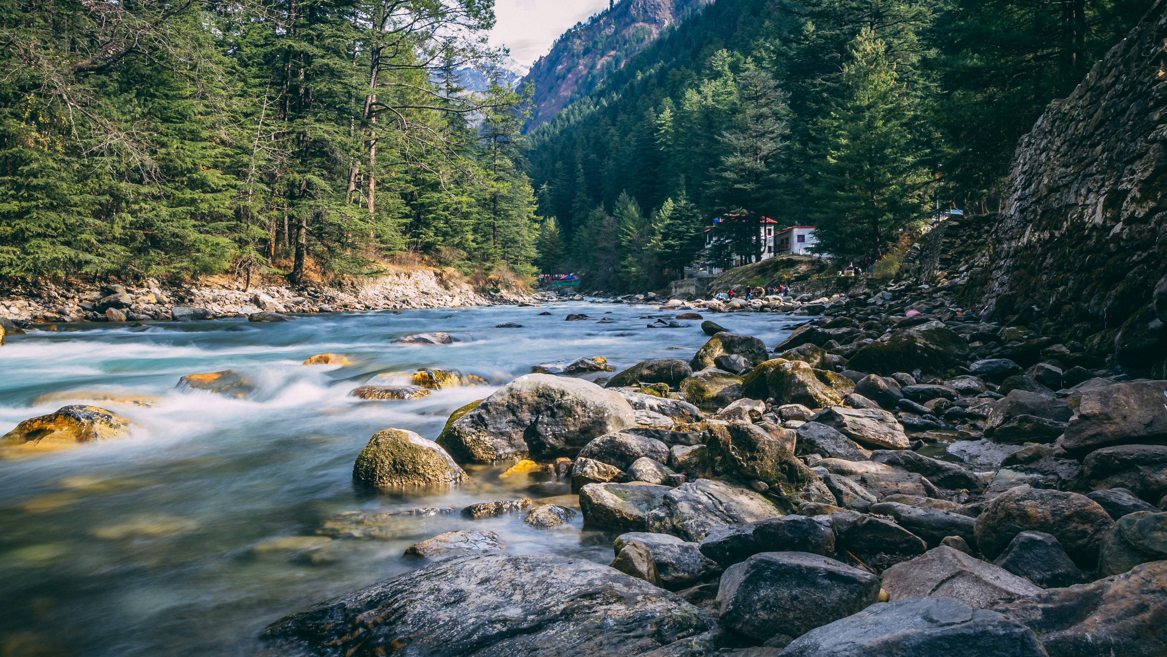
Beyond Kheerganga, the trail continues upstream into a more remote part of the Parvati Valley. Forests, mountain streams and open meadows characterise sections of the route, with the landscape gradually becoming more rugged as elevation increases.
Tunda Bhuj is a recognised campsite on the approach to Pin Parvati Pass. The surroundings feel increasingly remote compared with the lower valley, and facilities become limited.
This stage is part of the gradual transition from a popular trekking trail into a demanding wilderness expedition. Camping arrangements and the precise day’s endpoint depend on the itinerary.
Stage 3: Tunda Bhuj to Thakur Kuan and Odi Thach
The route continues through the upper Parvati Valley towards Thakur Kuan and Odi Thach. The trail includes rocky ground, uneven paths and sections where progress can be slow. The natural rock formations and river crossings along this stretch are among the memorable features of the approach.
Odi Thach is another important campsite before the route reaches Mantalai Lake. Depending on the expedition plan, the distance between camps may be covered in one or more days.
As the trail moves farther from established settlements, trekkers must rely on their expedition team’s judgement regarding river crossings, camping locations and weather. This is not a section where a fixed walking time should take priority over safety.
Stage 4: Odi Thach to Mantalai Lake
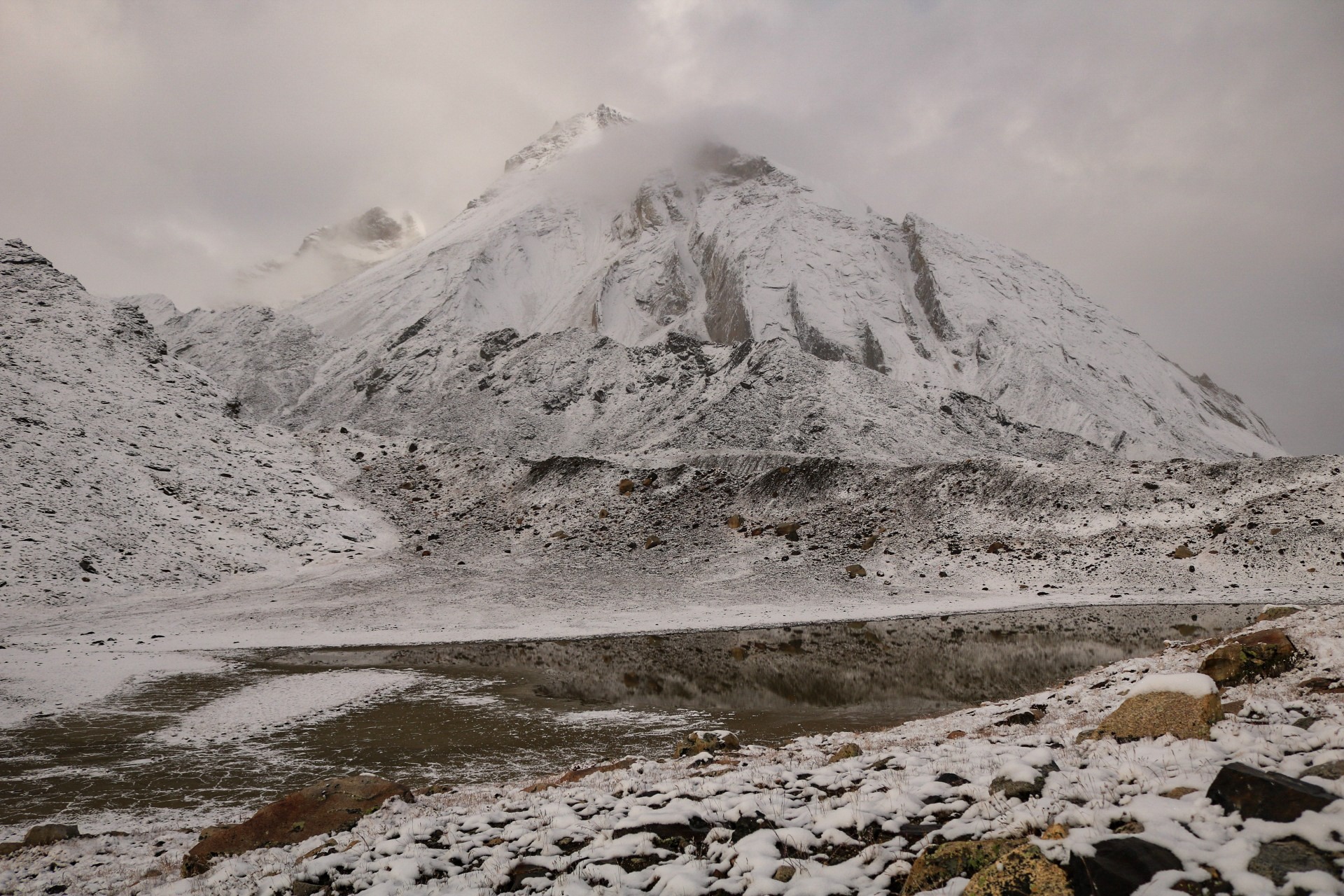
Mantalai Lake is one of the major landmarks on the Pin Parvati Pass Trek. Located in the upper Parvati Valley at roughly 4,100 metres, it is regarded in local religious tradition as the source region of the Parvati River.
The approach crosses increasingly open and rocky terrain, with streams, boulders and glacial features becoming more prominent. The lake sits within a dramatic high mountain basin surrounded by rugged slopes and distant snow covered peaks.
Mantalai is more than a scenic stop. It is an important point in the expedition because trekkers are approaching the higher and more demanding section of the route. An acclimatisation day may be included here or at another suitable camp, depending on the itinerary and the team’s assessment.
Stage 5: Mantalai Lake to High Camp
Beyond Mantalai Lake, the route enters the more exposed terrain leading towards Pin Parvati Pass. The trail may involve steep slopes, loose moraine, glacial streams and snow or ice, depending on the season.
A high camp is established before the pass crossing, but the exact location and altitude vary with the expedition plan and prevailing conditions. At these elevations, even a relatively short distance can take considerable effort because of the terrain and reduced oxygen availability.
This stage requires careful pacing and appropriate equipment. Camping at high altitude also brings colder temperatures, stronger winds and limited protection from changing weather.
Stage 6: High Camp to Pin Valley via Pin Parvati Pass
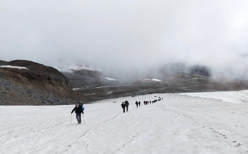
This is the most demanding section of the expedition. The ascent to Pin Parvati Pass reaches approximately 5,319 metres, where snow, ice, loose rock and glacier terrain may form part of the crossing.
The pass connects the upper Parvati Valley with the Pin Valley side of Spiti. Although the views can be extraordinary, the crossing is not simply a high viewpoint walk. Glacier conditions can change, and crevasse exposure, poor visibility, strong winds and fresh snowfall can make the route hazardous.
The descent on the Pin Valley side is also demanding. The terrain becomes increasingly dry and rugged, with rocky slopes and a landscape shaped by Spiti’s rain shadow climate. The precise descent route and campsite depend on the condition of the snow and glacier and the judgement of the expedition team.
The pass should be attempted only when the guide or expedition leader considers the conditions suitable. If weather or snow conditions deteriorate, postponing or abandoning the crossing may be necessary.
Stage 7: Descend Through Pin Valley to Mudh Village
After crossing the pass, trekkers continue down the Pin Valley side through remote mountain terrain. The route eventually reaches the vicinity of Mudh, a village in the Pin Valley region of Spiti.
The landscape is markedly different from the Parvati side. Dense forests and greener slopes give way to barren mountains, dry valleys and sparse vegetation. This contrast is one of the defining features of the expedition.
Mudh marks the usual end of the trekking section. From here, travellers can arrange road transport towards Kaza, the main town and travel base in Spiti Valley. Road conditions and transport availability should be confirmed in advance, especially outside the main summer travel season.
Trek Difficulty and Preparation
The Pin Parvati Pass Trek is an expert level, high altitude expedition, not a suitable first Himalayan trek. Its difficulty comes from the combination of altitude, sustained walking, glacier terrain, remote camps and limited opportunities to leave the route quickly if conditions deteriorate.
Trekkers should have previous experience on demanding multi day Himalayan treks, including camping and walking at high altitude. General fitness alone is not enough preparation for the challenges of a glaciated pass crossing.
Preparation should include:
- Acclimatisation: Follow a gradual ascent plan and allow additional days where needed. Recognise symptoms of altitude illness and descend promptly if serious symptoms develop.
- Experienced support: Travel with a qualified expedition team familiar with Pin Parvati’s glacier and river conditions.
- Appropriate equipment: Carry suitable trekking boots, layered clothing, waterproof outerwear, sleeping equipment and expedition specific gear.
- Food and shelter: Confirm who is responsible for tents, meals, cooking equipment, fuel and other supplies. Organised expeditions generally coordinate these arrangements.
- Weather planning: Allow buffer days and be prepared for changes to the itinerary.
- Permissions and local rules: Confirm the current permit requirements and any restrictions with the relevant authorities and expedition operator before departure.
Mobile connectivity and access to emergency assistance may be limited for long stretches. A responsible expedition plan should include communication arrangements, emergency procedures and a clear decision making process for turning back.
What Makes the Trek Special
The Pin Parvati Pass Trek stands out because it links two very different Himalayan environments within one journey.
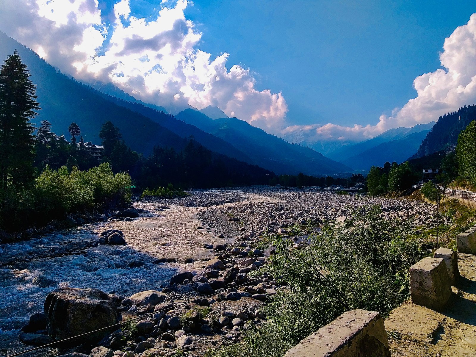
On the Parvati Valley side, trekkers encounter river landscapes, forests, alpine meadows and the high mountain basin around Mantalai Lake. The approach follows the upper Parvati River through a landscape shaped by abundant water and the monsoon influence.
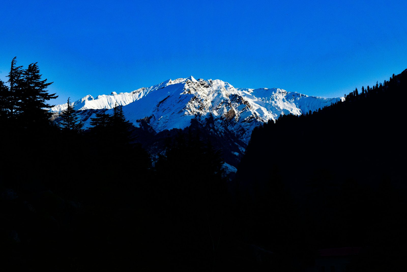
Around the pass, the environment becomes more austere. Snowfields, glacial terrain, rocky slopes and high camps create the atmosphere of a genuine mountain expedition. The crossing demands concentration and careful judgement rather than speed.
On the Pin Valley side, the landscape changes to the dry, cold desert terrain associated with Spiti. Sparse vegetation, bare mountain slopes and wide open valleys create a striking contrast with the greener approach from Kullu.
Few routes in Himachal Pradesh combine such a dramatic change in landscape with the physical challenge of a high altitude pass. The experience, however, depends on suitable conditions and responsible trekking practices.
Conclusion
The Pin Parvati Pass Trek is a demanding Himalayan crossing from the green upper Parvati Valley into the rugged cold desert of Pin Valley. Its forests, alpine camps, Mantalai Lake and high glaciated pass make it one of the region’s most memorable trekking expeditions.
The route also requires serious preparation. The altitude, glacier terrain, river crossings and remote setting mean that trekkers must have prior high altitude experience, use experienced support and allow flexibility in their plans.
For those who are properly prepared, the journey offers a rare opportunity to experience two contrasting Himalayan landscapes in a single expedition. The most important part of completing it safely is not simply reaching the pass, but making sound decisions throughout the journey.