Image Source: Amit Tiwary
About Harunta Bugyal
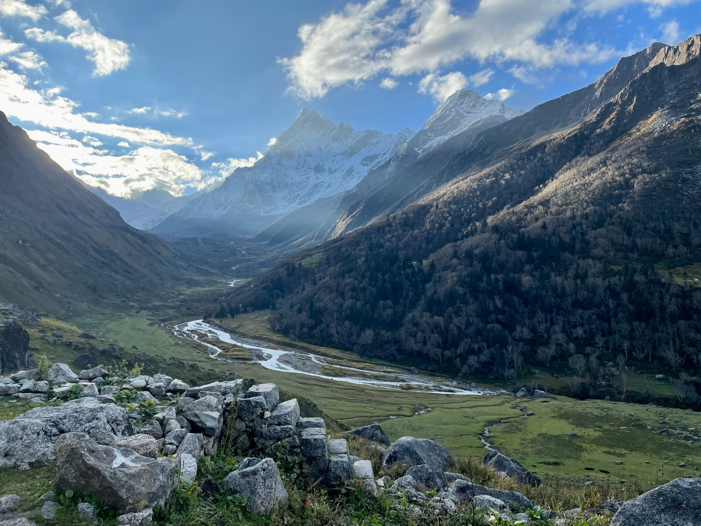
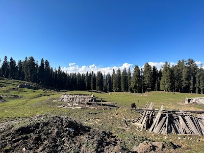
In the Uttarkashi district of Uttarakhand, there are dozens of beautiful Bugyals that are waiting to be explored. One such bugyal is Harunta Bugyal, which lies at an altitude of 2900 meters in the Ganga-Yamuna valley. Bugyal is also the source of the Indravati River that joins the Bhagrathi at Uttarkashi.
Every year, villagers from Badgaddi Paati worship the source of the Indravati, signifying its religious importance.
Harunta Bugyal is a high-altitude alpine meadow (bugyal) nestled deep within the middle–upper Himalaya of Uttarakhand, representing a living example of the traditional pastoral landscapes of Garhwal. Unlike well-known bugyals such as Dayara or Bedni, Harunta Bugyal remains largely outside mainstream trekking circuits, retaining its identity as a functional grazing ground shaped by seasonal migration, local ecology, and ancestral usage. For generations, this bugyal has existed not as a tourist destination but as a working landscape, tied closely to shepherding cycles, village economies, and mountain cosmology.
Meaning of “Bugyal” and Local Terminology
In Garhwali, “bugyal” refers to high mountain grasslands used for summer grazing, distinct from permanent pastures. Harunta Bugyal belongs to this ecological category, where grass growth is driven by snowmelt and brief alpine summers. Locally, shepherds distinguish between “naram ghaas” (soft grazing grass) and tougher alpine species, timing their livestock movement accordingly. Harunta is known among pastoral communities for its balanced grass cover rather than sheer size.
Vegetation and Alpine Ecology
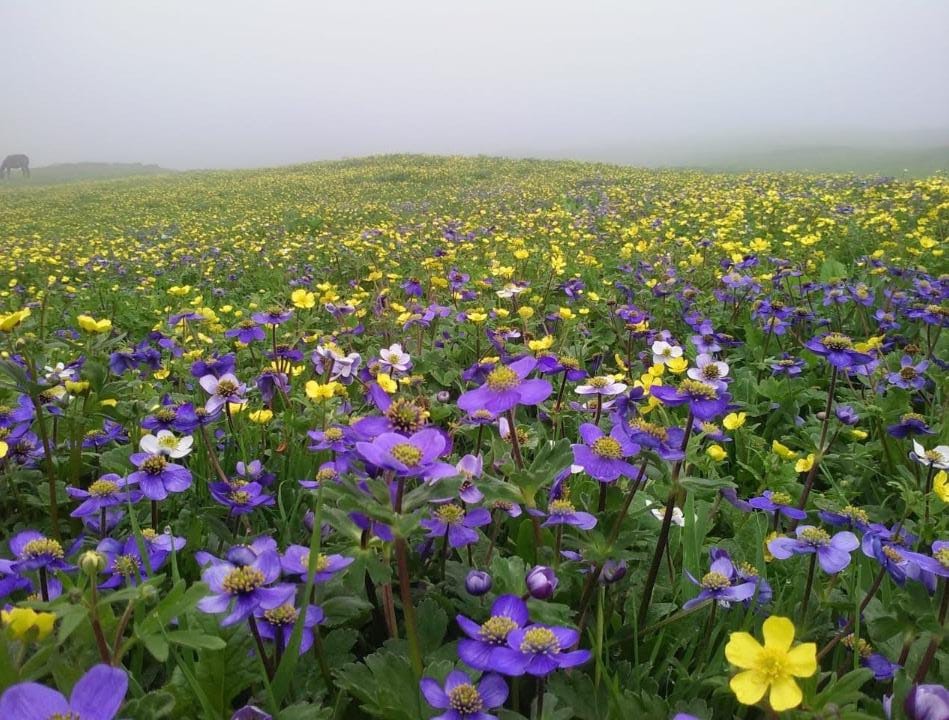
The meadow supports a mosaic of alpine grasses, sedges, and seasonal wildflowers, including species that bloom briefly between June and August. During peak summer, Harunta Bugyal transforms into a green expanse dotted with yellow, purple, and white blossoms, attracting pollinators such as alpine bees and butterflies. The surrounding slopes host juniper, dwarf rhododendron, and medicinal herbs, many of which are known locally for traditional uses rather than commercial extraction.
Puranas
Harunta Bugyal is mentioned in the Skand Purana of Kedarkhand. The surrounding area around Haruna Bugyals is written or known by the name Indrakeel Parvat.
Trek to Harunta Bugyal
The trek to Haurnta Bugyal starts from a village called Chaurangi that lies on the Kedarnath road and is at a distance of 52 km from Uttarkashi. During the trek, the dense forest of Banj Buransh takes you into a different world where calm sounds of wind and birds flow. During the trek , the first major attraction that falls is Chhota Bugyal Falls at a distance of 1 km. It’s also called Khal Bugyal. It takes you around 3 to 4 hours to cover a distance of 7 km to reach Harunta Bugyal.
Once you reach the top, the old traditional Chhanis, also called Goth, are found. It’s made of mudstone and wood, where generally animals come to life during the summer and rainy seasons. These cow sheds have been built in forests since ancient times.
Conservation Sensitivity and Threats
Harunta Bugyal is ecologically fragile. Overgrazing, unregulated camping, and climate-driven changes in snowfall patterns pose growing risks. As snowlines shift upward, the grass composition of the bugyal is slowly changing, affecting both wildlife and pastoral livelihoods. Conservation here depends less on fencing and more on reviving traditional usage limits that historically kept the meadow healthy.
How to Reach Harunta Bugyal
Harunta Bugyal is a beautiful high-altitude alpine meadow in the Uttarkashi district of Uttarakhand. Since it lies deep in the Garhwal Himalayas, there is no direct motorable road to the meadow. Visitors must first reach the base village and then undertake a multi-day trek through forests, streams, and lush bugyals to reach Harunta Bugyal.
By Air
The nearest airport is Jolly Grant Airport, Dehradun, located approximately 210–220 km from the trek’s base village, Agoda. The airport is well connected to Delhi and other major Indian cities. From Dehradun, taxis and buses are available to Uttarkashi, followed by a drive to Agoda, where the trek begins.
By Train
The nearest railway stations are Dehradun Railway Station (around 190 km) and Rishikesh Railway Station (approximately 170 km from Agoda). Both stations have regular train services from Delhi, Haridwar, and other major cities. From the railway station, travelers can hire a taxi or board a bus to Uttarkashi and then continue by road to Agoda.
By Road
Harunta Bugyal is approached via Agoda Village, one of the main trekking bases in Uttarkashi district. The road journey follows this route:
Dehradun → Mussoorie → Chamba → Dharasu Bend → Uttarkashi → Bhatwari → Agoda Village
Regular buses and shared jeeps operate between Dehradun, Rishikesh, Haridwar, and Uttarkashi. From Uttarkashi, local taxis are available for the final drive of about 18–20 km to Agoda.
Nearby Attractions to Harunta Bugyal
Dayara Bugyal
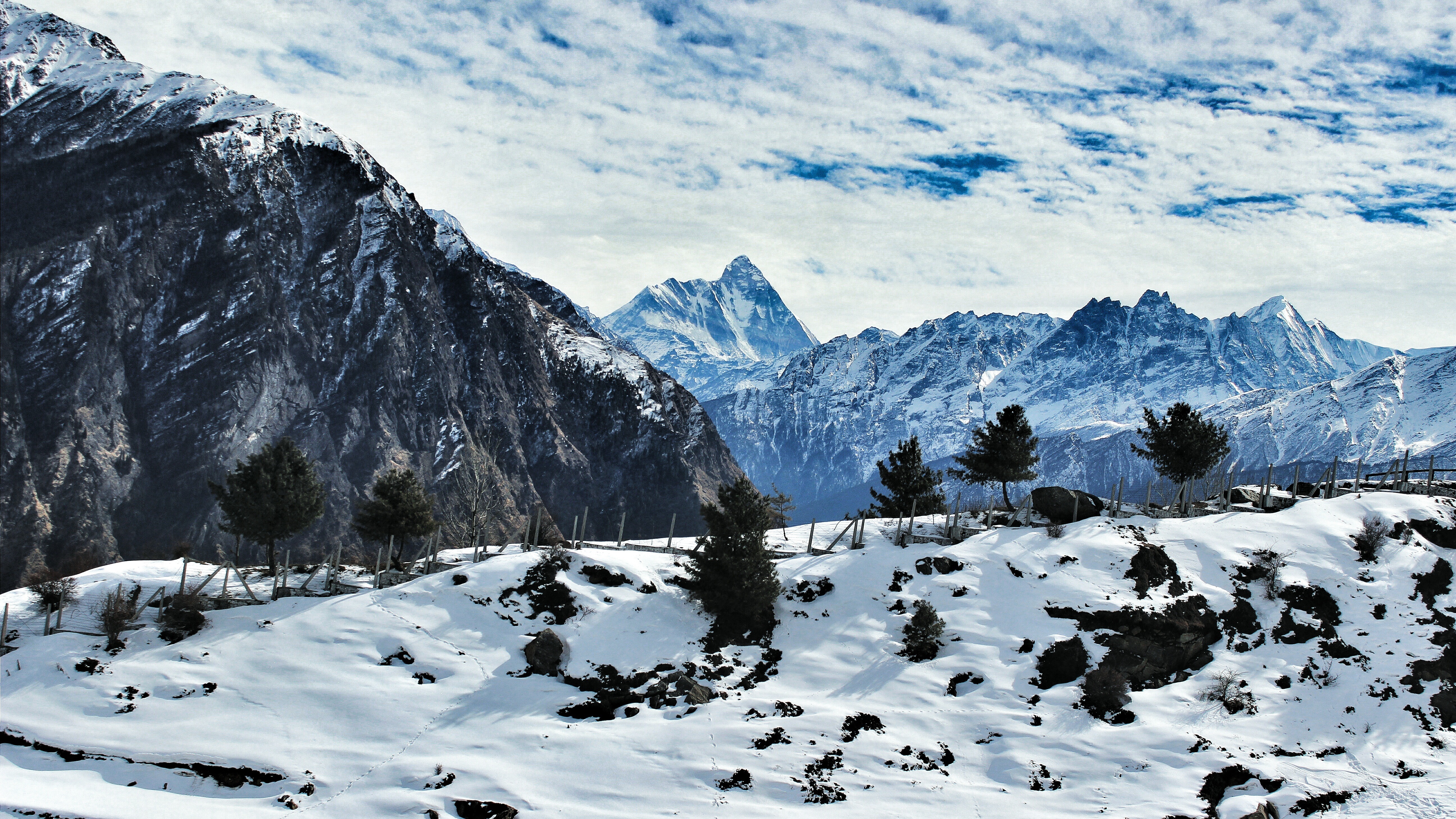
Located relatively close to Harunta Bugyal, Dayara Bugyal is one of Uttarakhand’s most famous alpine meadows. Spread across rolling grasslands at an altitude of over 3,400 meters, it offers magnificent views of the Bandarpoonch massif, Srikanth Peak, and Draupadi Ka Danda. During summer, the meadow is covered with vibrant wildflowers, while winter transforms it into a popular skiing destination.
Gidara Bugyal
Gidara Bugyal is another spectacular high-altitude meadow in the Garhwal Himalayas and is often combined with Harunta Bugyal on multi-day trekking itineraries. Known for its vast stretches of lush grasslands, seasonal flowers, and panoramic Himalayan views, Gidara Bugyal remains relatively untouched and offers a peaceful trekking experience away from crowded trails.
Siyari Bugyal
Situated along the trekking route, Siyari Bugyal is a picturesque alpine meadow surrounded by dense forests and towering Himalayan peaks. It serves as a beautiful camping location where trekkers can enjoy breathtaking sunrises, clear night skies, and uninterrupted views of the surrounding mountains.
Agoda Village
Agoda is the traditional base village for the Harunta Bugyal and Gidara Bugyal treks. Surrounded by terraced farms, oak forests, and rhododendron trees, the village offers visitors an authentic experience of Garhwali culture and hospitality before they begin their Himalayan adventure.
Bhangeli Village
Bhangeli is another scenic Himalayan village located near the trekking region. The village is known for its traditional stone houses, peaceful surroundings, and agricultural lifestyle. It offers an opportunity to interact with local communities and experience the rural charm of Uttarakhand.
Dayara Forests
The forests surrounding Harunta Bugyal are rich in oak, pine, maple, and rhododendron trees. During spring, blooming rhododendrons add vibrant colors to the landscape, while the forests provide excellent opportunities for birdwatching and wildlife spotting, including Himalayan monals and musk deer.
Gangotri National Park
The trekking region around Harunta Bugyal lies close to the ecological zone of Gangotri National Park, one of India’s largest protected Himalayan landscapes. The park is home to diverse flora and fauna, including Himalayan black bears, blue sheep, Himalayan tahr, musk deer, and numerous alpine bird species.
Dodital Lake
Located southwest of the Harunta Bugyal region, Dodital is a pristine freshwater lake surrounded by dense forests. Revered as the mythical birthplace of Lord Ganesha, it is one of Uttarakhand’s most scenic trekking destinations and a favorite among campers and anglers.
Uttarkashi
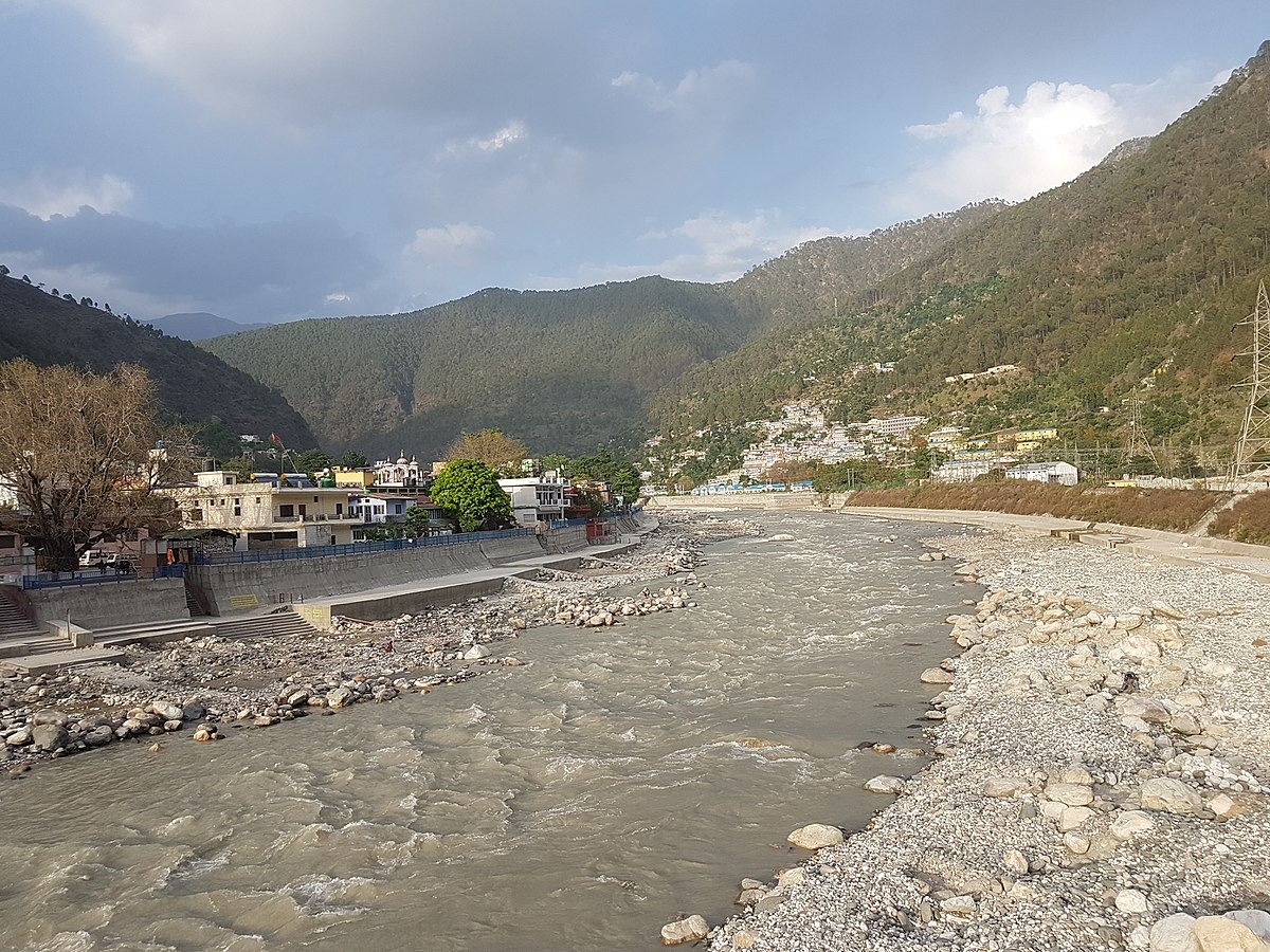
Approximately 90 km from Agoda, Uttarkashi serves as the main gateway to Harunta Bugyal. The town is famous for the ancient Kashi Vishwanath Temple, adventure training institutes, vibrant local markets, and the sacred Bhagirathi River. Most trekking expeditions begin after spending a night here.
Nachiketa Tal
Situated near Uttarkashi, Nachiketa Tal is a serene forest lake associated with ancient Hindu mythology. A short trek through dense oak and pine forests leads visitors to this peaceful destination, making it a great addition to a trip exploring the Garhwal Himalayas.
Lama Top
For those extending their journey toward the Gangotri Valley, Lama Top offers panoramic views of the Bhagirathi Valley, Harsil, and snow-covered Himalayan peaks. The short trek passes through dense deodar and pine forests and is especially rewarding during sunrise and sunset.
Maps
- Q: What is Harunta Bugyal?
Harunta Bugyal is a high-altitude alpine meadow in Uttarakhand traditionally used for seasonal grazing.
- Q: Where is Harunta Bugyal located?
It lies in the Garhwal Himalaya above the forest line, within a remote mountain zone.
- Q: Is Harunta Bugyal suitable for beginners?
No, it requires prior trekking experience and good physical conditioning.
- Q: What makes Harunta Bugyal different from popular bugyals?
It remains largely non-commercial and retains a strong pastoral and ecological character.
- Q: Can camping be done at Harunta Bugyal?
Camping is possible but must be done responsibly and away from sensitive grass cover.